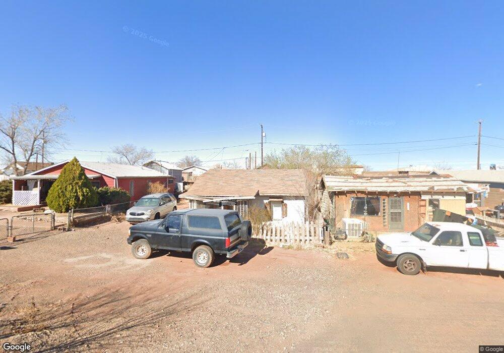
1210 W First St Winslow, AZ 86047
Estimated Value: $86,000 - $209,000
--
Bed
--
Bath
819
Sq Ft
$175/Sq Ft
Est. Value
About This Home
This home is located at 1210 W First St, Winslow, AZ 86047 and is currently estimated at $143,572, approximately $175 per square foot. 1210 W First St is a home located in Navajo County with nearby schools including Winslow High School and Red Sands Christian School.
Ownership History
Date
Name
Owned For
Owner Type
Purchase Details
Closed on
May 17, 2005
Sold by
Lamirande Roberta
Bought by
Mcdonald Donovan A
Current Estimated Value
Home Financials for this Owner
Home Financials are based on the most recent Mortgage that was taken out on this home.
Original Mortgage
$4,000
Interest Rate
5.74%
Mortgage Type
Purchase Money Mortgage
Purchase Details
Closed on
May 5, 2005
Sold by
Mcdonald Donovan A
Bought by
Romero Anthony A and Romero Sara M
Home Financials for this Owner
Home Financials are based on the most recent Mortgage that was taken out on this home.
Original Mortgage
$4,000
Interest Rate
5.74%
Mortgage Type
Purchase Money Mortgage
Create a Home Valuation Report for This Property
The Home Valuation Report is an in-depth analysis detailing your home's value as well as a comparison with similar homes in the area
Home Values in the Area
Average Home Value in this Area
Purchase History
| Date | Buyer | Sale Price | Title Company |
|---|---|---|---|
| Mcdonald Donovan A | -- | First American Title | |
| Romero Anthony A | $5,000 | First American Title |
Source: Public Records
Mortgage History
| Date | Status | Borrower | Loan Amount |
|---|---|---|---|
| Previous Owner | Mcdonald Donovan A | $4,000 | |
| Previous Owner | Romero Anthony A | $4,000 |
Source: Public Records
Tax History Compared to Growth
Tax History
| Year | Tax Paid | Tax Assessment Tax Assessment Total Assessment is a certain percentage of the fair market value that is determined by local assessors to be the total taxable value of land and additions on the property. | Land | Improvement |
|---|---|---|---|---|
| 2026 | $159 | -- | -- | -- |
| 2025 | $152 | $4,353 | $450 | $3,903 |
| 2024 | $145 | $3,798 | $395 | $3,403 |
| 2023 | $152 | $3,046 | $548 | $2,498 |
| 2022 | $145 | $0 | $0 | $0 |
| 2021 | $145 | $0 | $0 | $0 |
| 2020 | $139 | $0 | $0 | $0 |
| 2019 | $134 | $0 | $0 | $0 |
| 2018 | $128 | $0 | $0 | $0 |
| 2017 | $123 | $0 | $0 | $0 |
| 2016 | $110 | $0 | $0 | $0 |
| 2015 | $111 | $1,073 | $483 | $590 |
Source: Public Records
Map
Nearby Homes
- 1100 W 2nd St Unit 23
- 1100 W 2nd St
- 415 S Edwin Ave
- 1421 Central St
- 516 2nd St
- 420 W 2nd St
- 510 W Aspinwall St
- 1498 N Prairie Ave
- 901 N Prairie Ave
- 212 W First St
- 601 N Berry Ave
- 3-Lots Deer Field Blvd
- 108 W 1st St
- 113 W Fourth St
- 806 W Henderson St
- 1105 W 3rd St
- TBD-1 Deer Feild Blvd
- 401 N Kinsley Ave
- 1950 W 3rd St
- 108 E 2nd St
- 1202 W First St
- 1214 W First St
- 1200 W First St
- 1203 W First St
- 1205 W First St
- 1205 W First St
- 1213 W Second St
- 1211 W Second St
- 1209 W 2nd St
- 1211 W 2nd St
- 1201 W First St
- 1209 W Second St
- 1201 W Second St
- 1201 W 2nd Steet St
- 1221 W Second St
- 1123 W First St
- 1120 W First St
- 111 N Dent Ave
- 1121 W First St
- 1210 W 2nd St