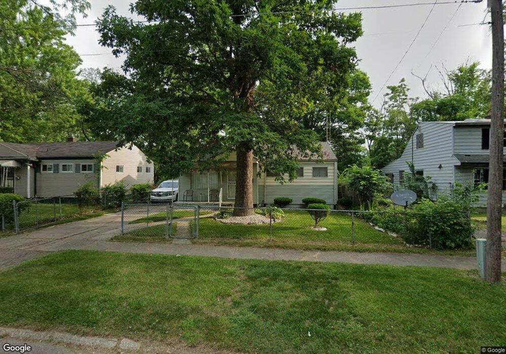
1210 W Moore St Flint, MI 48504
Sterling and Myrtle NeighborhoodEstimated Value: $39,431 - $58,000
3
Beds
1
Bath
880
Sq Ft
$59/Sq Ft
Est. Value
About This Home
This home is located at 1210 W Moore St, Flint, MI 48504 and is currently estimated at $52,358, approximately $59 per square foot. 1210 W Moore St is a home located in Genesee County with nearby schools including Brownell STEM Academy, The New Standard Academy, and Eagle's Nest Academy.
Ownership History
Date
Name
Owned For
Owner Type
Purchase Details
Closed on
Sep 24, 2024
Sold by
Genesee County Treasurer
Bought by
Adams Quinnell Monique
Current Estimated Value
Purchase Details
Closed on
Jun 27, 2016
Sold by
Genesee County Land Bank Authority
Bought by
Brown Roy Douglas
Purchase Details
Closed on
Sep 16, 2014
Sold by
The Genesee County Land Bank Authority
Bought by
Brown Roy Douglas
Purchase Details
Closed on
Dec 21, 2011
Sold by
Genesee County Treasurer
Bought by
Genesee County Land Bank
Purchase Details
Closed on
Apr 15, 1999
Sold by
U S Mtg
Bought by
Va
Purchase Details
Closed on
Feb 24, 1999
Sold by
Graham Irving Thomas and Graham Joyce
Bought by
U S Mtg
Create a Home Valuation Report for This Property
The Home Valuation Report is an in-depth analysis detailing your home's value as well as a comparison with similar homes in the area
Home Values in the Area
Average Home Value in this Area
Purchase History
| Date | Buyer | Sale Price | Title Company |
|---|---|---|---|
| Adams Quinnell Monique | $12,500 | None Listed On Document | |
| Brown Roy Douglas | $3,500 | None Available | |
| Brown Roy Douglas | $3,500 | None Available | |
| Genesee County Land Bank | -- | None Available | |
| Va | -- | -- | |
| U S Mtg | $8,811 | -- |
Source: Public Records
Mortgage History
| Date | Status | Borrower | Loan Amount |
|---|---|---|---|
| Closed | Brown Roy Douglas | $0 |
Source: Public Records
Tax History
| Year | Tax Paid | Tax Assessment Tax Assessment Total Assessment is a certain percentage of the fair market value that is determined by local assessors to be the total taxable value of land and additions on the property. | Land | Improvement |
|---|---|---|---|---|
| 2025 | $875 | $12,100 | $0 | $0 |
| 2024 | $661 | $12,000 | $0 | $0 |
| 2023 | $655 | $9,400 | $0 | $0 |
| 2022 | $0 | $7,800 | $0 | $0 |
| 2021 | $675 | $7,500 | $0 | $0 |
| 2020 | $651 | $8,100 | $0 | $0 |
| 2019 | $683 | $8,900 | $0 | $0 |
| 2018 | $727 | $9,800 | $0 | $0 |
| 2017 | $718 | $0 | $0 | $0 |
| 2016 | $784 | $0 | $0 | $0 |
| 2015 | -- | $0 | $0 | $0 |
| 2014 | -- | $0 | $0 | $0 |
| 2012 | -- | $0 | $0 | $0 |
Source: Public Records
Map
Nearby Homes
- 4306 Berger Dr
- 4310 Berger Dr
- 1315 W Myrtle Ave
- 4539 Trumbull Dr
- 3722 Sterling St
- 4702 Warrington Dr
- 3808 Comstock Ave
- 606 W Stewart Ave
- 4808 Edwards Ave
- 702/718 W Flint Park Blvd
- 2013 Canniff St
- 3420 Fleming Rd
- 3517 Leerda St
- 3505 Leerda St
- 3419 Leerda St
- 3422 Race St
- 3413 Leerda St
- 1909 Cherrylawn Dr
- 510 W Bishop Ave
- 3506 Brownell Blvd
- 1214 W Moore St
- 1206 W Moore St
- 1202 W Moore St
- 1209 W Stewart Ave
- 1201 W Stewart Ave
- 1215 W Moore St
- 1120 W Moore St
- 4133 Lawndale Ave
- 1302 W Moore St
- 1116 W Moore St
- 1119 W Stewart Ave
- 4129 Lawndale Ave
- 1301 W Stewart Ave
- 1123 W Stewart Ave
- 1306 W Moore St
- 4130 Sterling St
- 4125 Lawndale Ave
- 1113 W Stewart Ave
- 4126 Sterling St
- 1309 W Stewart Ave
Your Personal Tour Guide
Ask me questions while you tour the home.