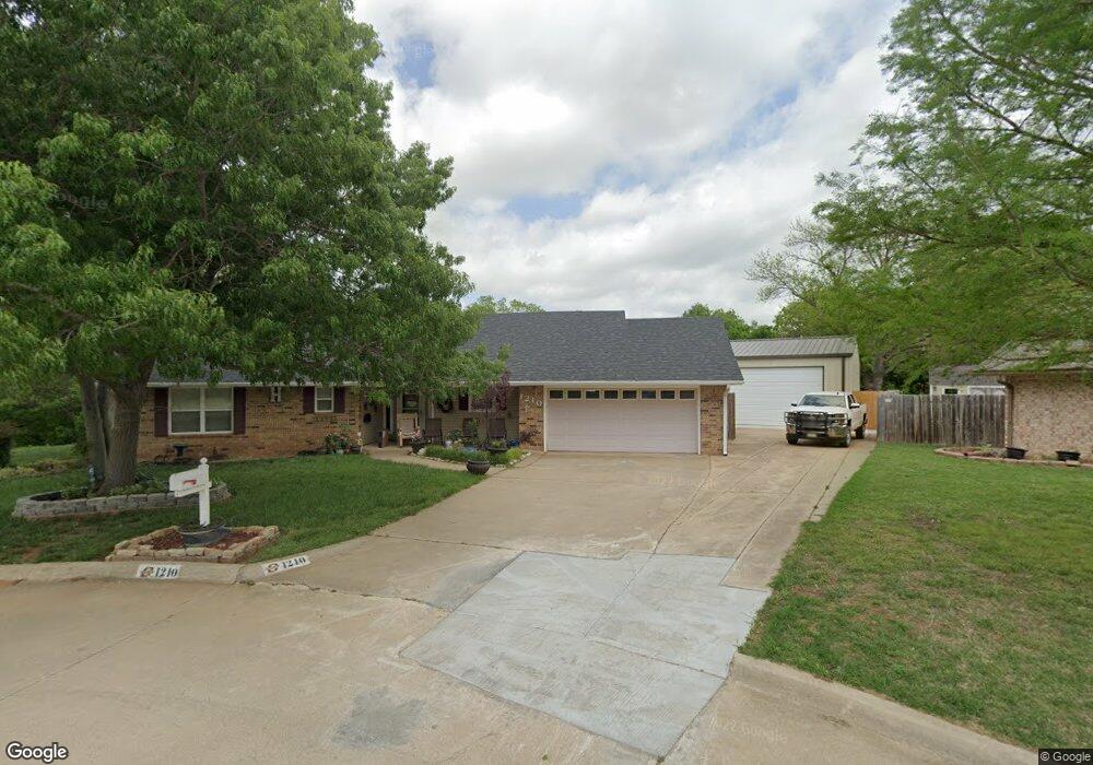
1210 W Randall Ct Duncan, OK 73533
Estimated Value: $176,000 - $211,006
3
Beds
2
Baths
1,539
Sq Ft
$128/Sq Ft
Est. Value
About This Home
This home is located at 1210 W Randall Ct, Duncan, OK 73533 and is currently estimated at $197,252, approximately $128 per square foot. 1210 W Randall Ct is a home located in Stephens County with nearby schools including Horace Mann Elementary School, Duncan Middle School, and Duncan High School.
Ownership History
Date
Name
Owned For
Owner Type
Purchase Details
Closed on
Jul 19, 2011
Sold by
Cair Jay D St and Clair Diane A St
Bought by
Heenan Bryan Joel
Current Estimated Value
Home Financials for this Owner
Home Financials are based on the most recent Mortgage that was taken out on this home.
Original Mortgage
$137,800
Outstanding Balance
$94,504
Interest Rate
4.52%
Mortgage Type
VA
Estimated Equity
$102,748
Purchase Details
Closed on
Nov 8, 2001
Sold by
Mcclennen Harold Dale
Purchase Details
Closed on
May 21, 1992
Sold by
Baldridge Morris Gene
Create a Home Valuation Report for This Property
The Home Valuation Report is an in-depth analysis detailing your home's value as well as a comparison with similar homes in the area
Home Values in the Area
Average Home Value in this Area
Purchase History
| Date | Buyer | Sale Price | Title Company |
|---|---|---|---|
| Heenan Bryan Joel | $135,000 | None Available | |
| -- | $91,500 | -- | |
| -- | $74,000 | -- |
Source: Public Records
Mortgage History
| Date | Status | Borrower | Loan Amount |
|---|---|---|---|
| Open | Heenan Bryan Joel | $137,800 |
Source: Public Records
Tax History Compared to Growth
Tax History
| Year | Tax Paid | Tax Assessment Tax Assessment Total Assessment is a certain percentage of the fair market value that is determined by local assessors to be the total taxable value of land and additions on the property. | Land | Improvement |
|---|---|---|---|---|
| 2025 | $1,724 | $21,254 | $1,640 | $19,614 |
| 2024 | $1,724 | $20,242 | $1,640 | $18,602 |
| 2023 | $1,724 | $20,242 | $1,640 | $18,602 |
| 2022 | $1,561 | $19,279 | $1,640 | $17,639 |
| 2021 | $1,156 | $13,574 | $1,640 | $11,934 |
| 2020 | $1,258 | $14,574 | $1,640 | $12,934 |
| 2019 | $1,218 | $14,082 | $1,640 | $12,442 |
| 2018 | $1,289 | $14,469 | $1,640 | $12,829 |
| 2017 | $1,244 | $14,479 | $1,640 | $12,839 |
| 2016 | $1,182 | $13,902 | $1,640 | $12,262 |
| 2015 | $1,285 | $14,485 | $1,640 | $12,845 |
| 2014 | $1,285 | $14,485 | $1,640 | $12,845 |
Source: Public Records
Map
Nearby Homes
- 2230 W Spruce St
- 2204 W Parkview Ave
- 2206 2206 W Spruce
- 1929 W Chisholm Dr
- 2110 W Amhurst Ave
- 2202 W Canary Ave
- 1212 1212 N 21st
- 1302 N 21st St
- 507 N Alice Dr
- 1311 1311 N 20 St
- 2210 Western Dr
- 2120 2120 Flamingo Ln
- 1902 W Randall Ave
- 1099 N 19th St
- 1244 Carriage Dr
- 2150 Drexal Place
- 1807 W Chisholm Dr
- 1385 Smith Rd
- 1359 Smith Rd
- 3421 Salter St
- 1208 W Randall Ct
- 1208 W Randall Ct
- 1212 W Randall Ct
- 1206 W Randall Ct
- 1213 N Harville Rd
- 1211 N Harville Rd
- 1204 1204 Randall Ct
- 1204 W Randall Ct
- 2407 W Randall Ave
- 1207 N Harville Rd
- 2409 W Randall Ave
- 1205 1205 Harville
- 1209 N Harville Rd
- 1202 W Randall Ct
- 1205 N Harville Rd
- 1215 N Harville Rd
- 1203 N Harville Rd
- 1201 N Harville Rd
- 1301 N Harville Rd
- 2406 W Randall Ave