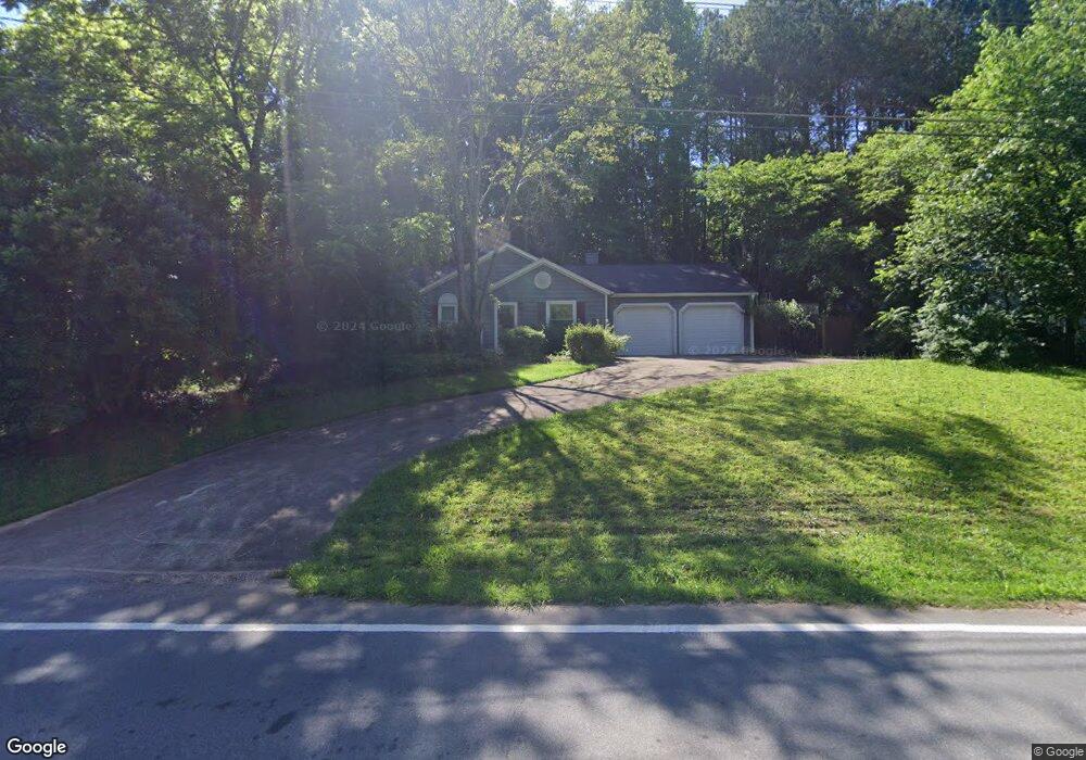
1210 W Wylie Bridge Rd Woodstock, GA 30188
Estimated Value: $363,000
3
Beds
2
Baths
1,184
Sq Ft
$307/Sq Ft
Est. Value
About This Home
This home is located at 1210 W Wylie Bridge Rd, Woodstock, GA 30188 and is currently estimated at $363,000, approximately $306 per square foot. 1210 W Wylie Bridge Rd is a home located in Cherokee County with nearby schools including Little River Elementary, Mill Creek Middle School, and River Ridge High School.
Ownership History
Date
Name
Owned For
Owner Type
Purchase Details
Closed on
Mar 31, 2008
Sold by
Smith Joseph T
Bought by
Turpin Christopher
Current Estimated Value
Home Financials for this Owner
Home Financials are based on the most recent Mortgage that was taken out on this home.
Original Mortgage
$158,500
Outstanding Balance
$99,506
Interest Rate
5.97%
Estimated Equity
$263,494
Purchase Details
Closed on
Jul 25, 1996
Sold by
Prieto Alicia
Bought by
Smith Joseph and Franklin Cecil
Create a Home Valuation Report for This Property
The Home Valuation Report is an in-depth analysis detailing your home's value as well as a comparison with similar homes in the area
Home Values in the Area
Average Home Value in this Area
Purchase History
| Date | Buyer | Sale Price | Title Company |
|---|---|---|---|
| Turpin Christopher | $158,500 | -- | |
| Smith Joseph | $93,600 | -- |
Source: Public Records
Mortgage History
| Date | Status | Borrower | Loan Amount |
|---|---|---|---|
| Open | Turpin Christopher | $158,500 | |
| Closed | Smith Joseph | $0 |
Source: Public Records
Tax History Compared to Growth
Tax History
| Year | Tax Paid | Tax Assessment Tax Assessment Total Assessment is a certain percentage of the fair market value that is determined by local assessors to be the total taxable value of land and additions on the property. | Land | Improvement |
|---|---|---|---|---|
| 2025 | $3,394 | $129,256 | $29,600 | $99,656 |
| 2024 | $3,273 | $125,936 | $29,600 | $96,336 |
| 2023 | $3,055 | $117,576 | $28,000 | $89,576 |
| 2022 | $2,567 | $97,668 | $23,600 | $74,068 |
| 2021 | $2,321 | $81,764 | $18,000 | $63,764 |
| 2020 | $2,083 | $73,296 | $14,400 | $58,896 |
| 2019 | $1,794 | $63,120 | $14,400 | $48,720 |
| 2018 | $1,600 | $55,960 | $12,800 | $43,160 |
| 2017 | $1,600 | $138,800 | $12,800 | $42,720 |
| 2016 | $1,551 | $133,200 | $11,600 | $41,680 |
| 2015 | $1,449 | $123,200 | $10,080 | $39,200 |
| 2014 | $1,328 | $112,700 | $10,080 | $35,000 |
Source: Public Records
Map
Nearby Homes
- 504 E Lake Ct
- 321 Knollwood Ln
- 1486 Willow Bend
- 103 Branch Dr
- 1070 Daventry Crossing
- 166 Churchcliff Dr
- 403 Heron Landing
- 106 Pioneer Dr
- 424 Loblolly St
- 313 Derrymore Dr
- Magnolia Plan at Magnolia Reserve
- Chatham Plan at Magnolia Reserve
- Turnberry Plan at Magnolia Reserve
- Heritage Plan at Magnolia Reserve
- 119 Chateau Place
- 319 Dexter Dr
- 126 Heron Crossing
- 5305 Shotwell Ct Unit III
- 120 Fernwood Dr
- 1208 W Wylie Bridge Rd
- 1208 Wiley Bridge Rd W Unit 1
- 1212 W Wylie Bridge Rd
- 302 Colemans Ct
- 204 Colemans Bluff Dr
- 101 Colemans Walk
- 304 Colemans Ct Unit 1
- 202 Colemans Bluff Dr Unit 1
- 303 Colemans Ct Unit I
- 207 Colemans Bluff Dr
- 208 Colemans Bluff Dr
- 100 Colemans Walk
- 205 Colemans Bluff Dr
- 200 Colemans Bluff Dr
- 203 Colemans Bluff Dr
- 209 Colemans Bluff Dr
- 210 Colemans Bluff Dr
- 207 Windcrest Ct
- 205 Windcrest Ct Unit 1
- 1218 W Wylie Bridge Rd Unit 2