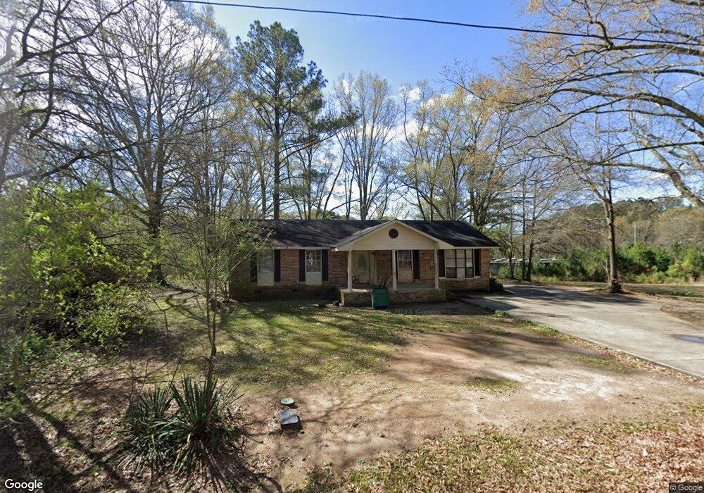
1210 Watson Ave Union Point, GA 30669
Estimated Value: $95,000 - $229,000
2
Beds
2
Baths
1,300
Sq Ft
$120/Sq Ft
Est. Value
About This Home
This home is located at 1210 Watson Ave, Union Point, GA 30669 and is currently estimated at $155,958, approximately $119 per square foot. 1210 Watson Ave is a home located in Greene County with nearby schools including Greene County High School.
Ownership History
Date
Name
Owned For
Owner Type
Purchase Details
Closed on
Apr 9, 2001
Sold by
Walker Charrise
Bought by
Walker Charrise M and Walker Harold
Current Estimated Value
Purchase Details
Closed on
Jan 1, 1986
Sold by
Farmers Home Admn
Bought by
Walker Charrise
Purchase Details
Closed on
Jan 1, 1985
Sold by
Turner Judge and Turner Mary J
Bought by
Farmers Home Admn
Purchase Details
Closed on
Jan 1, 1981
Sold by
Gibbs Barbara
Bought by
Turner Judge and Turner Mary J
Purchase Details
Closed on
Jan 1, 1978
Sold by
Peek Willie Clark
Bought by
Gibbs Barbara
Purchase Details
Closed on
Jan 1, 1971
Bought by
Peek Willie Clark
Create a Home Valuation Report for This Property
The Home Valuation Report is an in-depth analysis detailing your home's value as well as a comparison with similar homes in the area
Purchase History
| Date | Buyer | Sale Price | Title Company |
|---|---|---|---|
| Walker Charrise M | -- | -- | |
| Walker Charrise | -- | -- | |
| Farmers Home Admn | -- | -- | |
| Turner Judge | -- | -- | |
| Gibbs Barbara | -- | -- | |
| Peek Willie Clark | -- | -- |
Source: Public Records
Tax History
| Year | Tax Paid | Tax Assessment Tax Assessment Total Assessment is a certain percentage of the fair market value that is determined by local assessors to be the total taxable value of land and additions on the property. | Land | Improvement |
|---|---|---|---|---|
| 2025 | $868 | $28,240 | $2,200 | $26,040 |
| 2024 | $821 | $26,360 | $2,200 | $24,160 |
| 2023 | $248 | $26,000 | $2,200 | $23,800 |
| 2022 | $449 | $23,440 | $2,200 | $21,240 |
| 2021 | $460 | $20,880 | $2,200 | $18,680 |
| 2020 | $435 | $15,440 | $1,320 | $14,120 |
| 2019 | $447 | $15,440 | $1,320 | $14,120 |
| 2018 | $309 | $15,440 | $1,320 | $14,120 |
| 2017 | $402 | $15,496 | $1,350 | $14,146 |
| 2016 | $415 | $15,878 | $1,350 | $14,528 |
| 2015 | $384 | $15,878 | $1,350 | $14,528 |
| 2014 | $362 | $14,427 | $1,350 | $13,077 |
Source: Public Records
Map
Nearby Homes
- 000 Washington Hwy
- 215 Hunter St
- 0 S Rhodes St Unit 10618488
- 607 Bryan Ave
- 202 Veazey St
- 0 Woodland Ct Unit 10543600
- 405 Crawfordville Rd
- 1160 Moody St
- 1241 Old Siloam Rd
- 1041 Hillcrest Dr
- 1251 Adams Rd
- 1581 Highway 77 S Hwy
- 1581 Highway 77 S
- 5401 Union Point Hwy
- 1201 Buffalo Lick Rd
- 0 Buffalo Lick Rd Unit 10551234
- 0 Buffalo Lick Rd Unit 10551325
- 0 Old Union Point Rd Unit 1 10557753
- 1251 Brick House Rd
- 1251 Brickhouse Rd
- 1208 Watson Ave
- 1209 Watson Ave
- 1171 Washington Hwy
- 1181 Washington Hwy
- 1191 Washington Hwy
- 1121 Washington Hwy
- 1203 Watson Ave
- 1019 Dolvin Ave
- 1102 Watson Ave
- 1113 Watson Ave
- 1100 Watson Ave Unit 2
- 1012 Dolvin Ave
- 1101 Watson Ave
- 1012 Watson Ave
- 1007 Dolvin Ave
- 1009 Watson Ave
- 1008 Dolvin Ave
- 1006 Watson Ave
- 1005 Dolvin Ave
- 308 Church St
Your Personal Tour Guide
Ask me questions while you tour the home.