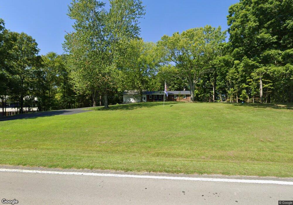
12101 N Highway 127 Albany, KY 42602
Estimated Value: $157,000 - $200,000
3
Beds
1
Bath
1,404
Sq Ft
$132/Sq Ft
Est. Value
About This Home
This home is located at 12101 N Highway 127, Albany, KY 42602 and is currently estimated at $185,552, approximately $132 per square foot. 12101 N Highway 127 is a home located in Clinton County with nearby schools including Clinton County Early Childhood Center, Albany Elementary School, and Clinton County Middle School.
Ownership History
Date
Name
Owned For
Owner Type
Purchase Details
Closed on
Aug 6, 2025
Sold by
Denney Leon and Denney Elaine
Bought by
Butler Jerry S and Butler Tricia
Current Estimated Value
Purchase Details
Closed on
Nov 13, 2018
Sold by
Mackey Melvina Susan and Brown Melvina
Bought by
Butler Jerry Steven and Butler Tricia C
Purchase Details
Closed on
Sep 5, 2014
Sold by
Brown Melvina V and Brown Ralph E
Bought by
Brown Charles D
Home Financials for this Owner
Home Financials are based on the most recent Mortgage that was taken out on this home.
Original Mortgage
$241,830
Interest Rate
4.2%
Mortgage Type
Purchase Money Mortgage
Create a Home Valuation Report for This Property
The Home Valuation Report is an in-depth analysis detailing your home's value as well as a comparison with similar homes in the area
Home Values in the Area
Average Home Value in this Area
Purchase History
| Date | Buyer | Sale Price | Title Company |
|---|---|---|---|
| Butler Jerry S | $140,000 | None Listed On Document | |
| Butler Jerry S | $140,000 | None Listed On Document | |
| Butler Jerry Steven | $97,200 | None Available | |
| Brown Charles D | $300,000 | None Available |
Source: Public Records
Mortgage History
| Date | Status | Borrower | Loan Amount |
|---|---|---|---|
| Previous Owner | Brown Charles D | $241,830 |
Source: Public Records
Tax History Compared to Growth
Tax History
| Year | Tax Paid | Tax Assessment Tax Assessment Total Assessment is a certain percentage of the fair market value that is determined by local assessors to be the total taxable value of land and additions on the property. | Land | Improvement |
|---|---|---|---|---|
| 2024 | $809 | $97,200 | $0 | $0 |
| 2023 | $816 | $97,200 | $0 | $0 |
| 2022 | $812 | $97,200 | $0 | $0 |
| 2021 | $811 | $97,200 | $0 | $0 |
| 2020 | $813 | $97,200 | $0 | $0 |
| 2019 | $805 | $97,200 | $0 | $0 |
| 2018 | $398 | $86,000 | $6,000 | $80,000 |
| 2015 | $374 | $86,000 | $6,000 | $80,000 |
| 2013 | -- | $86,000 | $6,000 | $80,000 |
Source: Public Records
Map
Nearby Homes
- 102.71 Desda Loop
- 266 Carmel Ln
- 0 S Highway 127 Unit LotWP001 22170345
- lot 6 Campbells Ferry Ln
- lot 7 Campbells Ferry Ln
- lot 4 Campbells Ferry Ln
- lot 1 Campbells Ferry Ln
- Lot 2 Campbells Ferry Ln
- 420 Campbells Ferry Ln
- 0 Manntown Rd
- 0 Rockhouse Trace Rd Unit Lots 36 & 37
- 0 Rockhouse Trace Rd Unit RTC2747842
- 381 Cave Spring Rd
- 8239 S Highway 379
- 2440 S Highway 379
- 267 Irish Bottom Rd
- 6 Swan Pond Rd
- T1 S Highway 379
- T2 S Highway 379
- 121 Story Cemetery Rd
- 12158 N Highway 127
- 12209 N Highway 127
- 12216 N Highway 127
- 7 Glen Connor Rd
- 27 Glen Connor Rd
- 45 Glen Connor Rd
- 11874 N Hwy 127
- 11874 N Highway 127
- 270 Malone Ridge Rd
- 141 Malone Ridge
- 11801 N Highway 127
- 160 Glen Connor Rd
- 11806 N Highway 127
- 0 Desda-Wells Bottom Rd
- 4 Desda-Wells Bottom Rd
- 10 Old Highway 127
- 109 Crow Creek Rd
- 12517 N Highway 127
- 11664 N Highway 127
- 127 Desda-Wells Bottom Rd