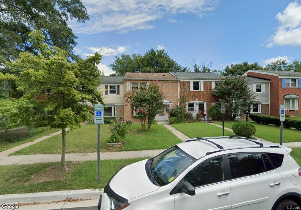
12109 Pheasant Run Dr Laurel, MD 20708
South Laurel NeighborhoodEstimated Value: $327,000 - $348,468
Studio
3
Baths
1,522
Sq Ft
$221/Sq Ft
Est. Value
About This Home
This home is located at 12109 Pheasant Run Dr, Laurel, MD 20708 and is currently estimated at $336,367, approximately $221 per square foot. 12109 Pheasant Run Dr is a home located in Prince George's County with nearby schools including Montpelier Elementary School, Dwight D. Eisenhower Middle School, and Laurel High School.
Ownership History
Date
Name
Owned For
Owner Type
Purchase Details
Closed on
May 6, 2016
Bought by
Vargas Manuel
Current Estimated Value
Home Financials for this Owner
Home Financials are based on the most recent Mortgage that was taken out on this home.
Original Mortgage
$186,666
Outstanding Balance
$147,953
Interest Rate
3.61%
Estimated Equity
$188,414
Purchase Details
Closed on
Oct 2, 1998
Sold by
Mcclellan Daniel M
Bought by
Vargas Manuel A
Purchase Details
Closed on
Jul 20, 1988
Sold by
Moskal Frank L
Bought by
Mcclellan Daniel M and Mcclellan Jamie C
Create a Home Valuation Report for This Property
The Home Valuation Report is an in-depth analysis detailing your home's value as well as a comparison with similar homes in the area
Home Values in the Area
Average Home Value in this Area
Purchase History
We collect this data history from publicly available records. To have your information removed, we recommend requesting removal directly through your county’s website.
| Date | Buyer | Sale Price | Title Company |
|---|---|---|---|
| Vargas Manuel | -- | -- | |
| Vargas Manuel A | $101,500 | -- | |
| Mcclellan Daniel M | $96,500 | -- |
Source: Public Records
Mortgage History
We collect this data history from publicly available records. To have your information removed, we recommend requesting removal directly through your county’s website.
| Date | Status | Borrower | Loan Amount |
|---|---|---|---|
| Open | Vargas Manuel | $186,666 | |
| Closed | Vargas Manuel | -- |
Source: Public Records
Tax History
| Year | Tax Paid | Tax Assessment Tax Assessment Total Assessment is a certain percentage of the fair market value that is determined by local assessors to be the total taxable value of land and additions on the property. | Land | Improvement |
|---|---|---|---|---|
| 2025 | $3,442 | $285,000 | $85,000 | $200,000 |
| 2024 | $3,442 | $275,067 | -- | -- |
| 2023 | $3,343 | $265,133 | $0 | $0 |
| 2022 | $3,215 | $255,200 | $75,000 | $180,200 |
| 2021 | $3,072 | $241,167 | $0 | $0 |
| 2020 | $2,989 | $227,133 | $0 | $0 |
| 2019 | $2,891 | $213,100 | $100,000 | $113,100 |
| 2018 | $2,808 | $204,700 | $0 | $0 |
| 2017 | $2,739 | $196,300 | $0 | $0 |
| 2016 | -- | $187,900 | $0 | $0 |
| 2015 | $2,416 | $186,667 | $0 | $0 |
| 2014 | $2,416 | $185,433 | $0 | $0 |
Source: Public Records
Map
Nearby Homes
- 12109 Spirit Ave
- 12107 Spirit Ave
- 12105 Spirit Ave
- 12103 Spirit Ave
- 12101 Spirit Ave
- 12128 Running Bull Way
- 12124 Running Bull Way
- 12122 Running Bull Way
- 9423 Rosmarin Way
- 12114 Running Bull Way
- 11801 Bignonia Ct
- 12513 Laurel Bowie Rd
- 12229 Shadetree Ln
- 11707 Balsamwood Terrace
- 11386 Laurelwalk Dr
- 11376 Laurelwalk Dr
- 11420 Hermosa Dr
- 12605 Cedarbrook Ln
- 11907 Callow Terrace
- 12600 Cedarbrook Ln
- 12107 Pheasant Run Dr
- 12111 Pheasant Run Dr
- 12113 Pheasant Run Dr
- 12105 Pheasant Run Dr
- 12103 Pheasant Run Dr
- 12115 Pheasant Run Dr
- 9900 Mallard Dr
- 12179 Dove Cir
- 12177 Dove Cir
- 12181 Dove Cir
- 12175 Dove Cir
- 12183 Dove Cir
- 12185 Dove Cir
- 12201 Pheasant Run Dr
- 9902 Mallard Dr
- 12173 Dove Cir
- 12203 Pheasant Run Dr
- 12171 Dove Cir
- 12205 Pheasant Run Dr
- 12169 Dove Cir
Your Personal Tour Guide
Ask me questions while you tour the home.