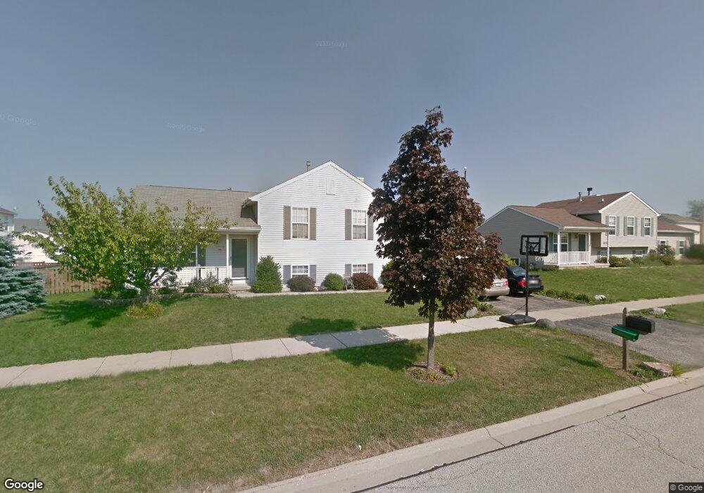
1211 Cardinal Dr Zion, IL 60099
West Zion NeighborhoodEstimated Value: $287,000 - $310,000
4
Beds
2
Baths
1,104
Sq Ft
$268/Sq Ft
Est. Value
About This Home
This home is located at 1211 Cardinal Dr, Zion, IL 60099 and is currently estimated at $295,631, approximately $267 per square foot. 1211 Cardinal Dr is a home located in Lake County with nearby schools including Newport Elementary School, Beach Park Middle School, and Zion-Benton Township High School.
Ownership History
Date
Name
Owned For
Owner Type
Purchase Details
Closed on
Apr 13, 2005
Sold by
Franks David W and Franks Mary J
Bought by
Lenzie Roy H and Lenzie Maritess
Current Estimated Value
Home Financials for this Owner
Home Financials are based on the most recent Mortgage that was taken out on this home.
Original Mortgage
$193,000
Outstanding Balance
$101,401
Interest Rate
6.06%
Mortgage Type
VA
Estimated Equity
$194,230
Purchase Details
Closed on
Apr 11, 2003
Sold by
Anderson Mark J and Anderson Andrea
Bought by
Franks David W and Franks Mary J
Home Financials for this Owner
Home Financials are based on the most recent Mortgage that was taken out on this home.
Original Mortgage
$50,000
Interest Rate
5.87%
Mortgage Type
Unknown
Purchase Details
Closed on
Aug 17, 1998
Sold by
Bank Of Waukegan
Bought by
Anderson Mark J and Anderson Andrea
Home Financials for this Owner
Home Financials are based on the most recent Mortgage that was taken out on this home.
Original Mortgage
$133,896
Interest Rate
7.03%
Mortgage Type
FHA
Create a Home Valuation Report for This Property
The Home Valuation Report is an in-depth analysis detailing your home's value as well as a comparison with similar homes in the area
Home Values in the Area
Average Home Value in this Area
Purchase History
| Date | Buyer | Sale Price | Title Company |
|---|---|---|---|
| Lenzie Roy H | $193,000 | Ticor | |
| Franks David W | $180,000 | First American Title | |
| Anderson Mark J | $136,000 | Chicago Title Insurance Co |
Source: Public Records
Mortgage History
| Date | Status | Borrower | Loan Amount |
|---|---|---|---|
| Open | Lenzie Roy H | $193,000 | |
| Previous Owner | Franks David W | $50,000 | |
| Previous Owner | Anderson Mark J | $133,896 |
Source: Public Records
Tax History Compared to Growth
Tax History
| Year | Tax Paid | Tax Assessment Tax Assessment Total Assessment is a certain percentage of the fair market value that is determined by local assessors to be the total taxable value of land and additions on the property. | Land | Improvement |
|---|---|---|---|---|
| 2024 | -- | $78,636 | $9,900 | $68,736 |
| 2023 | -- | $70,111 | $8,827 | $61,284 |
| 2022 | $0 | $61,513 | $7,234 | $54,279 |
| 2021 | $0 | $57,704 | $6,786 | $50,918 |
| 2020 | $0 | $54,274 | $6,383 | $47,891 |
| 2019 | $0 | $50,558 | $5,946 | $44,612 |
| 2018 | $5,569 | $45,171 | $5,420 | $39,751 |
| 2017 | $5,436 | $41,903 | $5,028 | $36,875 |
| 2016 | $4,971 | $38,038 | $4,564 | $33,474 |
| 2015 | $4,696 | $34,514 | $4,141 | $30,373 |
| 2014 | $4,815 | $33,289 | $4,039 | $29,250 |
| 2012 | $5,275 | $35,451 | $4,301 | $31,150 |
Source: Public Records
Map
Nearby Homes
- 1302 Lorelei Dr
- 1304 Lorelei Dr
- 908 Countrywood Dr
- 1417 Westside Trail
- 4014 Ridge Rd
- 3717 Willow Crest Dr
- 0 9th St
- 3707 Willow Crest Dr
- 4539 Illinois 173
- 4533 Illinois 173
- 1304 Pelican Ct
- 41320 N Green Bay Rd
- 1916 Sunshine Ct
- 2010 Sunset Ct
- 1531 Southport Ct
- 1521 Southport Ct
- 1405 Lewis Ave
- 42334 N Heritage Lot 7 Trail
- 43389 N Oakcrest Ln
- 43411 Lynn Dale Dr
- 1213 Cardinal Dr
- 1209 Cardinal Dr
- 1238 Pheasant Run
- 4219 Quail St
- 1236 Pheasant Run
- 4217 Quail St
- 1234 Pheasant Run
- 4215 Quail St
- 1232 Pheasant Run
- 1205 Cardinal Dr
- 1241 Pheasant Run
- 1239 Pheasant Run
- 4213 Quail St
- 1243 Pheasant Run
- 4218 Quail St
- 1237 Pheasant Run
- 1245 Pheasant Run
- 4216 Quail St
- 1230 Pheasant Run
- 1235 Pheasant Run