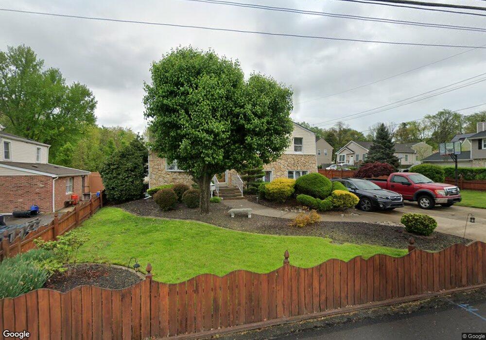
1211 Cornwells Ave Bensalem, PA 19020
Estimated Value: $386,000 - $511,000
3
Beds
2
Baths
1,148
Sq Ft
$387/Sq Ft
Est. Value
About This Home
This home is located at 1211 Cornwells Ave, Bensalem, PA 19020 and is currently estimated at $443,740, approximately $386 per square foot. 1211 Cornwells Ave is a home located in Bucks County with nearby schools including Robert K. Shafer Middle School, School Lane Charter School, and St Charles Borromeo School.
Ownership History
Date
Name
Owned For
Owner Type
Purchase Details
Closed on
Aug 7, 2006
Sold by
Mcgrath Ronald J and Mcgrath Joann M
Bought by
Vile Donald and Vile Maryanne
Current Estimated Value
Home Financials for this Owner
Home Financials are based on the most recent Mortgage that was taken out on this home.
Original Mortgage
$61,700
Outstanding Balance
$37,375
Interest Rate
6.83%
Mortgage Type
Credit Line Revolving
Estimated Equity
$406,365
Purchase Details
Closed on
Sep 6, 2002
Sold by
Dandrea Vincent C and Dandrea Patrice T
Bought by
Mcgrath Ronald J and Mcgrath Joann M
Home Financials for this Owner
Home Financials are based on the most recent Mortgage that was taken out on this home.
Original Mortgage
$168,000
Interest Rate
6.24%
Create a Home Valuation Report for This Property
The Home Valuation Report is an in-depth analysis detailing your home's value as well as a comparison with similar homes in the area
Home Values in the Area
Average Home Value in this Area
Purchase History
| Date | Buyer | Sale Price | Title Company |
|---|---|---|---|
| Vile Donald | $308,500 | None Available | |
| Mcgrath Ronald J | $210,000 | -- |
Source: Public Records
Mortgage History
| Date | Status | Borrower | Loan Amount |
|---|---|---|---|
| Open | Vile Donald | $61,700 | |
| Open | Vile Donald | $246,800 | |
| Previous Owner | Mcgrath Ronald J | $168,000 |
Source: Public Records
Tax History Compared to Growth
Tax History
| Year | Tax Paid | Tax Assessment Tax Assessment Total Assessment is a certain percentage of the fair market value that is determined by local assessors to be the total taxable value of land and additions on the property. | Land | Improvement |
|---|---|---|---|---|
| 2025 | $4,366 | $20,000 | $3,520 | $16,480 |
| 2024 | $4,366 | $20,000 | $3,520 | $16,480 |
| 2023 | $4,243 | $20,000 | $3,520 | $16,480 |
| 2022 | $4,218 | $20,000 | $3,520 | $16,480 |
| 2021 | $4,218 | $20,000 | $3,520 | $16,480 |
| 2020 | $4,176 | $20,000 | $3,520 | $16,480 |
| 2019 | $4,082 | $20,000 | $3,520 | $16,480 |
| 2018 | $3,988 | $20,000 | $3,520 | $16,480 |
| 2017 | $3,963 | $20,000 | $3,520 | $16,480 |
| 2016 | $3,963 | $20,000 | $3,520 | $16,480 |
| 2015 | -- | $20,000 | $3,520 | $16,480 |
| 2014 | -- | $20,000 | $3,520 | $16,480 |
Source: Public Records
Map
Nearby Homes
- 2387 Forrest Ave
- 1032 Sunset Ln
- 1319 Rosalie Ave
- 943 Cornwells Ave
- 833 Simons Ave
- 2498 Ogden Ave
- 1155 Regina Ave
- 1742 Paradise Ln
- 1421 Custom House Square
- 4471 Ernie Davis Cir
- 2692 June Ave
- 4274 Lawnside Rd
- 2025 State Rd
- 11913 Millbrook Rd
- 128 Federal St
- 126B Royal Mews
- 4207 Fairdale Rd
- 136b Alexandria St
- 1236 Whittier Ave
- 117B Prince George St
- 1219 Cornwells Ave
- 2211 Ogden Ave
- 2224 Ogden Ave
- 2219 Ogden Ave
- 1229 Cornwells Ave
- 2229 Ogden Ave
- 1204 Cornwells Ave
- 2224 Bowman Ave
- 1157 Cornwells Ave
- 2232 Ogden Ave
- 2233 Ogden Ave
- 2244 Ogden Ave
- 2214 Bowman Ave
- 1156 Cornwells Ave
- 1218 Cornwells Ave
- 1226 Cornwells Ave
- 2232 Bowman Ave
- 1166 Cornwells Ave
- 2250 Bowman Ave
- 2239 Ogden Ave