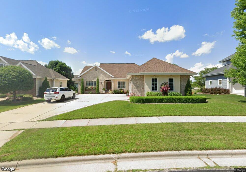
1211 Dartmouth Dr Waunakee, WI 53597
Estimated Value: $683,442 - $978,000
1
Bed
--
Bath
3,725
Sq Ft
$214/Sq Ft
Est. Value
About This Home
This home is located at 1211 Dartmouth Dr, Waunakee, WI 53597 and is currently estimated at $796,611, approximately $213 per square foot. 1211 Dartmouth Dr is a home located in Dane County with nearby schools including Arboretum Elementary School, Waunakee Community Middle School, and Waunakee Intermediate School.
Ownership History
Date
Name
Owned For
Owner Type
Purchase Details
Closed on
Dec 23, 2011
Sold by
Bledes Robert and Debeck Joyce
Bought by
Bledes Robert and Debeck Joyce
Current Estimated Value
Purchase Details
Closed on
Nov 10, 2009
Sold by
Debeck Joyce A
Bought by
Debeck Joyce A and Bledes Robert P
Home Financials for this Owner
Home Financials are based on the most recent Mortgage that was taken out on this home.
Original Mortgage
$186,000
Interest Rate
4.3%
Mortgage Type
New Conventional
Create a Home Valuation Report for This Property
The Home Valuation Report is an in-depth analysis detailing your home's value as well as a comparison with similar homes in the area
Home Values in the Area
Average Home Value in this Area
Purchase History
| Date | Buyer | Sale Price | Title Company |
|---|---|---|---|
| Bledes Robert | -- | None Available | |
| Debeck Joyce A | -- | None Available |
Source: Public Records
Mortgage History
| Date | Status | Borrower | Loan Amount |
|---|---|---|---|
| Closed | Debeck Joyce A | $186,000 |
Source: Public Records
Tax History Compared to Growth
Tax History
| Year | Tax Paid | Tax Assessment Tax Assessment Total Assessment is a certain percentage of the fair market value that is determined by local assessors to be the total taxable value of land and additions on the property. | Land | Improvement |
|---|---|---|---|---|
| 2024 | $9,159 | $557,900 | $111,000 | $446,900 |
| 2023 | $8,856 | $557,900 | $111,000 | $446,900 |
| 2021 | $8,964 | $457,000 | $105,500 | $351,500 |
| 2020 | $8,675 | $457,000 | $105,500 | $351,500 |
| 2019 | $8,642 | $457,000 | $105,500 | $351,500 |
| 2018 | $8,430 | $394,000 | $102,500 | $291,500 |
| 2017 | $8,366 | $394,000 | $102,500 | $291,500 |
| 2016 | $8,251 | $394,000 | $102,500 | $291,500 |
| 2015 | $8,105 | $394,000 | $102,500 | $291,500 |
| 2014 | $7,913 | $394,000 | $102,500 | $291,500 |
| 2013 | $8,859 | $394,000 | $102,500 | $291,500 |
Source: Public Records
Map
Nearby Homes
- 1306 Hanover Ct
- 1140 Reese Trail
- 1151 Reese Trail
- 1109 Stephenson Ln
- 1104 Reese Trail
- 1033 Quinn Dr
- 1110 Stephenson Ln
- 1122 Stephenson Ln
- 5802 Woodland Dr
- 1146 Irene Ct
- 1148 Irene Ct
- 1155 Irene Ct Unit 15
- 1153 Irene Ct Unit 14
- 1157 Irene Ct Unit 16
- 1151 Irene Ct Unit 13
- 1028 Quinn Dr
- 1016 Quinn Dr
- 5018 Apricot Blossom Ct
- 5006 Apricot Blossom Ct
- Lot 36 Cooper Hawk Dr
- 1209 Dartmouth Dr
- 1213 Dartmouth Dr
- 1002 Franconia Ct
- 1207 Dartmouth Dr
- 1215 Dartmouth Dr
- 1000 Franconia Ct
- 1004 Franconia Ct
- 1201 Hanover Trail
- 1212 Dartmouth Dr
- 1205 Dartmouth Dr
- 1221 Dartmouth Dr
- 1006 Franconia Ct
- 1203 Hanover Trail
- 1204 Wenzel Way
- 1203 Dartmouth Dr
- 1001 Franconia Ct
- 1223 Dartmouth Dr
- 1003 Franconia Ct
- 1205 Hanover Trail
- 1008 Franconia Ct