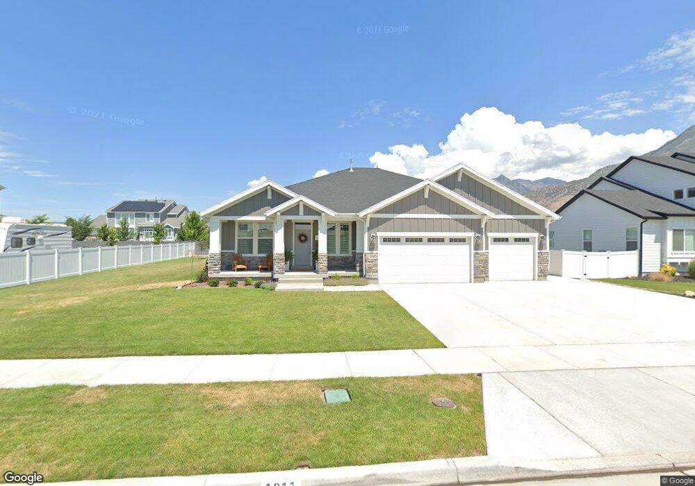
1211 E 1030 N American Fork, UT 84003
Estimated Value: $1,110,000 - $1,212,604
2
Beds
3
Baths
2,130
Sq Ft
$544/Sq Ft
Est. Value
About This Home
This home is located at 1211 E 1030 N, American Fork, UT 84003 and is currently estimated at $1,159,201, approximately $544 per square foot. 1211 E 1030 N is a home with nearby schools including Deerfield Elementary School, Mountain Ridge Junior High School, and American Fork High School.
Ownership History
Date
Name
Owned For
Owner Type
Purchase Details
Closed on
Mar 24, 2022
Sold by
Baxter T D
Bought by
T D Sam And Luann Baxter Trust
Current Estimated Value
Purchase Details
Closed on
Jan 4, 2022
Sold by
Baxter T D
Bought by
Td Sam And Luann Baxter Trust
Purchase Details
Closed on
May 6, 2019
Sold by
Cadence Homes Building Corp
Bought by
Baxter Timothy D and Baxter Luann M
Create a Home Valuation Report for This Property
The Home Valuation Report is an in-depth analysis detailing your home's value as well as a comparison with similar homes in the area
Home Values in the Area
Average Home Value in this Area
Purchase History
| Date | Buyer | Sale Price | Title Company |
|---|---|---|---|
| T D Sam And Luann Baxter Trust | -- | None Listed On Document | |
| Td Sam And Luann Baxter Trust | -- | None Listed On Document | |
| Baxter Timothy D | -- | Artisan Title | |
| Cadence Homes Building Corp | -- | Artisan Title |
Source: Public Records
Tax History
| Year | Tax Paid | Tax Assessment Tax Assessment Total Assessment is a certain percentage of the fair market value that is determined by local assessors to be the total taxable value of land and additions on the property. | Land | Improvement |
|---|---|---|---|---|
| 2025 | $4,898 | $571,505 | -- | -- |
| 2024 | $4,898 | $544,225 | $0 | $0 |
| 2023 | $4,769 | $561,825 | $0 | $0 |
| 2022 | $4,733 | $550,275 | $0 | $0 |
| 2021 | $3,943 | $715,900 | $232,700 | $483,200 |
| 2020 | $3,740 | $658,600 | $215,500 | $443,100 |
| 2019 | $2,074 | $207,800 | $207,800 | $0 |
Source: Public Records
Map
Nearby Homes
- 1125 N 1270 E
- 3518 N 1450 W
- 1045 N 930 E Unit 58
- 1077 N 950 E
- 1121 E 580 N
- 9587 N 4500 W
- 4675 W Ferguson Way
- 9752 N Dorchester Dr
- 9506 N 4000 W
- 4552 W Windsor Cir
- 681 W 2760 N
- 4531 W Cambridge Dr
- 462 N 950 E Unit 5
- 912 E Ellens St Unit 1
- 3810 W Valley View Dr
- 9481 N 3830 W
- 837 E 475 N
- 470 N 950 E Unit LOT 6
- 472 W 2760 N
- 9547 N Canyon Rd
- 1223 E 1030 N
- 1235 E 1030 N
- 1199 E 1030 N Unit 11
- 1206 E Candy Ln
- 1222 E Candy Ln
- 1192 E Candy Ln Unit 10
- 1214 E 1030 N
- 1249 E 1030 N
- 1236 E Candy Ln
- 1021 N 1250 E
- 1194 E 1030 N
- 1183 E 1030 N Unit 46
- 1184 E Candy Ln Unit 63
- 1028 N 1250 E
- 1231 E Stuart Cir
- 1225 E Stuart Cir Unit 31
- 1178 E 1030 N
- 1207 E Candy Ln
- 1193 E Candy Ln Unit 1
- 1243 E Stuart Cir
Your Personal Tour Guide
Ask me questions while you tour the home.