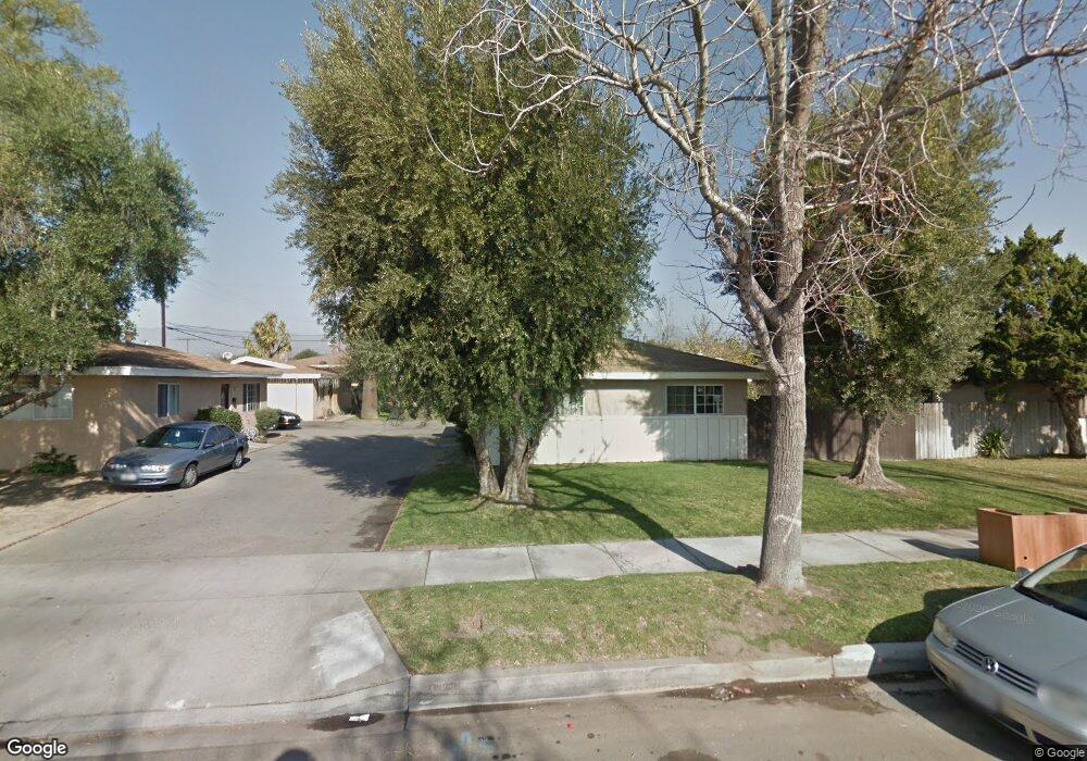
1211 E Nocta St Unit A & B Ontario, CA 91764
Estimated Value: $653,000 - $903,000
4
Beds
2
Baths
1,768
Sq Ft
$431/Sq Ft
Est. Value
About This Home
This home is located at 1211 E Nocta St Unit A & B, Ontario, CA 91764 and is currently estimated at $761,892, approximately $430 per square foot. 1211 E Nocta St Unit A & B is a home located in San Bernardino County with nearby schools including Mariposa Elementary, Ray Wiltsey Middle School, and Colony High.
Ownership History
Date
Name
Owned For
Owner Type
Purchase Details
Closed on
Jun 1, 2009
Sold by
Bank Of New York
Bought by
Rangwala Shabbir H and Rangwala Zehra S
Current Estimated Value
Purchase Details
Closed on
Sep 15, 2008
Sold by
Alor Carlo
Bought by
Bank Of New York and Cwalt Inc Alternative Loan Trust 2005-30
Purchase Details
Closed on
Dec 20, 2004
Sold by
Fiore Teresa and Sepe Anthony
Bought by
Alor Carlo
Home Financials for this Owner
Home Financials are based on the most recent Mortgage that was taken out on this home.
Original Mortgage
$256,000
Interest Rate
5.81%
Mortgage Type
Purchase Money Mortgage
Create a Home Valuation Report for This Property
The Home Valuation Report is an in-depth analysis detailing your home's value as well as a comparison with similar homes in the area
Purchase History
| Date | Buyer | Sale Price | Title Company |
|---|---|---|---|
| Rangwala Shabbir H | $248,500 | Landsafe Title | |
| Bank Of New York | $279,897 | Landsafe | |
| Alor Carlo | $320,000 | First American |
Source: Public Records
Mortgage History
| Date | Status | Borrower | Loan Amount |
|---|---|---|---|
| Previous Owner | Alor Carlo | $256,000 | |
| Closed | Alor Carlo | $64,000 |
Source: Public Records
Tax History
| Year | Tax Paid | Tax Assessment Tax Assessment Total Assessment is a certain percentage of the fair market value that is determined by local assessors to be the total taxable value of land and additions on the property. | Land | Improvement |
|---|---|---|---|---|
| 2025 | $3,527 | $320,013 | $96,584 | $223,429 |
| 2024 | $3,447 | $313,738 | $94,690 | $219,048 |
| 2023 | $3,350 | $307,586 | $92,833 | $214,753 |
| 2022 | $3,306 | $301,555 | $91,013 | $210,542 |
| 2021 | $3,285 | $295,642 | $89,228 | $206,414 |
| 2020 | $3,228 | $292,610 | $88,313 | $204,297 |
| 2019 | $3,200 | $286,872 | $86,581 | $200,291 |
| 2018 | $3,156 | $281,247 | $84,883 | $196,364 |
| 2017 | $3,043 | $275,733 | $83,219 | $192,514 |
| 2016 | $2,923 | $270,326 | $81,587 | $188,739 |
| 2015 | $2,903 | $266,265 | $80,361 | $185,904 |
| 2014 | $2,813 | $261,049 | $78,787 | $182,262 |
Source: Public Records
Map
Nearby Homes
- 1205 E D St
- 1094 E D St
- 1373 E Holt Blvd
- 522 N Parkside Dr
- 507 N Imperial Ave
- 436 N Imperial Ave Unit C
- 527 N Cucamonga Ave
- 1448 E Elma Ct
- 750 N Del Norte Ave
- 821 N Alameda Ave
- 811 E Nocta St
- 535 N Allyn Ave
- 744 E Holt Blvd
- 927 N Glenn Ave
- 736 E Holt Blvd
- 341 Muscatel Ave
- 1437 E I St
- 802 E Granada Ct
- 945 E I St
- 127 N Campus Ave
- 1211 E Nocta St
- 1217 E Nocta St
- 1205 E Nocta St
- 1223 E Nocta St Unit A
- 1212 E Elma St
- 1206 E Elma St
- 1218 E Elma St
- 1224 E Elma St
- 1229 E Nocta St
- 1230 E Elma St
- 209 N Grove Ave
- 203 N Grove Ave
- 1235 E Nocta St
- 213 N Grove Ave
- 219 N Grove Ave
- 1236 E Elma St
- 1186 E Elma St
- 1182 E Nocta St
- 1241 E Nocta St Unit B
- 1241 E Nocta St
Your Personal Tour Guide
Ask me questions while you tour the home.