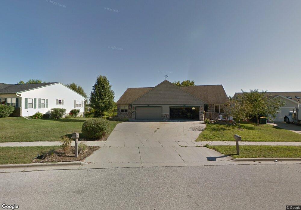
1211 Firethorn Dr West Bend, WI 53090
Estimated Value: $301,000 - $456,000
3
Beds
3
Baths
2,085
Sq Ft
$173/Sq Ft
Est. Value
About This Home
This home is located at 1211 Firethorn Dr, West Bend, WI 53090 and is currently estimated at $360,667, approximately $172 per square foot. 1211 Firethorn Dr is a home located in Washington County with nearby schools including Fair Park Elementary School, Silverbrook Intermediate School, and East High School.
Ownership History
Date
Name
Owned For
Owner Type
Purchase Details
Closed on
Jul 29, 2021
Sold by
Martin Dale L
Bought by
Ruby Rents Llc
Current Estimated Value
Home Financials for this Owner
Home Financials are based on the most recent Mortgage that was taken out on this home.
Original Mortgage
$325,500
Outstanding Balance
$296,113
Interest Rate
2.93%
Mortgage Type
Purchase Money Mortgage
Estimated Equity
$64,554
Create a Home Valuation Report for This Property
The Home Valuation Report is an in-depth analysis detailing your home's value as well as a comparison with similar homes in the area
Home Values in the Area
Average Home Value in this Area
Purchase History
| Date | Buyer | Sale Price | Title Company |
|---|---|---|---|
| Ruby Rents Llc | $465,000 | None Available |
Source: Public Records
Mortgage History
| Date | Status | Borrower | Loan Amount |
|---|---|---|---|
| Open | Ruby Rents Llc | $325,500 |
Source: Public Records
Tax History Compared to Growth
Tax History
| Year | Tax Paid | Tax Assessment Tax Assessment Total Assessment is a certain percentage of the fair market value that is determined by local assessors to be the total taxable value of land and additions on the property. | Land | Improvement |
|---|---|---|---|---|
| 2024 | $3,461 | $258,000 | $25,000 | $233,000 |
| 2023 | $3,093 | $164,000 | $16,000 | $148,000 |
| 2022 | $2,975 | $164,000 | $16,000 | $148,000 |
| 2021 | $3,072 | $164,000 | $16,000 | $148,000 |
| 2020 | $2,975 | $164,000 | $16,000 | $148,000 |
| 2019 | $2,893 | $164,000 | $16,000 | $148,000 |
| 2018 | $2,796 | $164,000 | $16,000 | $148,000 |
| 2017 | $2,658 | $141,100 | $16,000 | $125,100 |
| 2016 | $2,682 | $141,100 | $16,000 | $125,100 |
| 2015 | $2,663 | $141,100 | $16,000 | $125,100 |
| 2014 | $2,663 | $141,100 | $16,000 | $125,100 |
| 2013 | $2,879 | $141,100 | $16,000 | $125,100 |
Source: Public Records
Map
Nearby Homes
- 829 Royal Dr
- 1401 Lee Ave
- 1363 Legion Cir
- 1117 Schmidt Rd Unit 2
- 1123 Marcia Ave Unit 206
- Lt2 N River Rd
- Lt1 N River Rd
- Lt3 N River Rd
- 1311 Daisy Dr
- 2008 Lenora Dr
- 628 Victoria St
- 1519 E Washington St
- 511 Robin St
- 2112 Deerfield Dr
- 801 E Washington St
- LT4 River Rd
- 2350 E Sandy Acre Rd
- 128 Wilson Ave
- 108 Edgewood Ln
- 1348 Fond du Lac St
- 1209 Firethorn Dr
- 1209 Firethorn Dr Unit 1211
- 1205 Firethorn Dr
- 1215 Firethorn Dr
- 1217 Firethorn Dr
- 1109 Firethorn Dr
- 1125 Red Pine Ct
- 1224 Creek Rd
- 1226 Firethorn Dr
- 1105 Firethorn Dr
- 1103 Firethorn Dr
- 1103 Firethorn Dr Unit 1
- 1103 Firethorn Dr Unit 1
- 1126 Red Pine Ct
- 1221 Firethorn Dr
- 1135 Red Pine Ct
- 1027 Firethorn Dr
- 1025 Firethorn Dr
- 1230 Firethorn Dr
- 1132 Red Pine Ct