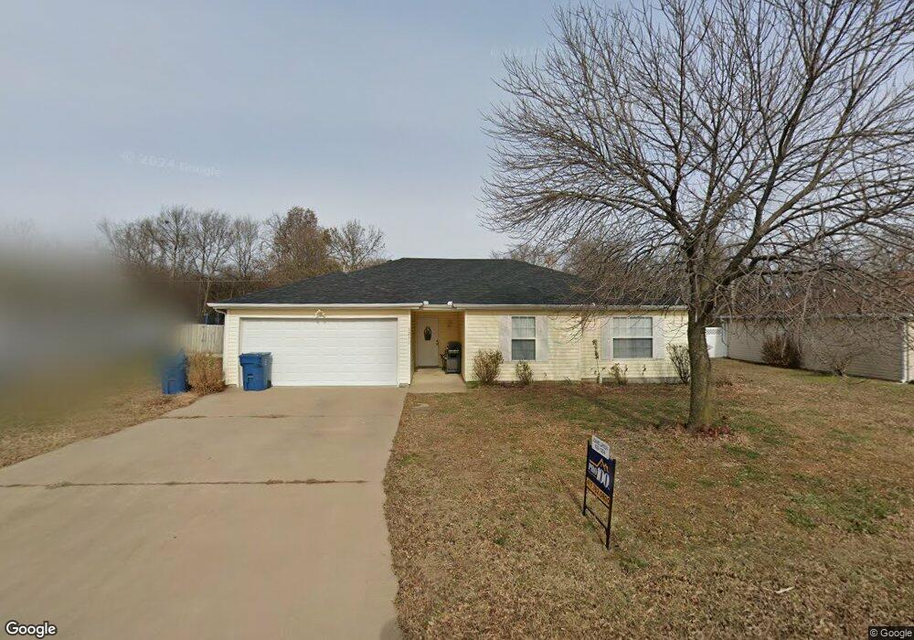
1211 Meadow Ridge Carl Junction, MO 64834
Estimated Value: $182,418 - $197,000
3
Beds
2
Baths
1,300
Sq Ft
$148/Sq Ft
Est. Value
About This Home
This home is located at 1211 Meadow Ridge, Carl Junction, MO 64834 and is currently estimated at $192,605, approximately $148 per square foot. 1211 Meadow Ridge is a home located in Jasper County with nearby schools including Carl Junction Primary School (K-1), Carl Junction Intermediate School, and Carl Junction Primary School (2-3).
Ownership History
Date
Name
Owned For
Owner Type
Purchase Details
Closed on
Nov 30, 2022
Sold by
E Farms Holding Llc
Bought by
King Miranda
Current Estimated Value
Purchase Details
Closed on
Apr 30, 2019
Sold by
Watson Lindsey and Watson Sara
Bought by
E Farms Hldg Llc
Purchase Details
Closed on
Aug 31, 2007
Sold by
Addington Jared H and Addington Tara
Bought by
Watson Lindsey and Miller Sara
Home Financials for this Owner
Home Financials are based on the most recent Mortgage that was taken out on this home.
Original Mortgage
$95,500
Interest Rate
6.72%
Mortgage Type
Purchase Money Mortgage
Purchase Details
Closed on
Jun 10, 2005
Sold by
Moudy Michael L
Bought by
Addington Jared H
Home Financials for this Owner
Home Financials are based on the most recent Mortgage that was taken out on this home.
Original Mortgage
$65,000
Interest Rate
5.25%
Mortgage Type
Fannie Mae Freddie Mac
Create a Home Valuation Report for This Property
The Home Valuation Report is an in-depth analysis detailing your home's value as well as a comparison with similar homes in the area
Purchase History
| Date | Buyer | Sale Price | Title Company |
|---|---|---|---|
| King Miranda | -- | -- | |
| E Farms Hldg Llc | -- | -- | |
| Watson Lindsey | -- | Jct | |
| Addington Jared H | -- | -- |
Source: Public Records
Mortgage History
| Date | Status | Borrower | Loan Amount |
|---|---|---|---|
| Previous Owner | Watson Lindsey | $95,500 | |
| Previous Owner | Addington Jared H | $65,000 |
Source: Public Records
Tax History
| Year | Tax Paid | Tax Assessment Tax Assessment Total Assessment is a certain percentage of the fair market value that is determined by local assessors to be the total taxable value of land and additions on the property. | Land | Improvement |
|---|---|---|---|---|
| 2025 | $889 | $17,110 | $2,100 | $15,010 |
| 2024 | $895 | $15,200 | $2,100 | $13,100 |
| 2023 | $895 | $15,200 | $2,100 | $13,100 |
| 2022 | $923 | $15,640 | $2,100 | $13,540 |
| 2021 | $792 | $15,640 | $2,100 | $13,540 |
| 2020 | $733 | $14,220 | $2,100 | $12,120 |
| 2019 | $696 | $14,220 | $2,100 | $12,120 |
| 2018 | $769 | $15,750 | $0 | $0 |
| 2017 | $771 | $15,750 | $0 | $0 |
| 2016 | $779 | $16,070 | $0 | $0 |
Source: Public Records
Map
Nearby Homes
- 1210 Bob White Ln
- 29923 Ivy Rd
- 310 N Grimes St
- TBD Temple St
- 104 Cambridge Dr
- 720 Sheridan Ave
- 120 Concord St
- 307 Ashmore St
- 805 Aberdeen Ave
- 1308 York St
- 903 Aberdeen Ave
- 905 Aberdeen Ave
- 907 Aberdeen Ave
- 900 Aberdeen Ave
- 909 Aberdeen Ave
- 407 Hodge Dr
- 1001 Aberdeen Ave
- 403 Ashmore Dr
- 804 Aberdeen Ave
- 806 Aberdeen Ave
- 1211 Meadow Ridge Unit 1
- 1301 Meadow Ridge
- 1209 Meadow Ridge
- 1303 Meadow Ridge
- 1207 Meadow Ridge
- 1302 Meadow Ridge
- 1305 Meadow Ridge
- 1210 Meadow Ridge
- 1205 Meadow Ridge
- 1205 Meadow Ridge Unit 1
- 1208 Meadow Ridge
- 1206 Meadow Ridge
- 1204 Meadow Ridge
- 1203 Meadow Ridge
- 1307 Covey Dr
- 1306 Covey Rd
- 1202 Meadow Ridge
- 1211 Bob White Ln
- 1201 Meadow Ridge
- 1209 Bob White Ln
Your Personal Tour Guide
Ask me questions while you tour the home.