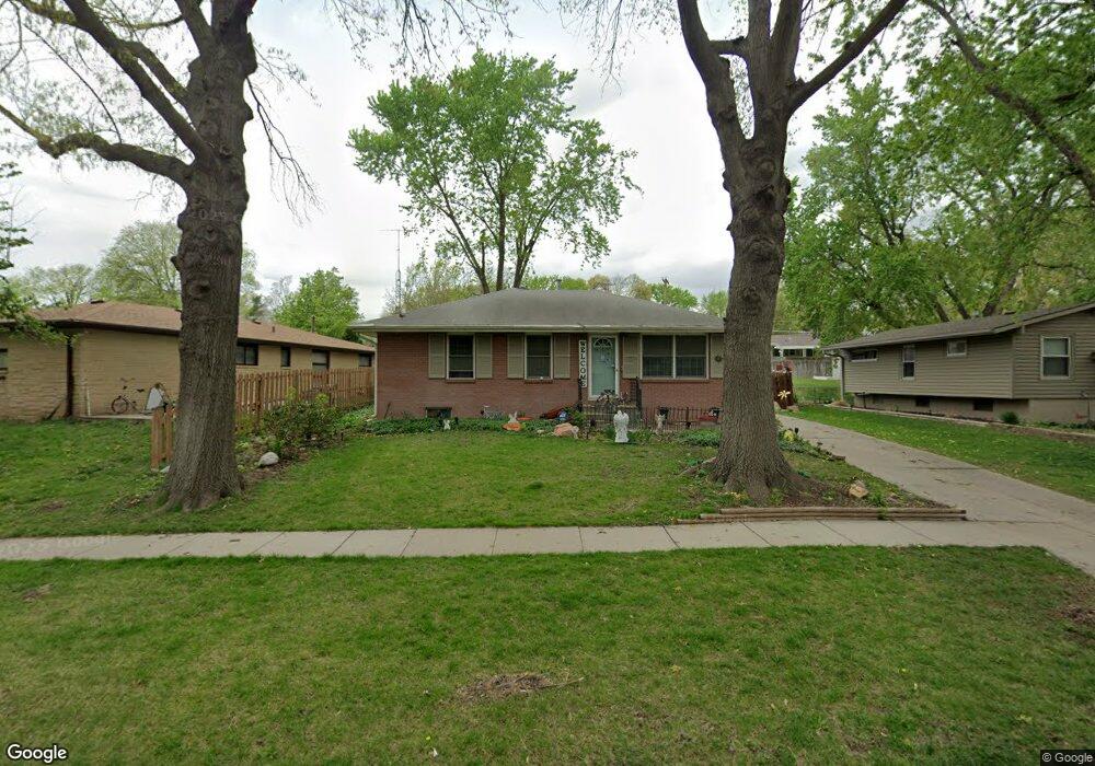
1211 Meadowdale Dr Lincoln, NE 68505
Meadowlane NeighborhoodEstimated Value: $261,000 - $271,000
3
Beds
2
Baths
1,776
Sq Ft
$150/Sq Ft
Est. Value
About This Home
This home is located at 1211 Meadowdale Dr, Lincoln, NE 68505 and is currently estimated at $266,729, approximately $150 per square foot. 1211 Meadowdale Dr is a home located in Lancaster County with nearby schools including Meadow Lane Elementary School, C. Culler Middle School, and Lincoln East High School.
Ownership History
Date
Name
Owned For
Owner Type
Purchase Details
Closed on
Dec 3, 2005
Sold by
Keeling Donald R and Keeling Sheila K
Bought by
Pace Morse A and Pace Barbara A
Current Estimated Value
Home Financials for this Owner
Home Financials are based on the most recent Mortgage that was taken out on this home.
Original Mortgage
$116,500
Outstanding Balance
$64,144
Interest Rate
6.12%
Mortgage Type
Fannie Mae Freddie Mac
Estimated Equity
$202,585
Purchase Details
Closed on
Apr 29, 2001
Sold by
Hopkins Douglas A
Bought by
Keeling Donald R and Keeling Sheila K
Home Financials for this Owner
Home Financials are based on the most recent Mortgage that was taken out on this home.
Original Mortgage
$110,950
Interest Rate
6.81%
Mortgage Type
FHA
Create a Home Valuation Report for This Property
The Home Valuation Report is an in-depth analysis detailing your home's value as well as a comparison with similar homes in the area
Home Values in the Area
Average Home Value in this Area
Purchase History
| Date | Buyer | Sale Price | Title Company |
|---|---|---|---|
| Pace Morse A | $133,000 | Ct | |
| Keeling Donald R | $112,000 | -- |
Source: Public Records
Mortgage History
| Date | Status | Borrower | Loan Amount |
|---|---|---|---|
| Open | Pace Morse A | $116,500 | |
| Previous Owner | Keeling Donald R | $110,950 |
Source: Public Records
Tax History Compared to Growth
Tax History
| Year | Tax Paid | Tax Assessment Tax Assessment Total Assessment is a certain percentage of the fair market value that is determined by local assessors to be the total taxable value of land and additions on the property. | Land | Improvement |
|---|---|---|---|---|
| 2025 | $3,288 | $249,600 | $50,000 | $199,600 |
| 2024 | $3,288 | $235,200 | $45,000 | $190,200 |
| 2023 | $3,704 | $221,000 | $45,000 | $176,000 |
| 2022 | $3,408 | $171,000 | $35,000 | $136,000 |
| 2021 | $3,224 | $171,000 | $35,000 | $136,000 |
| 2020 | $2,784 | $145,700 | $35,000 | $110,700 |
| 2019 | $2,784 | $145,700 | $35,000 | $110,700 |
| 2018 | $2,935 | $152,900 | $35,000 | $117,900 |
| 2017 | $2,962 | $152,900 | $35,000 | $117,900 |
| 2016 | $2,712 | $139,300 | $30,000 | $109,300 |
| 2015 | $2,694 | $139,300 | $30,000 | $109,300 |
| 2014 | $2,630 | $135,200 | $30,000 | $105,200 |
| 2013 | -- | $135,200 | $30,000 | $105,200 |
Source: Public Records
Map
Nearby Homes
- 1324 Meadow Dale Dr
- 7321 York Ln
- 7140 Starr St
- 1011 Scenic Ln
- 820 E Avon Ln
- 7601 Holdrege St
- 1624 N 73rd St
- 6927 Holdrege St
- 7611 Fairfax Ave
- 7620 Vine St
- 1131 N 79th St
- 6810 Holdrege St
- 7909 Leo Ln
- 601 N 75th St
- 6644 Dudley St
- 1736 N 76th St
- 6721 Bethany Park Dr
- 1040 N 66th St
- 630 Skyway Rd
- 601 Skyway Rd
- 1211 Meadow Dale Dr
- 7240 Orchard St
- 1217 Meadow Dale Dr
- 7230 Orchard St
- 1301 Lancaster Ln
- 1262 Meadow Dale Dr
- 0 Meadowdale Dr
- 7235 Dudley St
- 7225 Dudley St
- 1220 Meadow Dale Dr
- 1230 Meadow Dale Dr
- 7220 Orchard St
- 7245 Dudley St
- 1210 Meadow Dale Dr
- 7225 Orchard St
- 7219 Dudley St
- 1200 Meadow Dale Dr
- 1235 Lancaster Ln
- 7219 Orchard St
- 7210 Orchard St