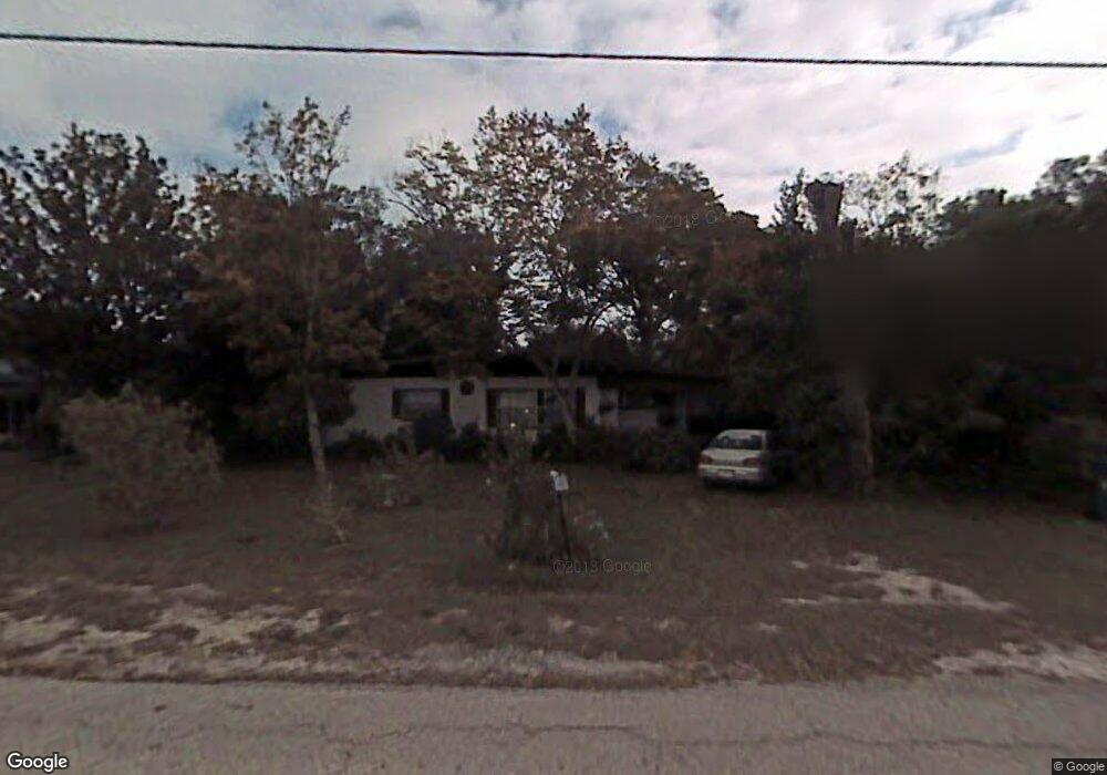
1211 N Boston Ave Deland, FL 32724
North DeLand NeighborhoodEstimated Value: $218,000 - $267,000
3
Beds
2
Baths
1,512
Sq Ft
$160/Sq Ft
Est. Value
About This Home
This home is located at 1211 N Boston Ave, Deland, FL 32724 and is currently estimated at $242,333, approximately $160 per square foot. 1211 N Boston Ave is a home located in Volusia County with nearby schools including Deland High School, George W. Marks Elementary School, and Deland Middle School.
Ownership History
Date
Name
Owned For
Owner Type
Purchase Details
Closed on
Jan 4, 2019
Sold by
Ryals Trivett Mary
Bought by
Pohlman Trivett Acree
Current Estimated Value
Purchase Details
Closed on
Feb 28, 2013
Sold by
Hall Karen Elaine
Bought by
Trivett Mary Ryals
Purchase Details
Closed on
Feb 26, 2013
Sold by
Barbee Timothy Wayne and Hall Karen Elaine
Bought by
Trivett Mary Ryals
Purchase Details
Closed on
Apr 15, 1990
Bought by
Trivett Mary Ryals
Create a Home Valuation Report for This Property
The Home Valuation Report is an in-depth analysis detailing your home's value as well as a comparison with similar homes in the area
Home Values in the Area
Average Home Value in this Area
Purchase History
| Date | Buyer | Sale Price | Title Company |
|---|---|---|---|
| Pohlman Trivett Acree | -- | None Available | |
| Trivett Mary Ryals | $49,000 | Volusia Title Services | |
| Trivett Mary Ryals | -- | Volusia Title Services | |
| Trivett Mary Ryals | $10,000 | -- |
Source: Public Records
Tax History Compared to Growth
Tax History
| Year | Tax Paid | Tax Assessment Tax Assessment Total Assessment is a certain percentage of the fair market value that is determined by local assessors to be the total taxable value of land and additions on the property. | Land | Improvement |
|---|---|---|---|---|
| 2025 | $2,192 | $194,818 | $39,200 | $155,618 |
| 2024 | $2,192 | $195,321 | $39,200 | $156,121 |
| 2023 | $2,192 | $163,393 | $32,800 | $130,593 |
| 2022 | $2,082 | $156,738 | $26,000 | $130,738 |
| 2021 | $1,583 | $63,388 | $22,400 | $40,988 |
| 2020 | $2,055 | $100,520 | $20,000 | $80,520 |
| 2019 | $2,000 | $91,193 | $16,000 | $75,193 |
| 2018 | $1,829 | $75,726 | $10,400 | $65,326 |
| 2017 | $1,683 | $63,635 | $10,400 | $53,235 |
| 2016 | $1,501 | $56,255 | $0 | $0 |
| 2015 | $1,435 | $52,959 | $0 | $0 |
| 2014 | $1,313 | $46,174 | $0 | $0 |
Source: Public Records
Map
Nearby Homes
- 1215 N Boston Ave
- 569 Parkdale Ct
- 717 E Grove Place
- 528 Compton Ct
- 1150 Orangewood Ave
- 605 John Thomas Ave
- 1401 Hendren Dr
- 708 Montreville Ave
- 1103 Lindley Cove Cir
- 1408 N Garfield Ave
- 931 Azalea Walk Cir
- 1403 Island Cove Dr
- 404 E Kentucky Ave
- 516 Grace Ave
- 1412 N Garfield Ave
- 1 Smith Ct
- 612 E Plymouth Ave
- 1500 N Clearview Ave
- 505 E Plymouth Ave
- 818 Eastover Cir
- 1209 N Boston Ave
- 1213 N Boston Ave
- 12 Sunshine Blvd
- 14 Sunshine Blvd
- 10 Sunshine Blvd
- 1207 N Boston Ave
- 578 Parkdale Ct
- 16 Sunshine Blvd
- 8 Sunshine Blvd
- 579 Parkdale Ct
- 701 E Abel Ave
- 1217 N Boston Ave
- 18 Sunshine Blvd
- 6 Sunshine Blvd
- 576 Parkdale Ct
- 577 Parkdale Ct
- 0 Abele St Unit G4651710
- 0 Abele St Unit G4651705
- 1219 N Boston Ave
- 690 Cumberland Rd