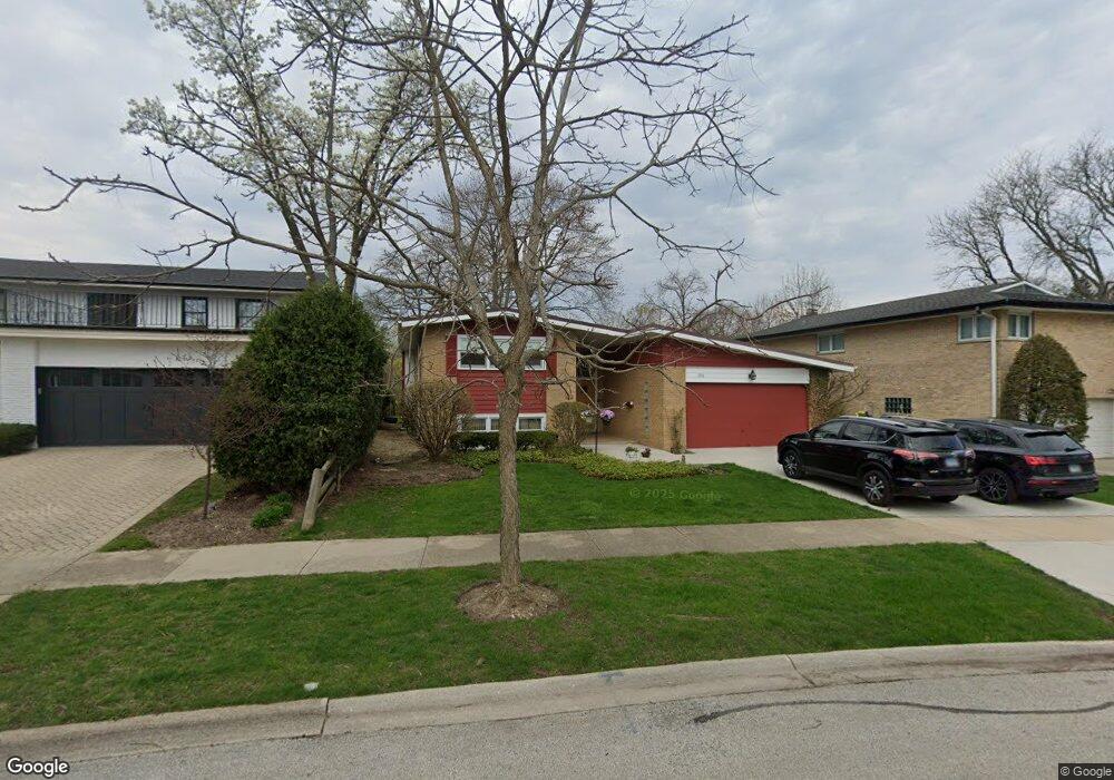
1211 N Branch Rd Wilmette, IL 60091
Estimated Value: $606,000 - $736,000
4
Beds
3
Baths
1,743
Sq Ft
$378/Sq Ft
Est. Value
About This Home
This home is located at 1211 N Branch Rd, Wilmette, IL 60091 and is currently estimated at $658,045, approximately $377 per square foot. 1211 N Branch Rd is a home located in Cook County with nearby schools including Marie Murphy School, Avoca West Elementary School, and New Trier Township High School - Northfield.
Ownership History
Date
Name
Owned For
Owner Type
Purchase Details
Closed on
Dec 18, 1998
Sold by
Kontos Diana D
Bought by
Crowe Robert John and Crowe Lisa
Current Estimated Value
Home Financials for this Owner
Home Financials are based on the most recent Mortgage that was taken out on this home.
Original Mortgage
$310,500
Outstanding Balance
$70,347
Interest Rate
6.75%
Estimated Equity
$587,698
Create a Home Valuation Report for This Property
The Home Valuation Report is an in-depth analysis detailing your home's value as well as a comparison with similar homes in the area
Home Values in the Area
Average Home Value in this Area
Purchase History
| Date | Buyer | Sale Price | Title Company |
|---|---|---|---|
| Crowe Robert John | $345,000 | -- |
Source: Public Records
Mortgage History
| Date | Status | Borrower | Loan Amount |
|---|---|---|---|
| Open | Crowe Robert John | $310,500 |
Source: Public Records
Tax History Compared to Growth
Tax History
| Year | Tax Paid | Tax Assessment Tax Assessment Total Assessment is a certain percentage of the fair market value that is determined by local assessors to be the total taxable value of land and additions on the property. | Land | Improvement |
|---|---|---|---|---|
| 2024 | $8,874 | $42,767 | $13,920 | $28,847 |
| 2023 | $9,077 | $45,904 | $13,920 | $31,984 |
| 2022 | $9,077 | $45,904 | $13,920 | $31,984 |
| 2021 | $9,155 | $39,954 | $10,005 | $29,949 |
| 2020 | $9,054 | $39,954 | $10,005 | $29,949 |
| 2019 | $8,888 | $43,906 | $10,005 | $33,901 |
| 2018 | $7,836 | $37,460 | $8,265 | $29,195 |
| 2017 | $8,036 | $39,116 | $8,265 | $30,851 |
| 2016 | $7,777 | $39,116 | $8,265 | $30,851 |
| 2015 | $7,498 | $34,212 | $6,742 | $27,470 |
| 2014 | $7,386 | $34,212 | $6,742 | $27,470 |
| 2013 | $7,041 | $34,212 | $6,742 | $27,470 |
Source: Public Records
Map
Nearby Homes
- 1133 Manor Dr
- 3507 Greenwood Ave
- 228 Mark Dr
- 5020 Arbor Ln Unit 203
- 3030 Arbor Ln Unit 203
- 5040 Arbor Ln Unit 303
- 32 Meadowview Dr
- 828 Lavergne Ave
- 726 Lawler Ave
- 4072 Bunker Ln
- 15 Landmark
- 1656 Harding Rd
- 711 Becker Rd
- 62 Woodley Rd
- 1201 Harms Rd
- 1115 Hunter Rd
- 805 Hibbard Rd
- 185 Happ Rd
- 737 Becker Rd
- 542 Laramie Ave
- 1207 N Branch Rd
- 1215 N Branch Rd
- 3522 Illinois Rd
- 1221 N Branch Rd
- 1210 Manor Dr
- 1206 Manor Dr
- 1214 Manor Dr
- 3532 Illinois Rd
- 1220 Manor Dr
- 1200 N Branch Rd
- 3525 Riverside Dr
- 3529 Riverside Dr
- 1226 Manor Dr
- 1225 N Branch Rd
- 1214 N Branch Rd Unit S
- 3500 Illinois Rd
- 3504 Illinois Rd
- 1220 N Branch Rd
- 3521 Illinois Rd
- 3535 Riverside Dr