Estimated Value: $256,094 - $339,000
--
Bed
--
Bath
1,060
Sq Ft
$270/Sq Ft
Est. Value
About This Home
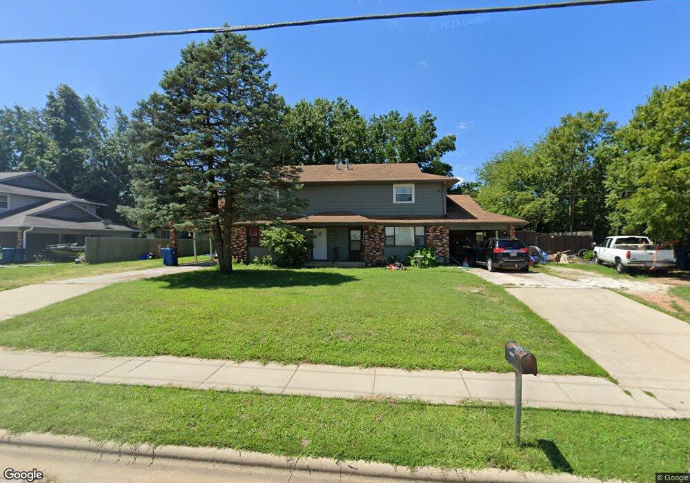
This home is located at 1211 N Main St, Nixa, MO 65714 and is currently estimated at $286,365, approximately $270 per square foot. 1211 N Main St is a home located in Christian County with nearby schools including High Pointe Elementary School, Summit Intermediate School, and Nixa Junior High School.
Ownership History
Date
Name
Owned For
Owner Type
Purchase Details
Closed on
Sep 6, 2019
Sold by
Crotts F Lynn
Bought by
Satterfield Roger and Satterfield Kimberly
Current Estimated Value
Home Financials for this Owner
Home Financials are based on the most recent Mortgage that was taken out on this home.
Original Mortgage
$103,000
Outstanding Balance
$90,404
Interest Rate
3.7%
Mortgage Type
New Conventional
Estimated Equity
$195,961
Purchase Details
Closed on
Mar 1, 2006
Sold by
Crotts F Lynn
Bought by
Satterfield Roger and Satterfield Kimberly
Create a Home Valuation Report for This Property
The Home Valuation Report is an in-depth analysis detailing your home's value as well as a comparison with similar homes in the area
Home Values in the Area
Average Home Value in this Area
Purchase History
| Date | Buyer | Sale Price | Title Company |
|---|---|---|---|
| Satterfield Roger | -- | Ozark Abstract & Title | |
| Satterfield Roger | -- | Guaranty Title Co Of Swmo |
Source: Public Records
Mortgage History
| Date | Status | Borrower | Loan Amount |
|---|---|---|---|
| Open | Satterfield Roger | $103,000 |
Source: Public Records
Tax History Compared to Growth
Tax History
| Year | Tax Paid | Tax Assessment Tax Assessment Total Assessment is a certain percentage of the fair market value that is determined by local assessors to be the total taxable value of land and additions on the property. | Land | Improvement |
|---|---|---|---|---|
| 2024 | $1,590 | $25,520 | -- | -- |
| 2023 | $1,590 | $25,520 | $0 | $0 |
| 2022 | $1,429 | $22,900 | $0 | $0 |
| 2021 | $1,430 | $22,900 | $0 | $0 |
| 2020 | $1,376 | $21,030 | $0 | $0 |
| 2019 | $1,376 | $21,030 | $0 | $0 |
| 2018 | $1,211 | $19,870 | $0 | $0 |
| 2017 | $1,211 | $19,870 | $0 | $0 |
| 2016 | $1,192 | $19,870 | $0 | $0 |
| 2015 | $1,194 | $19,870 | $19,870 | $0 |
| 2014 | $1,159 | $19,780 | $0 | $0 |
| 2013 | $11 | $19,780 | $0 | $0 |
| 2011 | $11 | $39,020 | $0 | $0 |
Source: Public Records
Map
Nearby Homes
- 1259 N Maxine Ave
- 1271 N Maxine Ave
- 1281 N Maxine Ave
- 1343 N Maxine Ave
- 1301 N Maxine Ave
- 1313 N Maxine Ave
- Obsidian B Plan at Walker Estates
- 1383 N Maxine Ave
- Diamond Plan at Walker Estates
- Amber Plan at Walker Estates
- Amethyst Plan at Walker Estates
- Jasper Plan at Walker Estates
- 1327 N Maxine Ave
- 1363 N Maxine Ave
- 211 W Hunter Dr
- 909 Erin Ct
- 608 E Penzance Dr
- 1398 N Sandy Creek Cir Unit 2
- 1396 N Sandy Creek Cir Unit 2
- 1102 N Arlington
- 1209 N Main St Unit A-B
- 1209 N Main St
- 1212 N Viola St
- 1212 Viola St
- 106 E Greenbriar Dr
- 1213 N Viola St
- 1213 N Viola St Unit A & B
- 1213 N Viola St
- 1209 N A&b Viola St
- 1211 N Viola St
- 1209 Viola St Unit A & B
- 1209 Viola St
- 1207 Viola St Unit A & B
- 109 W Greenbriar St
- 109 W Greenbriar St
- 110 W Greenbriar St
- 1211 Flora St
- 1201 N Main St
- 1209 Flora St
- 1207 Flora St