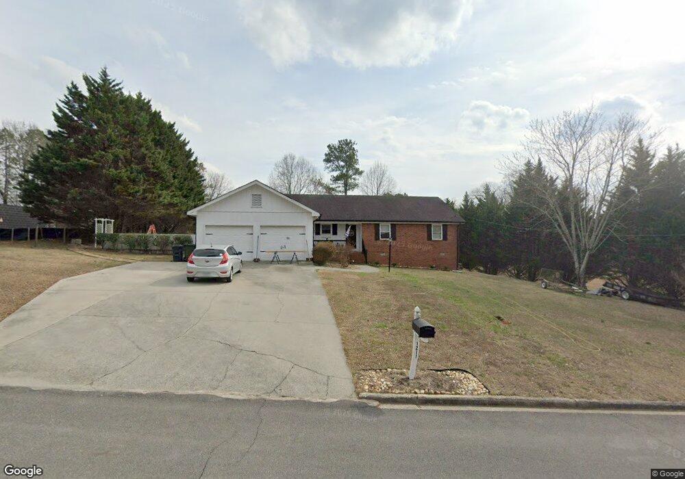
1211 Phillips Dr Dalton, GA 30720
Estimated Value: $294,000 - $352,000
3
Beds
3
Baths
2,000
Sq Ft
$160/Sq Ft
Est. Value
About This Home
This home is located at 1211 Phillips Dr, Dalton, GA 30720 and is currently estimated at $319,814, approximately $159 per square foot. 1211 Phillips Dr is a home located in Whitfield County with nearby schools including City Park Elementary School, Dalton High School, and Rock Hill School.
Ownership History
Date
Name
Owned For
Owner Type
Purchase Details
Closed on
Jul 7, 2017
Sold by
Riddle Odell
Bought by
Defore Tracy and Defore William
Current Estimated Value
Home Financials for this Owner
Home Financials are based on the most recent Mortgage that was taken out on this home.
Original Mortgage
$154,230
Outstanding Balance
$126,888
Interest Rate
3.89%
Mortgage Type
New Conventional
Estimated Equity
$192,926
Purchase Details
Closed on
Jun 13, 2006
Sold by
Riddle William Michael
Bought by
Graves Lois K
Purchase Details
Closed on
Apr 1, 1997
Bought by
Riddle William Michael
Create a Home Valuation Report for This Property
The Home Valuation Report is an in-depth analysis detailing your home's value as well as a comparison with similar homes in the area
Purchase History
| Date | Buyer | Sale Price | Title Company |
|---|---|---|---|
| Defore Tracy | $159,900 | -- | |
| Graves Lois K | $175,000 | -- | |
| Riddle William Michael | -- | -- |
Source: Public Records
Mortgage History
| Date | Status | Borrower | Loan Amount |
|---|---|---|---|
| Open | Defore Tracy | $154,230 |
Source: Public Records
Tax History
| Year | Tax Paid | Tax Assessment Tax Assessment Total Assessment is a certain percentage of the fair market value that is determined by local assessors to be the total taxable value of land and additions on the property. | Land | Improvement |
|---|---|---|---|---|
| 2025 | $2,687 | $99,986 | $14,000 | $85,986 |
| 2024 | $2,687 | $99,986 | $14,000 | $85,986 |
| 2023 | $2,473 | $72,858 | $14,000 | $58,858 |
| 2022 | $1,887 | $62,173 | $9,660 | $52,513 |
| 2021 | $1,980 | $64,798 | $9,660 | $55,138 |
| 2020 | $2,045 | $64,798 | $9,660 | $55,138 |
| 2019 | $2,105 | $64,798 | $9,660 | $55,138 |
| 2018 | $2,099 | $64,798 | $9,660 | $55,138 |
| 2017 | $2,339 | $64,798 | $9,660 | $55,138 |
| 2016 | $2,162 | $59,521 | $8,820 | $50,701 |
| 2014 | $1,871 | $56,687 | $8,400 | $48,287 |
| 2013 | -- | $56,686 | $8,400 | $48,286 |
Source: Public Records
Map
Nearby Homes
- 1501 Anthony Ave
- Tract 2 Willowdale Rd Unit TRACT 2
- 1414 Walston Ave
- lot 25 Covie Ridge
- 1006 Willowdale Rd NW
- 1613 Broadrick Dr
- Lot 5 Haig Mill Lake Rd
- 413 Haig Mill Lake Rd
- 412 Haig Mill Lake Rd
- 1295 Walston St
- 1310 Cleo Way
- 1202 Covie Dr
- 1705 Wellington NW
- 1521 Ashton Woods Way
- 0 Chatham Dr
- 114 Roslyn Ct
- Lot 4 0 Point North Place
- 2100 Coventry
- 1504 Arlington Dr NW
- 2239 Rocky Face Cir
- 1215 Phillips Dr
- 0 Phillips Dr Unit 121770
- 1210 Phillips Dr
- 1206 Tacoma Dr
- 1208 Tacoma Dr
- 1205 Phillips Dr
- 1214 Phillips Dr
- 1204 Tacoma Dr
- 1700 Anthony Ave
- 1204 Phillips Dr
- 1202 Tacoma Dr
- 0 Tacoma Dr Unit 1317015
- 0 Tacoma Dr Unit RTC2716217
- 0 Tacoma Dr Unit RTC2715340
- 0 Tacoma Dr Unit 81733
- 26 Tacoma Dr Unit 26
- 0 Tacoma Dr Unit RTC2556624
- 000 Tacoma Dr
- 0 Tacoma Dr Unit RTC2483796
- 0 Tacoma Dr Unit 1364765
Your Personal Tour Guide
Ask me questions while you tour the home.