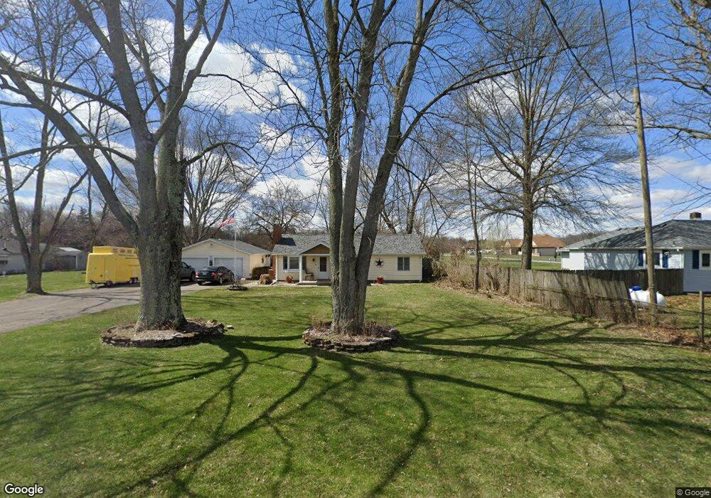
1211 S Bird Rd Springfield, OH 45505
Estimated Value: $223,091 - $259,000
3
Beds
2
Baths
1,374
Sq Ft
$178/Sq Ft
Est. Value
About This Home
This home is located at 1211 S Bird Rd, Springfield, OH 45505 and is currently estimated at $244,523, approximately $177 per square foot. 1211 S Bird Rd is a home located in Clark County with nearby schools including Possum Elementary School, Shawnee Middle School/High School, and Catholic Central Elementary School - Lagonda Campus.
Ownership History
Date
Name
Owned For
Owner Type
Purchase Details
Closed on
Jun 29, 2005
Sold by
Lyden David P and Lyden Nancy
Bought by
Osborne Lowell A and Osborne Patricia
Current Estimated Value
Home Financials for this Owner
Home Financials are based on the most recent Mortgage that was taken out on this home.
Original Mortgage
$113,600
Outstanding Balance
$58,012
Interest Rate
5.62%
Mortgage Type
Fannie Mae Freddie Mac
Estimated Equity
$186,511
Purchase Details
Closed on
Jun 13, 1997
Sold by
Wilson Cathy
Bought by
Freshour Dennis K and Freshour Pamela G
Home Financials for this Owner
Home Financials are based on the most recent Mortgage that was taken out on this home.
Original Mortgage
$83,333
Interest Rate
8.13%
Mortgage Type
FHA
Create a Home Valuation Report for This Property
The Home Valuation Report is an in-depth analysis detailing your home's value as well as a comparison with similar homes in the area
Home Values in the Area
Average Home Value in this Area
Purchase History
| Date | Buyer | Sale Price | Title Company |
|---|---|---|---|
| Osborne Lowell A | $142,000 | -- | |
| Freshour Dennis K | $83,900 | -- |
Source: Public Records
Mortgage History
| Date | Status | Borrower | Loan Amount |
|---|---|---|---|
| Open | Osborne Lowell A | $113,600 | |
| Previous Owner | Freshour Dennis K | $83,333 |
Source: Public Records
Tax History
| Year | Tax Paid | Tax Assessment Tax Assessment Total Assessment is a certain percentage of the fair market value that is determined by local assessors to be the total taxable value of land and additions on the property. | Land | Improvement |
|---|---|---|---|---|
| 2025 | $2,677 | $63,330 | $13,360 | $49,970 |
| 2024 | $2,607 | $53,380 | $9,670 | $43,710 |
| 2023 | $2,607 | $53,380 | $9,670 | $43,710 |
| 2022 | $2,586 | $53,380 | $9,670 | $43,710 |
| 2021 | $2,258 | $41,730 | $7,500 | $34,230 |
| 2020 | $2,276 | $41,730 | $7,500 | $34,230 |
| 2019 | $2,312 | $41,730 | $7,500 | $34,230 |
| 2018 | $2,018 | $35,920 | $6,820 | $29,100 |
| 2017 | $2,068 | $35,914 | $6,818 | $29,096 |
| 2016 | $1,865 | $35,914 | $6,818 | $29,096 |
| 2015 | $1,873 | $34,857 | $6,818 | $28,039 |
| 2014 | $1,878 | $34,857 | $6,818 | $28,039 |
| 2013 | $1,632 | $34,857 | $6,818 | $28,039 |
Source: Public Records
Map
Nearby Homes
- 224 Roebling St
- 225 Ambassador Dr
- 224 Mackinac Dr
- 255 S Bird Rd
- 216 Skyway Dr
- 3154 Sherwood Park Dr
- 218 Golden Gate Ave
- 2076-2078 Stowe Dr
- 2076 Stowe Dr
- 195 Skyway Dr
- 1011 Mount Joy St
- 3012 E High St
- 39 S Bird Rd
- 169 Chesapeake Cir
- 2670 Duncan St
- 4012 Altman Ave
- 138 Lawnview Ave
- 2560 Kenton St
- 221 Scorsese St
- 4017 Chakeres Ave
- 1201 S Bird Rd
- 1225 S Bird Rd
- 1233 S Bird Rd
- 3531 Eichelberger Ln
- 1212 S Bird Rd
- 3560 Eichelberger Ln
- 3548 Eichelberger Ln
- 1200 S Bird Rd
- 3522 Eichelberger Ln
- 3500 Eichelberger Ln
- 1120 S Bird Rd
- 3479 Eichelberger Ln
- 1055 S Bird Rd
- 3435 Eichelberger Ln
- 3450 Eichelberger Ln
- 1017 S Bird Rd
- 218 Scorsese St
- 1362 Woodbridge Ln
- 1347 S Bird Rd
- 3402 Eichelberger Ln
Your Personal Tour Guide
Ask me questions while you tour the home.