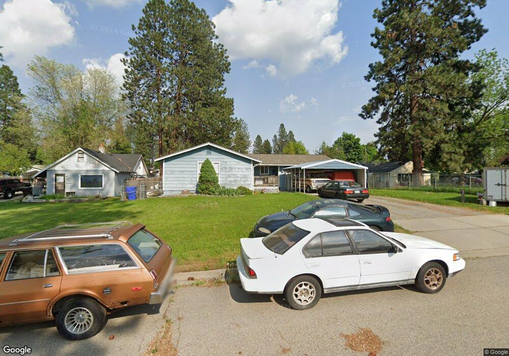
1211 S Raymond Rd Spokane, WA 99206
Dishman Hills NeighborhoodEstimated Value: $401,000 - $428,000
2
Beds
2
Baths
1,248
Sq Ft
$333/Sq Ft
Est. Value
About This Home
This home is located at 1211 S Raymond Rd, Spokane, WA 99206 and is currently estimated at $415,123, approximately $332 per square foot. 1211 S Raymond Rd is a home with nearby schools including University Elementary School, Bowdish Middle School, and University High School.
Ownership History
Date
Name
Owned For
Owner Type
Purchase Details
Closed on
Jun 6, 2001
Sold by
Faulkner David G
Bought by
Moreno Jesus and Moreno Karen
Current Estimated Value
Purchase Details
Closed on
May 3, 2000
Sold by
Smith Karl V and Smith Allissa R
Bought by
Faulkner David G and Moreno Jesus
Home Financials for this Owner
Home Financials are based on the most recent Mortgage that was taken out on this home.
Original Mortgage
$122,324
Interest Rate
8.25%
Mortgage Type
FHA
Create a Home Valuation Report for This Property
The Home Valuation Report is an in-depth analysis detailing your home's value as well as a comparison with similar homes in the area
Home Values in the Area
Average Home Value in this Area
Purchase History
| Date | Buyer | Sale Price | Title Company |
|---|---|---|---|
| Moreno Jesus | $60,488 | -- | |
| Faulkner David G | $123,200 | First American Title Ins |
Source: Public Records
Mortgage History
| Date | Status | Borrower | Loan Amount |
|---|---|---|---|
| Previous Owner | Faulkner David G | $122,324 |
Source: Public Records
Tax History Compared to Growth
Tax History
| Year | Tax Paid | Tax Assessment Tax Assessment Total Assessment is a certain percentage of the fair market value that is determined by local assessors to be the total taxable value of land and additions on the property. | Land | Improvement |
|---|---|---|---|---|
| 2025 | $3,520 | $351,900 | $110,000 | $241,900 |
| 2024 | $3,520 | $328,900 | $80,000 | $248,900 |
| 2023 | $3,723 | $347,800 | $80,000 | $267,800 |
| 2022 | $3,585 | $389,300 | $90,000 | $299,300 |
| 2021 | $3,081 | $246,700 | $50,000 | $196,700 |
| 2020 | $2,840 | $230,900 | $45,000 | $185,900 |
| 2019 | $2,242 | $189,900 | $35,000 | $154,900 |
| 2018 | $2,610 | $184,000 | $35,000 | $149,000 |
| 2017 | $2,441 | $175,100 | $35,000 | $140,100 |
| 2016 | $2,356 | $163,800 | $35,000 | $128,800 |
| 2015 | $2,197 | $149,900 | $50,000 | $99,900 |
| 2014 | -- | $149,900 | $50,000 | $99,900 |
| 2013 | -- | $0 | $0 | $0 |
Source: Public Records
Map
Nearby Homes
- 10612 E 10th Ave
- 10610 E 9th Ave
- 10508 E 15th Ave
- 10104 E 13th Ave
- 10212 E 8th Ave
- 1007 S Walnut Rd
- 10904 E 9th Ave
- 701 S Felts Rd
- 10128 E 16th Ave
- 1208 S Pierce Rd
- 1115 S Woodruff Rd
- 608 S University Rd
- 10212 E 6th Ln
- 11121 E 11th Ave
- 10718 E 18th Ave
- 9906 E 17th Ln
- 10522 E 4th Ave
- 1312 S Mica Park Dr
- 2004 S Fawn Dr Unit 2006
- 2023 S Fawn Dr
- 1203 S Raymond Rd
- 1215 S Raymond Rd
- 1204 S Oberlin Rd
- 10519 E 13th Ave
- 1127 S Raymond Rd
- 1120 S Oberlin Rd
- 1123 S Raymond Rd
- 10504 E 13th Ave
- 10508 E 13th Ave
- 10502 E 13th Ave
- 10512 E 13th Ave
- 1105 S Raymond Rd
- 10518 E 13th Ave
- 10422 E 13th Ave
- 10605 E 13th Ave
- 1205 S Oberlin Rd
- 10416 E 13th Ave
- 1121 S Oberlin Rd
- 10602 E 13th Ave
- 10613 E 13th Ave