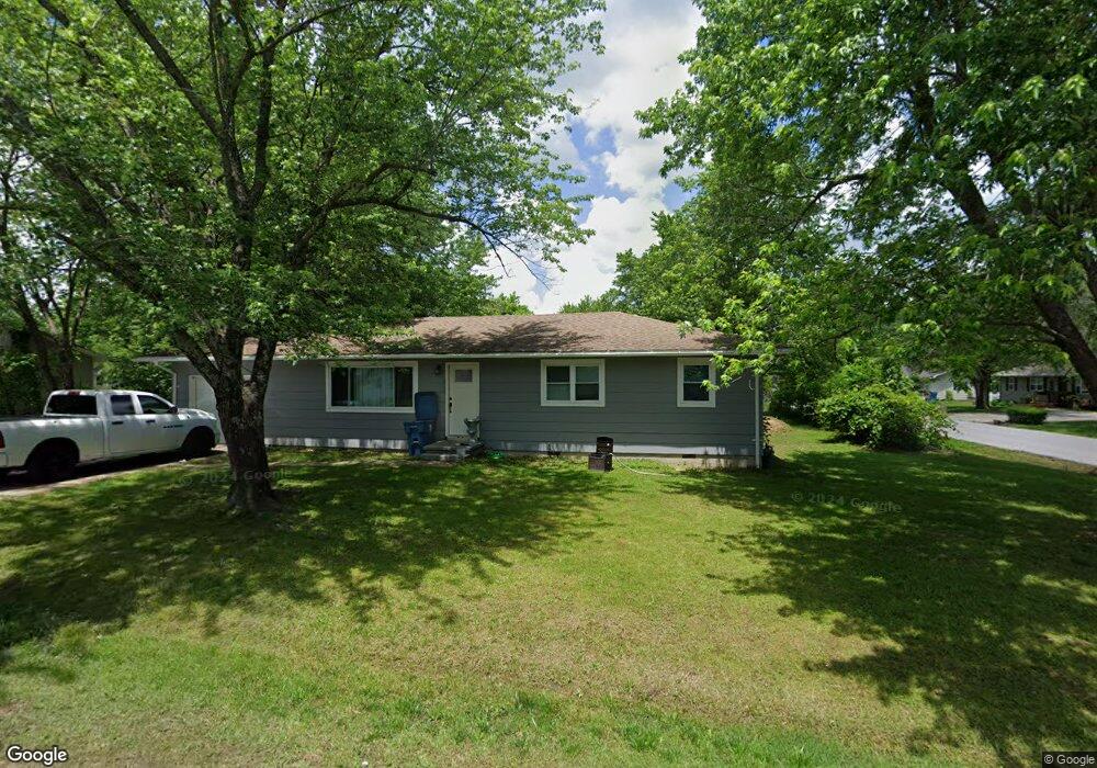
1211 Scott Dr Carl Junction, MO 64834
Estimated Value: $131,000 - $161,000
3
Beds
2
Baths
1,200
Sq Ft
$123/Sq Ft
Est. Value
About This Home
This home is located at 1211 Scott Dr, Carl Junction, MO 64834 and is currently estimated at $147,795, approximately $123 per square foot. 1211 Scott Dr is a home located in Jasper County with nearby schools including Carl Junction Primary School (K-1), Carl Junction Intermediate School, and Carl Junction Primary School (2-3).
Ownership History
Date
Name
Owned For
Owner Type
Purchase Details
Closed on
Jul 6, 2022
Sold by
Donham Regina S
Bought by
Mcnally Jessie Lee and Mcnally Randall Glenn
Current Estimated Value
Home Financials for this Owner
Home Financials are based on the most recent Mortgage that was taken out on this home.
Original Mortgage
$136,285
Outstanding Balance
$129,482
Interest Rate
5.1%
Mortgage Type
FHA
Estimated Equity
$18,313
Purchase Details
Closed on
Mar 20, 2017
Sold by
Wardlow Michael W and Wardlow Jennifer
Bought by
Donham Regina S
Create a Home Valuation Report for This Property
The Home Valuation Report is an in-depth analysis detailing your home's value as well as a comparison with similar homes in the area
Purchase History
| Date | Buyer | Sale Price | Title Company |
|---|---|---|---|
| Mcnally Jessie Lee | -- | None Listed On Document | |
| Donham Regina S | -- | None Available |
Source: Public Records
Mortgage History
| Date | Status | Borrower | Loan Amount |
|---|---|---|---|
| Open | Mcnally Jessie Lee | $136,285 |
Source: Public Records
Tax History
| Year | Tax Paid | Tax Assessment Tax Assessment Total Assessment is a certain percentage of the fair market value that is determined by local assessors to be the total taxable value of land and additions on the property. | Land | Improvement |
|---|---|---|---|---|
| 2025 | $606 | $11,670 | $1,300 | $10,370 |
| 2024 | $610 | $10,360 | $1,300 | $9,060 |
| 2023 | $610 | $10,360 | $1,300 | $9,060 |
| 2022 | $599 | $10,140 | $1,300 | $8,840 |
| 2021 | $514 | $10,140 | $1,300 | $8,840 |
| 2020 | $482 | $9,350 | $1,300 | $8,050 |
| 2019 | $457 | $9,350 | $1,300 | $8,050 |
| 2018 | $469 | $9,620 | $0 | $0 |
| 2017 | $471 | $9,620 | $0 | $0 |
| 2016 | $453 | $9,350 | $0 | $0 |
Source: Public Records
Map
Nearby Homes
- 1210 Bob White Ln
- 104 Cambridge Dr
- 02 County Road 270
- 01 County Road 270
- 039 County Road 270
- 120 Concord St
- 1308 York St
- 307 Ashmore St
- 310 N Grimes St
- 720 Sheridan Ave
- 403 Ashmore Dr
- TBD Temple St
- 29923 Ivy Rd
- 804 Summerlyn Ln
- 9130 Missouri 171
- 608 Valley View St
- 805 Aberdeen Ave
- 900 Aberdeen Ave
- 903 Aberdeen Ave
- 905 Aberdeen Ave
- 1209 Scott Dr
- 402 N Arlington St
- 1300 Scott Dr
- 403 N Arlington St
- 404 N Arlington St
- 1212 Scott Dr
- 1207 Scott Dr
- 1210 Scott Dr
- 305 N Arlington St
- 406 N Arlington St
- 405 N Arlington St
- 407 N Arlington St
- 1208 Scott Dr
- 1205 Scott Dr
- 409 N Arlington St
- 303 N Arlington St
- 408 N Arlington St
- 1211 Craig Dr
- 402 Karen Dr
- 1206 Scott Dr
Your Personal Tour Guide
Ask me questions while you tour the home.