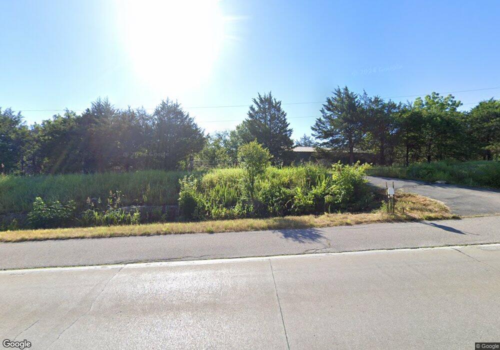
12116 State Route 21 de Soto, MO 63020
Estimated Value: $219,000 - $364,610
2
Beds
1
Bath
1,045
Sq Ft
$267/Sq Ft
Est. Value
About This Home
This home is located at 12116 State Route 21, de Soto, MO 63020 and is currently estimated at $279,403, approximately $267 per square foot. 12116 State Route 21 is a home located in Jefferson County with nearby schools including Hillsboro Elementary School, Hillsboro Primary School, and Hillsboro Middle Elementary School.
Ownership History
Date
Name
Owned For
Owner Type
Purchase Details
Closed on
May 18, 2001
Sold by
Holmes Joe R and Holmes Betty J
Bought by
Hammond William E and Hammond Jane
Current Estimated Value
Home Financials for this Owner
Home Financials are based on the most recent Mortgage that was taken out on this home.
Original Mortgage
$155,000
Outstanding Balance
$57,791
Interest Rate
7.01%
Estimated Equity
$221,612
Create a Home Valuation Report for This Property
The Home Valuation Report is an in-depth analysis detailing your home's value as well as a comparison with similar homes in the area
Home Values in the Area
Average Home Value in this Area
Purchase History
| Date | Buyer | Sale Price | Title Company |
|---|---|---|---|
| Hammond William E | -- | -- | |
| Hammond William E | -- | -- |
Source: Public Records
Mortgage History
| Date | Status | Borrower | Loan Amount |
|---|---|---|---|
| Open | Hammond William E | $155,000 |
Source: Public Records
Tax History Compared to Growth
Tax History
| Year | Tax Paid | Tax Assessment Tax Assessment Total Assessment is a certain percentage of the fair market value that is determined by local assessors to be the total taxable value of land and additions on the property. | Land | Improvement |
|---|---|---|---|---|
| 2025 | $1,771 | $29,600 | $14,200 | $15,400 |
| 2024 | $1,771 | $28,300 | $14,200 | $14,100 |
| 2023 | $1,771 | $28,300 | $14,200 | $14,100 |
| 2022 | $1,879 | $28,300 | $14,200 | $14,100 |
| 2021 | $2,003 | $28,300 | $14,200 | $14,100 |
| 2020 | $1,877 | $25,600 | $12,900 | $12,700 |
| 2019 | $1,876 | $25,600 | $12,900 | $12,700 |
| 2018 | $1,883 | $25,600 | $12,900 | $12,700 |
| 2017 | $1,792 | $25,600 | $12,900 | $12,700 |
| 2016 | $1,738 | $24,100 | $12,900 | $11,200 |
| 2015 | $1,512 | $24,100 | $12,900 | $11,200 |
| 2013 | $1,512 | $22,500 | $11,700 | $10,800 |
Source: Public Records
Map
Nearby Homes
- 4498 Liberty Ridge Rd
- 12323 State Route 21
- 4483 Liberty Meadows Rd
- 5000 Glory Ridge
- 5580 Cotter Creek Rd
- 12305 Hoffman Rd
- 4633 Dylan Dr
- 4640 Dylan Dr
- 5319 Victory Farm Rd
- 0 Scanlon Dr
- 5033 Whitehead Rd
- 5300 Scanlon Dr
- 000 Scanlon Dr
- 5039 Hampton Dr
- 1483 Saint Charles Dr
- N 7th Battles Ln
- 12279 Hyfield Rd
- 5059 Hampton Dr
- 1618 N 6th St
- 1420 Cortez Dr
- 12116 State Route 21
- 12122 State Route 21
- 4550 Jlj Ranch Rd
- 12060 Castle Ranch Rd
- 30 Acres Mg + -
- 30+/- Acres Mg
- 0 State Rt 21 Unit 90043542
- 96 Mo Hwy 21 Acres
- 4620 Leonard Dr
- 4587 Liberty Ridge Rd
- 4587 Liberty Ridge ( R-3 Schools)
- 4581 Liberty Ridge Rd
- 11880 Highway 21
- 4533 Twinbrook Rd
- 4527 Twinbrook Rd
- 4506 Twinbrook Rd
- 4633 Leonard Dr
- 4593 Liberty Ridge Rd
- 12025 Castle Ranch Rd
- 4515 Twinbrook Rd
