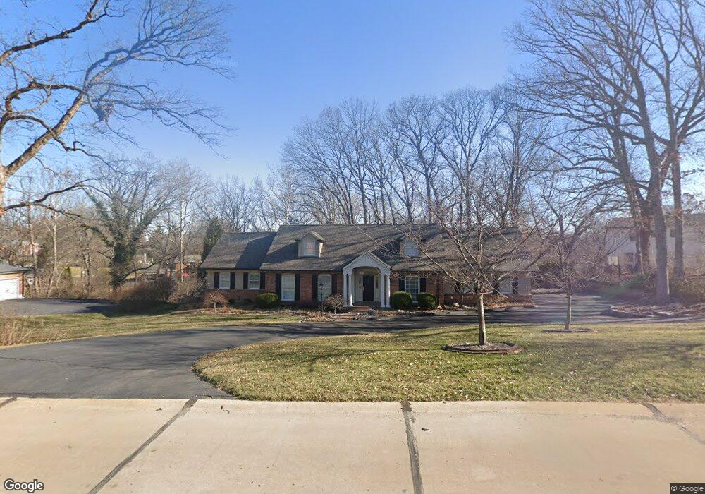
12119 Point Oak Rd Saint Louis, MO 63131
Estimated Value: $952,000 - $1,142,000
4
Beds
3
Baths
3,568
Sq Ft
$300/Sq Ft
Est. Value
About This Home
This home is located at 12119 Point Oak Rd, Saint Louis, MO 63131 and is currently estimated at $1,071,634, approximately $300 per square foot. 12119 Point Oak Rd is a home located in St. Louis County with nearby schools including Westchester Elementary School, North Kirkwood Middle School, and Kirkwood Senior High School.
Ownership History
Date
Name
Owned For
Owner Type
Purchase Details
Closed on
Jul 1, 2002
Sold by
Ferry Daniel and Ferry Eleanor A
Bought by
Coggan Gillian M and Coggan Jeffrey R
Current Estimated Value
Home Financials for this Owner
Home Financials are based on the most recent Mortgage that was taken out on this home.
Original Mortgage
$450,000
Outstanding Balance
$191,440
Interest Rate
6.76%
Estimated Equity
$880,194
Create a Home Valuation Report for This Property
The Home Valuation Report is an in-depth analysis detailing your home's value as well as a comparison with similar homes in the area
Home Values in the Area
Average Home Value in this Area
Purchase History
| Date | Buyer | Sale Price | Title Company |
|---|---|---|---|
| Coggan Gillian M | $679,000 | -- |
Source: Public Records
Mortgage History
| Date | Status | Borrower | Loan Amount |
|---|---|---|---|
| Open | Coggan Gillian M | $450,000 |
Source: Public Records
Tax History Compared to Growth
Tax History
| Year | Tax Paid | Tax Assessment Tax Assessment Total Assessment is a certain percentage of the fair market value that is determined by local assessors to be the total taxable value of land and additions on the property. | Land | Improvement |
|---|---|---|---|---|
| 2025 | $9,187 | $205,220 | $76,780 | $128,440 |
| 2024 | $9,187 | $159,050 | $62,380 | $96,670 |
| 2023 | $9,187 | $159,050 | $62,380 | $96,670 |
| 2022 | $8,147 | $133,500 | $62,380 | $71,120 |
| 2021 | $8,059 | $133,500 | $62,380 | $71,120 |
| 2020 | $8,536 | $135,970 | $37,700 | $98,270 |
| 2019 | $8,547 | $135,970 | $37,700 | $98,270 |
| 2018 | $7,721 | $110,190 | $27,840 | $82,350 |
| 2017 | $7,742 | $110,190 | $27,840 | $82,350 |
| 2016 | $7,890 | $113,760 | $27,840 | $85,920 |
| 2015 | $7,900 | $113,760 | $27,840 | $85,920 |
| 2014 | $7,885 | $110,980 | $28,900 | $82,080 |
Source: Public Records
Map
Nearby Homes
- The Hawthorne Plan at Ballas Ridge
- The Roclare II Plan at Ballas Ridge
- The Westchester IV Plan at Ballas Ridge
- The Nottingham II Plan at Ballas Ridge
- The Hawthorne II Plan at Ballas Ridge
- TBB Ballas Ridge Hawthorne II
- TBB Ballas Ridge Roclare II
- TBB
- TBB Ballas Ridge Westchester IV
- TBB
- 2056 N Ballas Rd
- 2062 N Ballas Rd
- 8 Briarbrook Trail
- 12439 Springdale Ln Unit TBB
- 0 Unknown Unit 22071090
- 1728 Folkstone Dr
- 1741 Pine Hill Dr
- 723 Oak Valley Dr
- 2409 N Ballas Rd
- 22 Countryside Ln
- 12101 Point Oak Rd
- 12135 Point Oak Rd
- 1880 Ironstone Rd
- 12120 Belle Meade Rd
- 12067 Point Oak Rd
- 12144 Point Oak Rd
- 1887 Candlewick Dr
- 12141 Point Oak Rd
- 12134 Belle Meade Rd
- 12112 Belle Meade Rd
- 1879 Ironstone Rd
- 1868 Ironstone Rd
- 1875 Candlewick Dr
- 12055 Point Oak Rd
- 12054 Point Oak Rd
- 1894 Point Oak Rd
- 12104 Belle Meade Rd
- 1867 Ironstone Rd
- 1940 Tricorn Ln
- 12161 Point Oak Rd