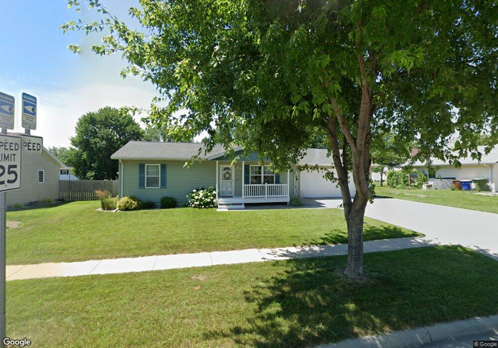
1212 17th Ave S Brookings, SD 57006
Estimated Value: $216,000 - $236,294
2
Beds
1
Bath
988
Sq Ft
$230/Sq Ft
Est. Value
About This Home
This home is located at 1212 17th Ave S, Brookings, SD 57006 and is currently estimated at $227,324, approximately $230 per square foot. 1212 17th Ave S is a home located in Brookings County with nearby schools including Brookings High School and St Thomas More Catholic School.
Ownership History
Date
Name
Owned For
Owner Type
Purchase Details
Closed on
Dec 7, 2012
Sold by
Laleman Bridget B and Laleman Paul C
Bought by
Mack Brent J
Current Estimated Value
Home Financials for this Owner
Home Financials are based on the most recent Mortgage that was taken out on this home.
Original Mortgage
$120,000
Outstanding Balance
$83,180
Interest Rate
3.38%
Estimated Equity
$144,144
Create a Home Valuation Report for This Property
The Home Valuation Report is an in-depth analysis detailing your home's value as well as a comparison with similar homes in the area
Home Values in the Area
Average Home Value in this Area
Purchase History
| Date | Buyer | Sale Price | Title Company |
|---|---|---|---|
| Mack Brent J | -- | -- |
Source: Public Records
Mortgage History
| Date | Status | Borrower | Loan Amount |
|---|---|---|---|
| Open | Mack Brent J | $120,000 |
Source: Public Records
Tax History
| Year | Tax Paid | Tax Assessment Tax Assessment Total Assessment is a certain percentage of the fair market value that is determined by local assessors to be the total taxable value of land and additions on the property. | Land | Improvement |
|---|---|---|---|---|
| 2025 | $2,369 | $188,400 | $33,000 | $155,400 |
| 2024 | $2,492 | $161,100 | $26,400 | $134,700 |
| 2023 | $2,268 | $161,100 | $26,400 | $134,700 |
| 2022 | $2,051 | $142,800 | $26,400 | $116,400 |
| 2021 | $1,995 | $136,600 | $26,400 | $110,200 |
| 2020 | $2,048 | $143,200 | $26,400 | $116,800 |
| 2019 | $1,992 | $134,600 | $26,400 | $108,200 |
| 2018 | $1,988 | $129,300 | $26,400 | $102,900 |
| 2017 | $1,802 | $129,300 | $26,400 | $102,900 |
| 2016 | $1,751 | $114,500 | $26,400 | $88,100 |
| 2010 | -- | $118,100 | $0 | $0 |
Source: Public Records
Map
Nearby Homes
- 1507 Sequoia Ct
- 2044 Arbor Ridge
- 1142 15th St S
- 1650 Moriarty Dr
- 701 Park Avenue Cir
- 709 Park Avenue Cir
- 1401 Windermere Way
- 1008 16th St S
- 1945 Orchard Dr
- 808 Sunflower Rd
- 723 Leprechaun Cir
- TBD Lucerne Ave
- 1529 Steamboat Trail
- 300 Medary Ave S Unit 90
- 104 16th Ave S
- 521 12th St S Unit 75
- 1218 1st St
- 2012 1st St
- 2333 Oak Branch Ave
- 1412 Spring St
- 1218 17th Ave S
- 1610 12th St S
- 1209 Breckenridge Ln
- 1215 Breckenridge Ln
- 1202 17th Ave S
- 1224 17th Ave S
- 1221 Breckenridge Ln
- 1604 12th St S
- 1227 Breckenridge Ln
- 1232 17th Ave S
- 1120 17th Ave S
- 1605 12th St S
- 1212 Breckenridge Ln
- 1204 Breckenridge Ln
- 1302 17th Ave S
- 1224 Breckenridge Ln
- 1539 King Arthur Ct
- 1307 Breckenridge Ln
- 1116 17th Ave S