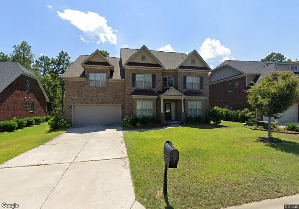
1212 Ashland Dr Columbia, SC 29229
Lake Carolina NeighborhoodEstimated Value: $459,000 - $488,000
5
Beds
4
Baths
4,069
Sq Ft
$116/Sq Ft
Est. Value
About This Home
This home is located at 1212 Ashland Dr, Columbia, SC 29229 and is currently estimated at $472,210, approximately $116 per square foot. 1212 Ashland Dr is a home located in Richland County with nearby schools including Lake Carolina Elementary Lower Campus, Lake Carolina Elementary Upper Campus, and Blythewood Middle School.
Ownership History
Date
Name
Owned For
Owner Type
Purchase Details
Closed on
Aug 18, 2021
Sold by
Rao Munukala R and Munukala Jaya L
Bought by
Hp South Carolina Llc
Current Estimated Value
Purchase Details
Closed on
Oct 29, 2013
Sold by
Munukala Jaya L
Bought by
Rao Munukala R and Munukala Jaya L
Home Financials for this Owner
Home Financials are based on the most recent Mortgage that was taken out on this home.
Original Mortgage
$253,503
Interest Rate
2.75%
Mortgage Type
Adjustable Rate Mortgage/ARM
Purchase Details
Closed on
Mar 19, 2013
Sold by
Lake Carolina Development Inc
Bought by
Essex Homes Southeast Inc
Create a Home Valuation Report for This Property
The Home Valuation Report is an in-depth analysis detailing your home's value as well as a comparison with similar homes in the area
Home Values in the Area
Average Home Value in this Area
Purchase History
| Date | Buyer | Sale Price | Title Company |
|---|---|---|---|
| Hp South Carolina Llc | $380,000 | None Available | |
| Rao Munukala R | -- | None Available | |
| Essex Homes Southeast Inc | $88,580 | None Available |
Source: Public Records
Mortgage History
| Date | Status | Borrower | Loan Amount |
|---|---|---|---|
| Previous Owner | Rao Munukala R | $253,503 |
Source: Public Records
Tax History Compared to Growth
Tax History
| Year | Tax Paid | Tax Assessment Tax Assessment Total Assessment is a certain percentage of the fair market value that is determined by local assessors to be the total taxable value of land and additions on the property. | Land | Improvement |
|---|---|---|---|---|
| 2024 | $13,629 | $422,000 | $62,500 | $359,500 |
| 2023 | $13,629 | $15,200 | $0 | $0 |
| 2022 | $12,911 | $380,000 | $45,000 | $335,000 |
| 2021 | $2,848 | $12,060 | $0 | $0 |
| 2020 | $2,894 | $12,060 | $0 | $0 |
| 2019 | $2,885 | $12,060 | $0 | $0 |
| 2018 | $2,749 | $11,270 | $0 | $0 |
| 2017 | $2,692 | $11,270 | $0 | $0 |
| 2016 | $2,682 | $11,270 | $0 | $0 |
| 2015 | $2,693 | $11,270 | $0 | $0 |
| 2014 | $2,688 | $281,700 | $0 | $0 |
| 2013 | -- | $17,350 | $0 | $0 |
Source: Public Records
Map
Nearby Homes
- 312 Baybridge Dr
- 201 Brooksdale Dr
- 1128 Ashland Dr
- 725 Pennywell Ct
- 2216 Lofton Rd
- 2204 Lofton Rd
- 404 Cartgate Cir
- 2196 Lofton Rd
- 2192 Lofton Rd
- 2188 Lofton Rd
- 2186 Lofton Rd
- 2182 Lofton Rd
- 2178 Lofton Rd
- 2181 Lofton Rd
- 2 Back Bay Ct
- 2179 Lofton Rd
- Ashford Plan at The Falls
- Lawson Plan at The Falls
- Henderson Plan at The Falls
- 2175 Lofton Rd
- 1216 Ashland Dr
- 1208 Ashland Dr
- 1220 Ashland Dr
- 1204 Ashland Dr
- 1211 Ashland Dr
- 1215 Ashland Dr
- 1205 Ashland Dr
- 1224 Ashland Dr
- 1219 Ashland Dr
- 1200 Ashland Dr
- 1199 Ashland Dr
- 1228 Ashland Dr
- 1196 Ashland Dr
- 328 Baybridge Dr
- 332 Baybridge Dr
- 1195 Ashland Dr
- 324 Baybridge Dr
- 336 Baybridge Dr
- 1229 Ashland Dr
- 1232 Ashland Dr