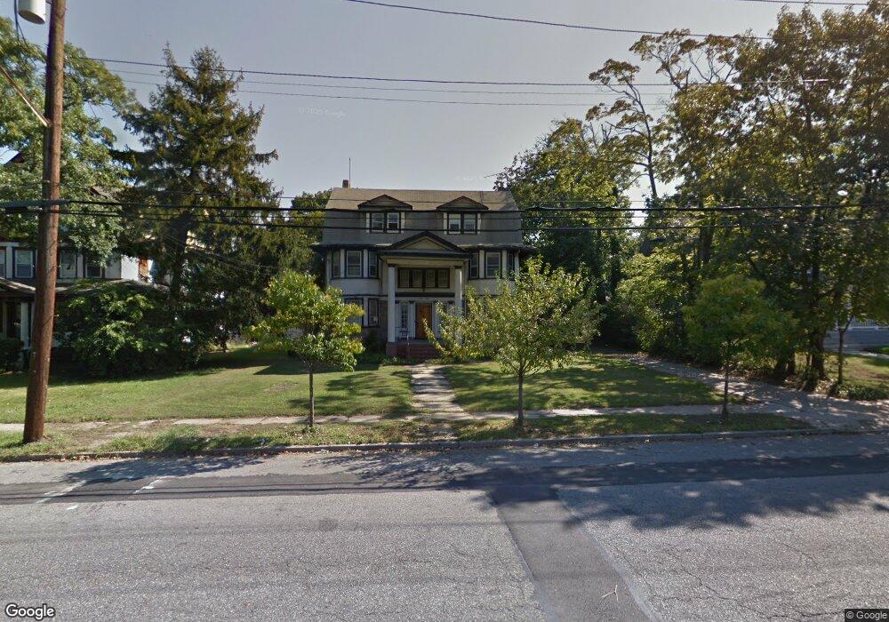
1212 Beach 9th St Far Rockaway, NY 11691
Far Rockaway NeighborhoodEstimated Value: $1,010,000 - $1,896,000
--
Bed
--
Bath
3,526
Sq Ft
$439/Sq Ft
Est. Value
About This Home
This home is located at 1212 Beach 9th St, Far Rockaway, NY 11691 and is currently estimated at $1,547,238, approximately $438 per square foot. 1212 Beach 9th St is a home located in Queens County with nearby schools including The Randolph Holder School for Social Justice - Q253, P.S. 253 The Magnet School of Multicultural Humanities, and Ms 53 Brian Piccolo.
Ownership History
Date
Name
Owned For
Owner Type
Purchase Details
Closed on
Aug 4, 2021
Sold by
Florence Sofer Irrevocable Trust and Shaya Sofer As Trustee
Bought by
1212 Beach 9Th Street Llc
Current Estimated Value
Purchase Details
Closed on
Jun 1, 2014
Sold by
Sofer Florence
Bought by
Florence Sofer Irrevocable Trust and Shaya Sofer Trustee
Create a Home Valuation Report for This Property
The Home Valuation Report is an in-depth analysis detailing your home's value as well as a comparison with similar homes in the area
Home Values in the Area
Average Home Value in this Area
Purchase History
| Date | Buyer | Sale Price | Title Company |
|---|---|---|---|
| 1212 Beach 9Th Street Llc | $1,250,000 | -- | |
| 1212 Beach 9Th Street Llc | $1,250,000 | -- | |
| Florence Sofer Irrevocable Trust | -- | -- | |
| Florence Sofer Irrevocable Trust | -- | -- |
Source: Public Records
Tax History Compared to Growth
Tax History
| Year | Tax Paid | Tax Assessment Tax Assessment Total Assessment is a certain percentage of the fair market value that is determined by local assessors to be the total taxable value of land and additions on the property. | Land | Improvement |
|---|---|---|---|---|
| 2025 | $9,870 | $55,080 | $13,328 | $41,752 |
| 2024 | $2,639 | $49,140 | $13,351 | $35,789 |
| 2023 | $5,278 | $26,280 | $46,561 | $0 |
| 2022 | $8,769 | $73,860 | $26,280 | $47,580 |
| 2021 | $3,545 | $70,140 | $26,280 | $43,860 |
| 2020 | $3,568 | $77,100 | $26,280 | $50,820 |
| 2019 | $3,481 | $84,900 | $26,280 | $58,620 |
| 2018 | $3,141 | $38,786 | $13,355 | $25,431 |
| 2017 | $6,510 | $36,604 | $13,541 | $23,063 |
| 2016 | $5,985 | $36,604 | $13,541 | $23,063 |
| 2015 | $3,740 | $34,536 | $16,079 | $18,457 |
| 2014 | $3,740 | $34,237 | $13,554 | $20,683 |
Source: Public Records
Map
Nearby Homes
- 833 Central Ave Unit 3M
- 1260 Central Ave
- 1211 Brunswick Ave
- 1092 Beach 12th St
- 1292 Augustina Ave
- 802 Empire Ave
- 1029 New McNeil Ave
- 12-99 Brunswick Ave
- 1040 Neilson St Unit 3B3
- 1047 Neilson St
- 1158 Redfern Ave
- 1507 Beach 11th St
- 15-20 Beach 12th St
- 115 Central Ave
- 34 Monroe St
- 31 Monroe St
- 130 Hards Ln
- 1 Hurley Ct
- 47 Monroe St
- 303 Bayview Ave
- 12-12 Beach 9th St
- 1204 Beach 9th St
- 1220 Beach 9th St
- 1209 Sage St
- 1215 Sage St
- 1219 Sage St
- 804 Bolton Rd
- 1223 Sage St
- 1200 Beach 9th St
- 1232 Beach 9th St
- 1209 Beach 9th St
- 1217 Beach 9th St
- 1165 Sage St
- 1201 Beach 9th St
- 1223 Beach 9th St
- 1212 Sage St
- 1220 Sage St
- 1193 Beach 9th St
- 1193 Beach 9th St