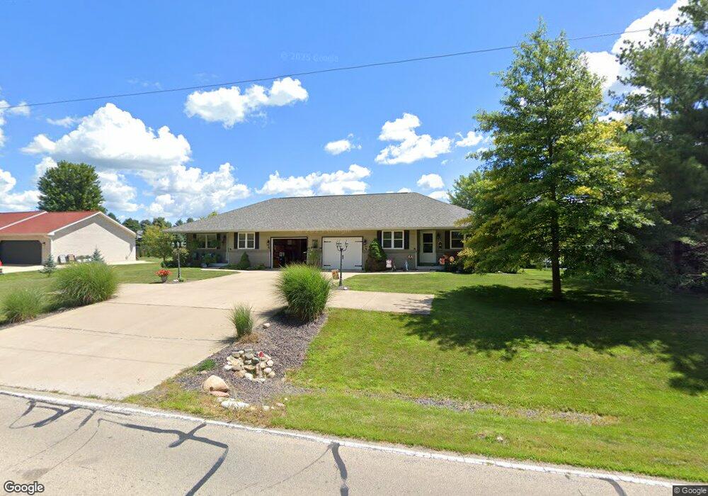
1212 Coal Bank Rd Metamora, IL 61548
Estimated Value: $227,000 - $243,000
1
Bed
--
Bath
2,668
Sq Ft
$88/Sq Ft
Est. Value
About This Home
This home is located at 1212 Coal Bank Rd, Metamora, IL 61548 and is currently estimated at $235,000, approximately $88 per square foot. 1212 Coal Bank Rd is a home with nearby schools including Metamora Grade School, Metamora High School, and St Mary's Catholic School.
Ownership History
Date
Name
Owned For
Owner Type
Purchase Details
Closed on
Oct 29, 2019
Sold by
James Dansart
Bought by
Dansart Jack Daniel
Current Estimated Value
Home Financials for this Owner
Home Financials are based on the most recent Mortgage that was taken out on this home.
Original Mortgage
$151,200
Outstanding Balance
$134,031
Interest Rate
3.99%
Mortgage Type
New Conventional
Estimated Equity
$100,969
Purchase Details
Closed on
Mar 4, 2019
Sold by
Dansart and Laura
Bought by
Dansart James and Dansart Jack Daniel
Create a Home Valuation Report for This Property
The Home Valuation Report is an in-depth analysis detailing your home's value as well as a comparison with similar homes in the area
Home Values in the Area
Average Home Value in this Area
Purchase History
| Date | Buyer | Sale Price | Title Company |
|---|---|---|---|
| Dansart Jack Daniel | -- | Cusack Gilfillan & Oday Llc | |
| Dansart Jack Daniel | -- | -- | |
| Dansart James | -- | Cusack Gilfillan Oday Llc |
Source: Public Records
Mortgage History
| Date | Status | Borrower | Loan Amount |
|---|---|---|---|
| Open | Dansart Jack Daniel | $151,200 | |
| Closed | Dansart Jack Daniel | $151,200 |
Source: Public Records
Tax History Compared to Growth
Tax History
| Year | Tax Paid | Tax Assessment Tax Assessment Total Assessment is a certain percentage of the fair market value that is determined by local assessors to be the total taxable value of land and additions on the property. | Land | Improvement |
|---|---|---|---|---|
| 2024 | $7,718 | $84,287 | $14,127 | $70,160 |
| 2023 | $7,081 | $77,491 | $12,988 | $64,503 |
| 2022 | $6,698 | $71,864 | $12,045 | $59,819 |
| 2021 | $6,595 | $70,788 | $11,865 | $58,923 |
| 2020 | $5,948 | $70,156 | $11,759 | $58,397 |
| 2019 | $4,796 | $72,475 | $12,148 | $60,327 |
| 2018 | $4,848 | $72,043 | $12,076 | $59,967 |
| 2017 | $4,824 | $72,043 | $12,076 | $59,967 |
| 2016 | $5,970 | $71,329 | $11,956 | $59,373 |
| 2015 | $4,799 | $57,011 | $11,585 | $45,426 |
| 2014 | $4,799 | $55,485 | $11,275 | $44,210 |
| 2013 | $4,799 | $55,882 | $11,356 | $44,526 |
Source: Public Records
Map
Nearby Homes
- 1003 White Horse Trail
- 1220 Coal Bank Rd
- 1441 Glenwood Ave
- 1101 White Horse Trail
- 1101 White Horse Trail Unit M
- 1435 Glenwood Ave
- 1435 Glenwood Ave Unit 3
- 1103 White Horse Trail
- 1395 Glenwood Ave
- 1440 Glenwood Ave
- 1104 White Horse Trail
- 1105 White Horse Trail
- 1430 Glenwood Ave
- 1301 Coal Bank Rd
- 1211 Coal Bank Rd
- 1201 Coal Bank Rd
- 1400 Glenwood Ave
- 1310 Coal Bank Rd
- 1385 Glenwood Ave
- 1107 White Horse Trail