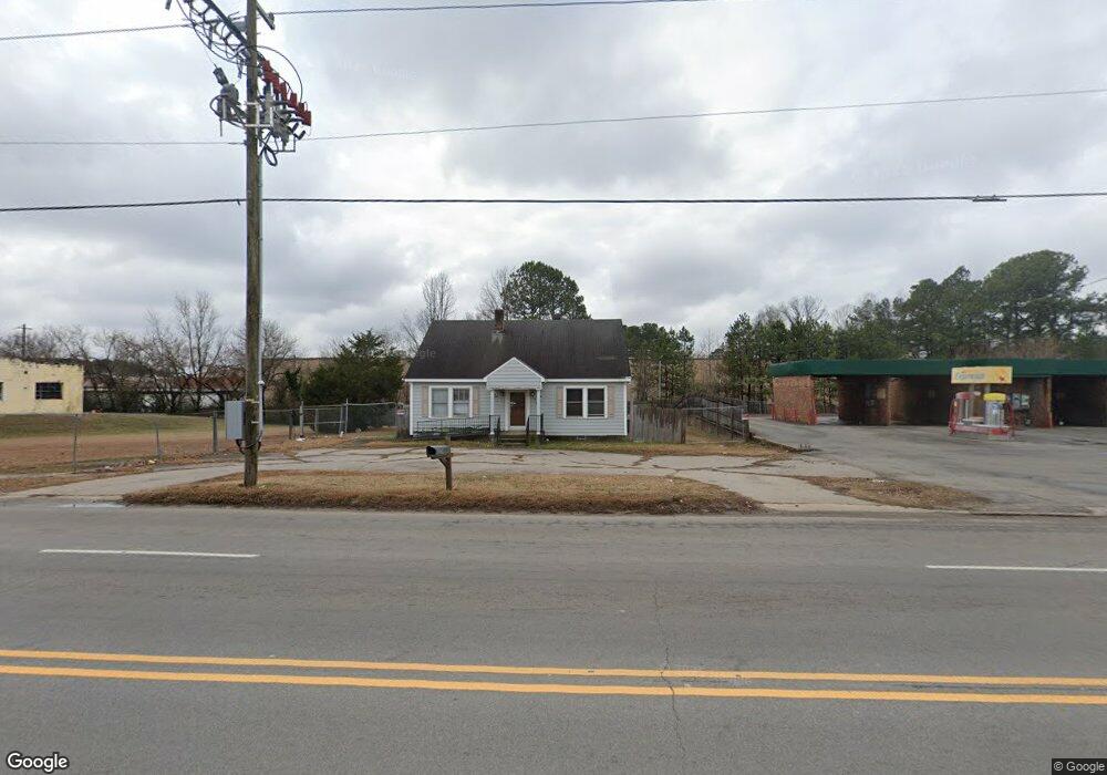
1212 E Andrews Ave Henderson, NC 27536
Estimated Value: $67,150
Studio
--
Bath
1,944
Sq Ft
$35/Sq Ft
Est. Value
About This Home
This home is located at 1212 E Andrews Ave, Henderson, NC 27536 and is currently estimated at $67,150, approximately $34 per square foot. 1212 E Andrews Ave is a home located in Vance County with nearby schools including Clarke Elementary School, Henderson Middle School, and Vance County High School.
Ownership History
Date
Name
Owned For
Owner Type
Purchase Details
Closed on
May 12, 2021
Sold by
Garcia Ruben Amilcar Rivas
Bought by
Garcia Adan Morales and Garcia Laura
Current Estimated Value
Purchase Details
Closed on
Nov 9, 2016
Sold by
Stanley Robert D and Stanley Kelly M
Bought by
Garcia Ruben Amilcar Rivas
Purchase Details
Closed on
Feb 10, 2015
Sold by
E Clips Llc
Bought by
Stanley Robert D and Stanley Bob
Home Financials for this Owner
Home Financials are based on the most recent Mortgage that was taken out on this home.
Original Mortgage
$15,000
Interest Rate
3.9%
Mortgage Type
Commercial
Create a Home Valuation Report for This Property
The Home Valuation Report is an in-depth analysis detailing your home's value as well as a comparison with similar homes in the area
Purchase History
| Date | Buyer | Sale Price | Title Company |
|---|---|---|---|
| Garcia Adan Morales | $45,000 | None Available | |
| Garcia Adan Morales | $45,000 | None Listed On Document | |
| Garcia Ruben Amilcar Rivas | $33,000 | None Available | |
| Stanley Robert D | $12,000 | None Available |
Source: Public Records
Mortgage History
| Date | Status | Borrower | Loan Amount |
|---|---|---|---|
| Previous Owner | Stanley Robert D | $15,000 |
Source: Public Records
Tax History
| Year | Tax Paid | Tax Assessment Tax Assessment Total Assessment is a certain percentage of the fair market value that is determined by local assessors to be the total taxable value of land and additions on the property. | Land | Improvement |
|---|---|---|---|---|
| 2025 | $936 | $68,701 | $22,500 | $46,201 |
| 2024 | $936 | $68,701 | $22,500 | $46,201 |
| 2023 | $503 | $30,680 | $18,112 | $12,568 |
| 2022 | $491 | $30,680 | $18,112 | $12,568 |
| 2021 | $491 | $30,680 | $18,112 | $12,568 |
| 2020 | $491 | $30,680 | $18,112 | $12,568 |
| 2019 | $491 | $30,680 | $18,112 | $12,568 |
| 2018 | $491 | $30,680 | $18,112 | $12,568 |
| 2017 | $491 | $30,680 | $18,112 | $12,568 |
| 2016 | $491 | $30,680 | $18,112 | $12,568 |
| 2015 | $1,007 | $64,430 | $27,168 | $37,262 |
| 2014 | $910 | $64,432 | $27,168 | $37,264 |
Source: Public Records
Map
Nearby Homes
- 00 Cardinal Dr
- 105 S Elizabeth St
- 248 Orville St
- 630 East Ave
- 628 Farrar Ave
- 936 Eaton St
- 210/212 N Shank St
- 417 Sunnyview Rd
- 723 Water St
- 431 Charles St
- 917 Gay St
- 0 Summit Rd Unit 100551033
- 503 Hilliard St
- 605 E Montgomery St
- 735 Alexander Ave
- 651 Marshall St
- 650 Marshall St
- 647 Marshall St
- 648 Marshall St
- 646 Marshall St
- 1208 E Andrews Ave
- 1209 E Andrews Ave
- 001 Andrews Ave
- 1202 E Andrews Ave
- 214 N Bullock St
- 212 N Bullock St
- 164 N Elizabeth St
- 210 N Bullock St
- 160 N Elizabeth St
- 176 N Elizabeth St
- 1130 E Andrews Ave
- 178 N Elizabeth St
- 0000 S Us 1 Hwy
- 0 S Us 1 Hwy
- 217 N Bullock St
- 157 N Elizabeth St
- 215 N Bullock St
- 158 N Bullock St
- 205 N Bullock St
- 201 N Bullock St
Your Personal Tour Guide
Ask me questions while you tour the home.