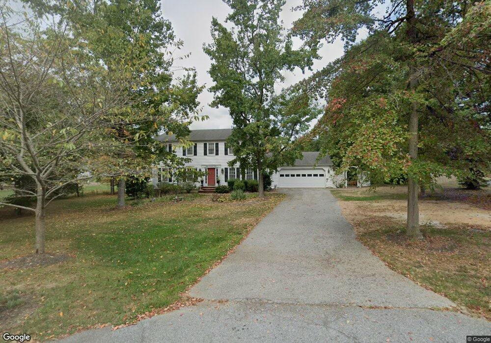
1212 E Patuxent Dr La Plata, MD 20646
Estimated Value: $482,000 - $542,000
--
Bed
3
Baths
2,352
Sq Ft
$214/Sq Ft
Est. Value
About This Home
This home is located at 1212 E Patuxent Dr, La Plata, MD 20646 and is currently estimated at $503,177, approximately $213 per square foot. 1212 E Patuxent Dr is a home located in Charles County with nearby schools including Walter J. Mitchell Elementary School, Milton M. Somers Middle School, and La Plata High School.
Ownership History
Date
Name
Owned For
Owner Type
Purchase Details
Closed on
Dec 15, 2003
Sold by
Lytle Leslie R
Bought by
Hancock Ralph and Hancock Leslie
Current Estimated Value
Purchase Details
Closed on
May 12, 1998
Sold by
Federal National Mortgage Association
Bought by
Lytle Leslie R
Purchase Details
Closed on
Apr 27, 1998
Sold by
Schwab Andrew P and Schwab Sheryl A
Bought by
Federal National Mortgage Association
Create a Home Valuation Report for This Property
The Home Valuation Report is an in-depth analysis detailing your home's value as well as a comparison with similar homes in the area
Home Values in the Area
Average Home Value in this Area
Purchase History
| Date | Buyer | Sale Price | Title Company |
|---|---|---|---|
| Hancock Ralph | $261,000 | -- | |
| Lytle Leslie R | $163,000 | -- | |
| Federal National Mortgage Association | $167,000 | -- |
Source: Public Records
Mortgage History
| Date | Status | Borrower | Loan Amount |
|---|---|---|---|
| Closed | Lytle Leslie R | -- |
Source: Public Records
Tax History Compared to Growth
Tax History
| Year | Tax Paid | Tax Assessment Tax Assessment Total Assessment is a certain percentage of the fair market value that is determined by local assessors to be the total taxable value of land and additions on the property. | Land | Improvement |
|---|---|---|---|---|
| 2025 | $11,169 | $358,367 | -- | -- |
| 2024 | $5,141 | $335,233 | $0 | $0 |
| 2023 | $5,459 | $312,100 | $109,300 | $202,800 |
| 2022 | $4,558 | $303,433 | $0 | $0 |
| 2021 | $4,314 | $294,767 | $0 | $0 |
| 2020 | $4,314 | $286,100 | $98,800 | $187,300 |
| 2019 | $4,457 | $286,100 | $98,800 | $187,300 |
| 2018 | $4,313 | $286,100 | $98,800 | $187,300 |
| 2017 | $4,394 | $289,900 | $0 | $0 |
| 2016 | -- | $275,500 | $0 | $0 |
| 2015 | $3,960 | $261,100 | $0 | $0 |
| 2014 | $3,960 | $246,700 | $0 | $0 |
Source: Public Records
Map
Nearby Homes
- 721 Clarks Run Rd
- 511 Dogwood Ct
- 507 Scarlet Oak Rd
- 513 Clarks Run Rd
- 1319 Redwood Cir
- 1061 Wales Dr
- 10665 Horseshoe Ct
- 6635 Horseshoe Dr
- 1018 Wales Dr
- 101 Middlesex Ct
- 1001 Agricopia Dr
- 1005 Agricopia Dr
- 111 Huckleberry Dr
- 1309 Leicester Dr
- 923 Hickory Cir
- 201 Heather Ct
- 905 Hickory Cir
- 107 Burning Bush Place
- 113 Burning Bush Place
- 1020 Chaff Way
- 1214 E Patuxent Dr
- 1210 E Patuxent Dr
- 722 Clarks Run Rd
- 1208 E Patuxent Dr
- Parcel 145 Charles S Charles St
- 1209 E Patuxent Dr
- 1213 E Patuxent Dr
- 1206 E Patuxent Dr
- 16 Normandie Woods Dr
- 720 Clarks Run Rd
- 1207 E Patuxent Dr
- 1204 E Patuxent Dr
- 6815 Normandie Woods Dr
- 719 Clarks Run Rd
- 9854 Charles St
- 718 Clarks Run Rd
- 9848 Charles St
- 6820 Normandie Woods Dr
- 1205 E Patuxent Dr
- 9788 Charles St