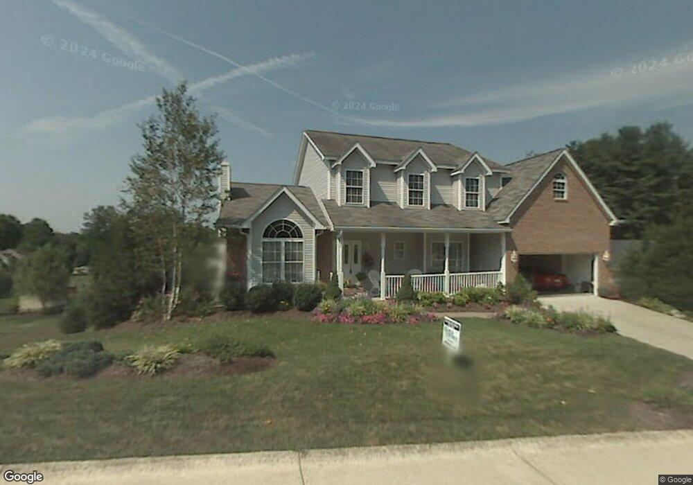
1212 Forest Dr Hurricane, WV 25526
Estimated Value: $489,338 - $527,000
5
Beds
4
Baths
3,848
Sq Ft
$132/Sq Ft
Est. Value
About This Home
This home is located at 1212 Forest Dr, Hurricane, WV 25526 and is currently estimated at $507,835, approximately $131 per square foot. 1212 Forest Dr is a home located in Putnam County with nearby schools including Calvary Baptist Academy.
Ownership History
Date
Name
Owned For
Owner Type
Purchase Details
Closed on
Oct 24, 2007
Sold by
Wilcox Daniel E and Wilcox Elaine M
Bought by
Barnett Stephen L and Barnett Beverly H
Current Estimated Value
Home Financials for this Owner
Home Financials are based on the most recent Mortgage that was taken out on this home.
Original Mortgage
$205,000
Outstanding Balance
$129,450
Interest Rate
6.43%
Mortgage Type
Purchase Money Mortgage
Estimated Equity
$378,385
Create a Home Valuation Report for This Property
The Home Valuation Report is an in-depth analysis detailing your home's value as well as a comparison with similar homes in the area
Home Values in the Area
Average Home Value in this Area
Purchase History
| Date | Buyer | Sale Price | Title Company |
|---|---|---|---|
| Barnett Stephen L | $305,000 | -- |
Source: Public Records
Mortgage History
| Date | Status | Borrower | Loan Amount |
|---|---|---|---|
| Open | Barnett Stephen L | $205,000 | |
| Closed | Barnett Stephen L | $100,000 |
Source: Public Records
Tax History Compared to Growth
Tax History
| Year | Tax Paid | Tax Assessment Tax Assessment Total Assessment is a certain percentage of the fair market value that is determined by local assessors to be the total taxable value of land and additions on the property. | Land | Improvement |
|---|---|---|---|---|
| 2024 | $3,793 | $222,840 | $38,640 | $184,200 |
| 2023 | $3,047 | $203,220 | $27,600 | $175,620 |
| 2022 | $3,139 | $200,520 | $27,600 | $172,920 |
| 2021 | $3,311 | $210,780 | $27,600 | $183,180 |
| 2020 | $3,268 | $208,260 | $27,600 | $180,660 |
| 2019 | $3,194 | $201,180 | $33,120 | $168,060 |
| 2018 | $3,192 | $200,640 | $34,620 | $166,020 |
| 2017 | $3,146 | $196,500 | $24,540 | $171,960 |
| 2016 | $2,998 | $186,480 | $24,540 | $161,940 |
| 2015 | $2,839 | $168,540 | $30,000 | $138,540 |
| 2014 | $2,839 | $175,620 | $29,460 | $146,160 |
Source: Public Records
Map
Nearby Homes
- 312 Lower Overlook Dr
- 110 John St
- 112 Mulberry Dr
- 106 Vista Ln
- 120 Sterling Dr
- 12 Meadow Brook
- 12 Meadow Brook Cir
- 8 Ellis Dr
- 401 Parkview Dr
- 1 Royal Oak Ct
- 539 Edgewood Rd
- 601 Ridgemont Rd
- 3 S Brook Dr
- 3715 Cambridge Dr
- 83 Gavin Ln
- 3570 Teays Valley Rd
- 1051 Crestmont Rd
- 3806 Kathy Dr
- 109 Caroline Cir
- 4052 Farmington Dr
- 212 Forrest Rd
- 1214 Forrest Dr
- 1210 Forrest Dr
- 1215 Forrest Dr
- 1221 Forrest Dr
- 1216 Forrest Dr
- 1217 Forrest Dr
- 1208 Forrest Dr
- 1219 Forrest Dr
- 1223 Forrest Dr
- 1213 Forrest Dr
- 1218 Forrest Dr
- 1225 Forrest Dr
- 1206 Forrest Dr
- 1211 Forrest Dr
- 1209 Forrest Dr
- 1207 Forrest Dr
- 1227 Forrest Dr
- 1220 Forrest Dr
- 1204 Forrest Dr