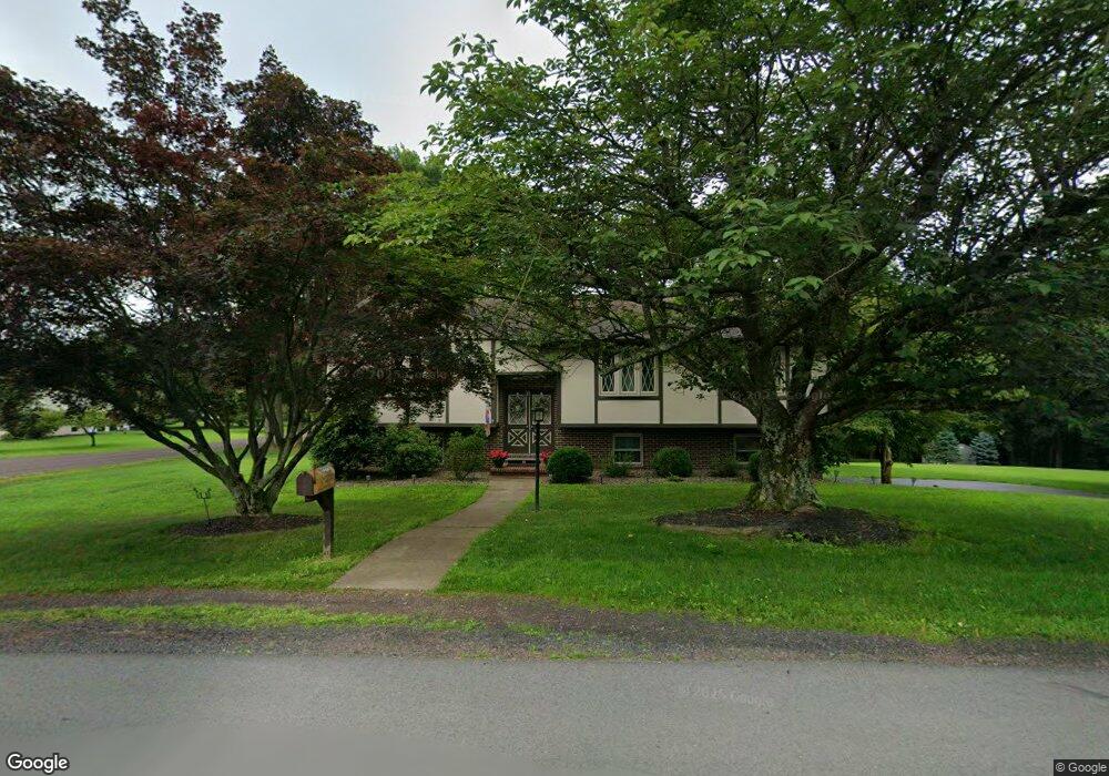
1212 Maple St Bloomsburg, PA 17815
Estimated Value: $300,705 - $392,000
--
Bed
--
Bath
2,280
Sq Ft
$158/Sq Ft
Est. Value
About This Home
This home is located at 1212 Maple St, Bloomsburg, PA 17815 and is currently estimated at $359,676, approximately $157 per square foot. 1212 Maple St is a home located in Columbia County with nearby schools including Central Columbia Elementary School, Central Columbia Middle School, and Central Columbia Senior High School.
Ownership History
Date
Name
Owned For
Owner Type
Purchase Details
Closed on
Jun 15, 2017
Sold by
Finn Joseph T and Finn Mary A
Bought by
Juliano Karen and Finn Joseph T
Current Estimated Value
Purchase Details
Closed on
Oct 27, 2011
Sold by
Seitz Dorothy and Pearl H Emery Revocable Living
Bought by
Finn Joseph T and Finn Mary A
Home Financials for this Owner
Home Financials are based on the most recent Mortgage that was taken out on this home.
Original Mortgage
$55,000
Interest Rate
5%
Mortgage Type
Adjustable Rate Mortgage/ARM
Create a Home Valuation Report for This Property
The Home Valuation Report is an in-depth analysis detailing your home's value as well as a comparison with similar homes in the area
Home Values in the Area
Average Home Value in this Area
Purchase History
| Date | Buyer | Sale Price | Title Company |
|---|---|---|---|
| Juliano Karen | -- | Attorney | |
| Finn Joseph T | $200,000 | None Available |
Source: Public Records
Mortgage History
| Date | Status | Borrower | Loan Amount |
|---|---|---|---|
| Previous Owner | Finn Joseph T | $55,000 |
Source: Public Records
Tax History Compared to Growth
Tax History
| Year | Tax Paid | Tax Assessment Tax Assessment Total Assessment is a certain percentage of the fair market value that is determined by local assessors to be the total taxable value of land and additions on the property. | Land | Improvement |
|---|---|---|---|---|
| 2025 | $4,353 | $62,559 | $0 | $0 |
| 2024 | $4,245 | $62,559 | $11,813 | $50,746 |
| 2023 | $4,058 | $62,559 | $11,813 | $50,746 |
| 2022 | $3,982 | $62,559 | $11,813 | $50,746 |
| 2021 | $3,948 | $62,559 | $11,813 | $50,746 |
| 2020 | $3,812 | $62,559 | $11,813 | $50,746 |
| 2019 | $3,734 | $62,559 | $11,813 | $50,746 |
| 2018 | $3,722 | $62,559 | $11,813 | $50,746 |
| 2017 | $4,265 | $62,559 | $11,813 | $50,746 |
| 2016 | -- | $62,559 | $11,813 | $50,746 |
| 2015 | -- | $62,559 | $11,813 | $50,746 |
| 2014 | -- | $62,559 | $11,813 | $50,746 |
Source: Public Records
Map
Nearby Homes
- 1219 Maple St
- 1238 Cherry St
- 575 Crestwood Dr
- 1246 Cherry St
- 1251 Chestnut St
- 1311 Sassafras St
- 1 Bittersweet Dr
- 925 Mcguire Rd
- 4 York Rd
- 829 Lightstreet Rd
- 712 Country Club Dr
- 34 Kara Ln
- 9 Crestmont Cir
- 601 Honeysuckle Ln
- 638 E 4th St
- 1032 Clifton Dr
- 9 Clifton Dr
- 200 Friar Ln
- 520 E 4th St
- 650652 Old Berwick Rd