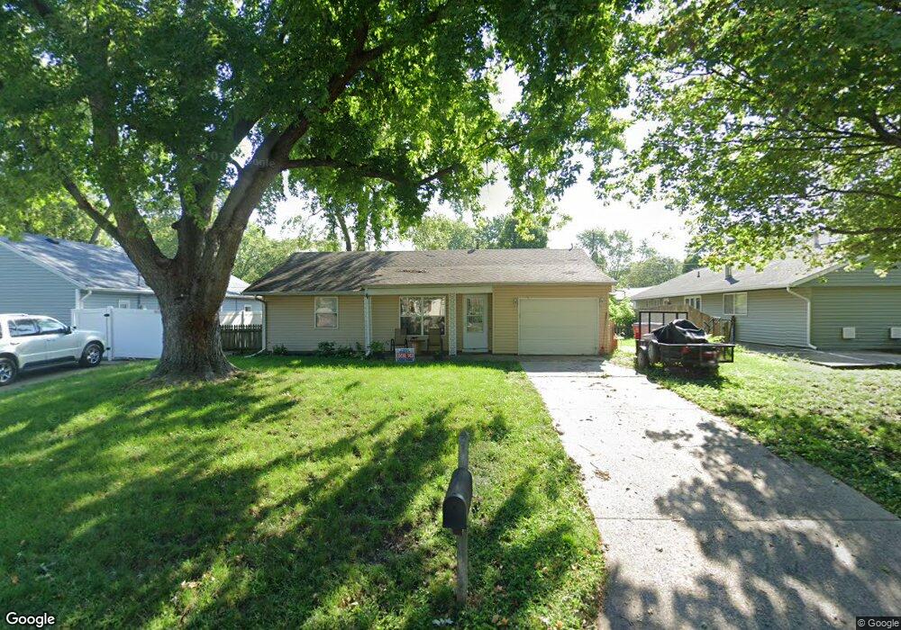
1212 Maplepark Dr Champaign, IL 61821
Estimated Value: $154,000 - $179,000
Studio
1
Bath
1,052
Sq Ft
$157/Sq Ft
Est. Value
About This Home
This home is located at 1212 Maplepark Dr, Champaign, IL 61821 and is currently estimated at $164,718, approximately $156 per square foot. 1212 Maplepark Dr is a home located in Champaign County with nearby schools including Centennial High School, Swann Special Care Center-Elem/Secondary School, and Countryside School.
Ownership History
Date
Name
Owned For
Owner Type
Purchase Details
Closed on
Jun 28, 2012
Sold by
Thorman Andrew M and Thorman Sarah E
Bought by
Chepan Douglas N and Chepan Beth L
Current Estimated Value
Purchase Details
Closed on
Aug 6, 2007
Sold by
Thorman Andrew M and Thorman Sarah E
Bought by
Thorman Andrew M and Thorman Sarah E
Purchase Details
Closed on
May 16, 2005
Sold by
Stiverson Anthony L and Stiverson Laura
Bought by
Thorman Andrew M and Young Sarah E
Home Financials for this Owner
Home Financials are based on the most recent Mortgage that was taken out on this home.
Original Mortgage
$86,925
Interest Rate
6.07%
Mortgage Type
Fannie Mae Freddie Mac
Create a Home Valuation Report for This Property
The Home Valuation Report is an in-depth analysis detailing your home's value as well as a comparison with similar homes in the area
Purchase History
| Date | Buyer | Sale Price | Title Company |
|---|---|---|---|
| Chepan Douglas N | $94,000 | None Available | |
| Thorman Andrew M | -- | None Available | |
| Thorman Andrew M | $91,500 | -- |
Source: Public Records
Mortgage History
| Date | Status | Borrower | Loan Amount |
|---|---|---|---|
| Previous Owner | Thorman Andrew M | $86,925 |
Source: Public Records
Tax History
| Year | Tax Paid | Tax Assessment Tax Assessment Total Assessment is a certain percentage of the fair market value that is determined by local assessors to be the total taxable value of land and additions on the property. | Land | Improvement |
|---|---|---|---|---|
| 2024 | $2,847 | $41,250 | $9,860 | $31,390 |
| 2023 | $2,847 | $37,570 | $8,980 | $28,590 |
| 2022 | $2,635 | $34,650 | $8,280 | $26,370 |
| 2021 | $2,561 | $33,970 | $8,120 | $25,850 |
| 2020 | $2,503 | $33,300 | $7,960 | $25,340 |
| 2019 | $2,412 | $32,620 | $7,800 | $24,820 |
| 2018 | $2,350 | $32,110 | $7,680 | $24,430 |
| 2017 | $2,359 | $32,110 | $7,680 | $24,430 |
| 2016 | $2,105 | $31,450 | $7,520 | $23,930 |
| 2015 | $2,113 | $30,900 | $7,390 | $23,510 |
| 2014 | $2,095 | $30,900 | $7,390 | $23,510 |
| 2013 | $2,076 | $30,900 | $7,390 | $23,510 |
Source: Public Records
Map
Nearby Homes
- 2812 Alton Dr
- 1208 S Duncan Rd
- 2705 Willowpark Dr
- 2703 Lawndale Dr
- 2704 W Kirby Ave
- 2612 W Kirby Ave
- 2605 Trafalgar Square
- 3120 Moraine Dr
- 1002 Goldenview Dr
- 2918 Sierra Dr Unit 2918
- 2504 Hathaway Dr
- 3102 W John St
- 618 Dogwood Dr
- 2401 Arden Dr
- 1608 Carolyn Dr
- 1818 Stratford Dr
- 3330 W William St
- 2016 Greendale Dr
- 3604 Thornhill Dr Unit 3604
- 2506 Brett Dr
- 2905 Alton Dr
- 2904 Sangamon Dr
- 2901 Alton Dr
- 2902 Sangamon Dr
- 1213 Maplepark Dr
- 2813 Alton Dr
- 2812 Sangamon Dr
- 1211 Maplepark Dr
- 1209 Maplepark Dr
- 2903 Sangamon Dr
- 2904 Alton Dr
- 2912 Sangamon Dr
- 2809 Alton Dr
- 2810 Sangamon Dr
- 2902 Alton Dr
- 2901 Sangamon Dr
- 1207 Maplepark Dr
- 1303 Maplepark Dr
- 1304 Maplepark Dr
- 1212 S Duncan Rd
Your Personal Tour Guide
Ask me questions while you tour the home.