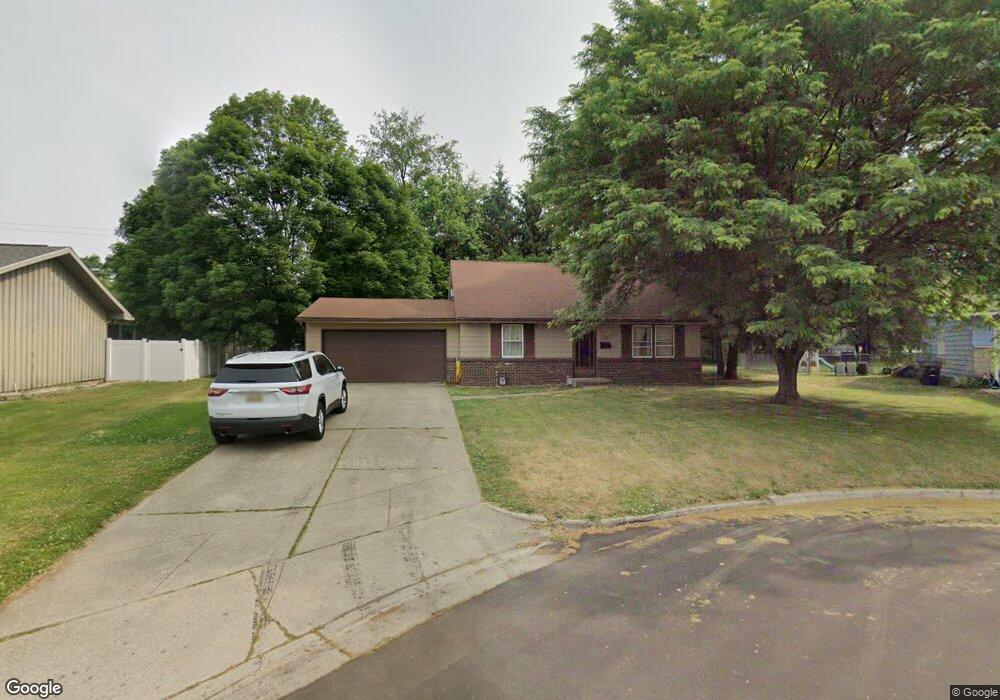
1212 Parkside Cir Sturgis, MI 49091
Estimated Value: $152,254 - $203,000
--
Bed
--
Bath
1,428
Sq Ft
$126/Sq Ft
Est. Value
About This Home
This home is located at 1212 Parkside Cir, Sturgis, MI 49091 and is currently estimated at $180,064, approximately $126 per square foot. 1212 Parkside Cir is a home located in St. Joseph County with nearby schools including Sturgis High School, Trinity Lutheran School, and Sturgis Christian School.
Ownership History
Date
Name
Owned For
Owner Type
Purchase Details
Closed on
Aug 11, 2017
Sold by
Century Bank & Trust
Bought by
Lowrey Timothy
Current Estimated Value
Home Financials for this Owner
Home Financials are based on the most recent Mortgage that was taken out on this home.
Original Mortgage
$95,353
Outstanding Balance
$79,565
Interest Rate
3.96%
Mortgage Type
New Conventional
Estimated Equity
$100,499
Purchase Details
Closed on
Jul 16, 2002
Sold by
Henry Uldeen Justice
Bought by
Justice Uldeen L-Trust
Purchase Details
Closed on
Jan 1, 1901
Create a Home Valuation Report for This Property
The Home Valuation Report is an in-depth analysis detailing your home's value as well as a comparison with similar homes in the area
Home Values in the Area
Average Home Value in this Area
Purchase History
| Date | Buyer | Sale Price | Title Company |
|---|---|---|---|
| Lowrey Timothy | $94,500 | Attorney | |
| Justice Uldeen L-Trust | -- | -- | |
| -- | -- | -- |
Source: Public Records
Mortgage History
| Date | Status | Borrower | Loan Amount |
|---|---|---|---|
| Open | Lowrey Timothy | $95,353 |
Source: Public Records
Tax History Compared to Growth
Tax History
| Year | Tax Paid | Tax Assessment Tax Assessment Total Assessment is a certain percentage of the fair market value that is determined by local assessors to be the total taxable value of land and additions on the property. | Land | Improvement |
|---|---|---|---|---|
| 2025 | $2,292 | $75,800 | $6,900 | $68,900 |
| 2024 | $1,885 | $71,200 | $6,900 | $64,300 |
| 2023 | $1,827 | $63,300 | $6,900 | $56,400 |
| 2022 | $1,682 | $54,200 | $6,400 | $47,800 |
| 2021 | $2,013 | $48,800 | $6,200 | $42,600 |
| 2020 | $1,988 | $44,300 | $5,300 | $39,000 |
| 2019 | $2,090 | $46,600 | $6,200 | $40,400 |
| 2018 | $2,089 | $49,900 | $6,400 | $43,500 |
| 2017 | $2,024 | $48,400 | $48,400 | $0 |
| 2016 | -- | $48,300 | $48,300 | $0 |
| 2015 | -- | $51,800 | $0 | $0 |
| 2014 | -- | $50,400 | $50,400 | $0 |
| 2012 | -- | $48,900 | $48,900 | $0 |
Source: Public Records
Map
Nearby Homes
- 1103 Walker St
- 300 Maplecrest Ave
- 219 S Lakeview St
- 0 Vl Farwell Ave
- 1218 Constitution Ave
- 505 Michigan Ave
- 607 Mechanic St
- 503 Michigan Ave
- 405 Michigan Ave
- 218 Michigan Ave
- 1105 Constitution Ave
- 302 E Electric Ct
- 1387 Flanders St
- 105 Jean St
- 605 E West St
- 1400 E Rishel Rd
- 69762 Eisenhower Rd
- 29050 Wilderness Trail
- 404 Susan Ave
- 405 Jean St
- 1216 Parkside Cir
- 1213 Walker St
- 1208 Parkside Cir
- 1219 Walker St
- 1207 Walker St
- 1202 Parkside Cir
- 1215 Parkside Cir
- 1211 Parkside Cir
- 68990 Farwell Ave
- 1207 Parkside Cir
- 602 Parkside Dr
- 68990 Farwell Ave
- 410 Pioneer St
- 704 Parkside Dr
- 405 Farwell Ave
- 409 Pioneer St
- 406 Farwell Ave
- 1212 Myrtle St
- 409 Pioneer Ave
- 601 Parkside Dr