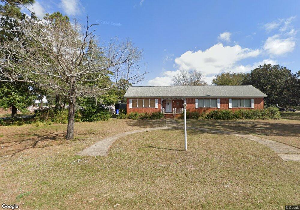
1212 Robin Rd Mount Pleasant, SC 29464
Rifle Range NeighborhoodEstimated Value: $687,000 - $1,021,000
3
Beds
2
Baths
2,486
Sq Ft
$364/Sq Ft
Est. Value
About This Home
This home is located at 1212 Robin Rd, Mount Pleasant, SC 29464 and is currently estimated at $905,171, approximately $364 per square foot. 1212 Robin Rd is a home located in Charleston County with nearby schools including Mamie Whitesides Elementary School, Moultrie Middle School, and Lucy Garrett Beckham High School.
Ownership History
Date
Name
Owned For
Owner Type
Purchase Details
Closed on
May 22, 2017
Sold by
Fitch Margaret Toler
Bought by
1212 Robin Road Llc
Current Estimated Value
Home Financials for this Owner
Home Financials are based on the most recent Mortgage that was taken out on this home.
Original Mortgage
$300,000
Outstanding Balance
$6,941
Interest Rate
4.1%
Mortgage Type
New Conventional
Estimated Equity
$898,230
Purchase Details
Closed on
May 16, 2011
Sold by
Toler Lillian W
Bought by
Toler Lillian W
Create a Home Valuation Report for This Property
The Home Valuation Report is an in-depth analysis detailing your home's value as well as a comparison with similar homes in the area
Home Values in the Area
Average Home Value in this Area
Purchase History
| Date | Buyer | Sale Price | Title Company |
|---|---|---|---|
| 1212 Robin Road Llc | $300,000 | None Available | |
| Toler Lillian W | -- | -- |
Source: Public Records
Mortgage History
| Date | Status | Borrower | Loan Amount |
|---|---|---|---|
| Open | 1212 Robin Road Llc | $300,000 |
Source: Public Records
Tax History
| Year | Tax Paid | Tax Assessment Tax Assessment Total Assessment is a certain percentage of the fair market value that is determined by local assessors to be the total taxable value of land and additions on the property. | Land | Improvement |
|---|---|---|---|---|
| 2024 | $5,961 | $20,700 | $0 | $0 |
| 2023 | $5,315 | $20,700 | $0 | $0 |
| 2022 | $4,865 | $20,700 | $0 | $0 |
| 2021 | $4,861 | $20,700 | $0 | $0 |
| 2020 | $4,803 | $20,700 | $0 | $0 |
| 2019 | $4,368 | $18,000 | $0 | $0 |
| 2017 | $4,738 | $20,380 | $0 | $0 |
| 2016 | $4,570 | $20,380 | $0 | $0 |
| 2015 | $4,351 | $20,380 | $0 | $0 |
| 2014 | $4,219 | $0 | $0 | $0 |
| 2011 | -- | $0 | $0 | $0 |
Source: Public Records
Map
Nearby Homes
- 1228 Melvin Bennett Rd
- 1226 Gannett Rd
- 1201 Gannett Rd
- 1213 Gannett Rd
- 1224 Decoy Ct
- 1032 Bowman Woods Dr
- 1166 N Shadow Dr
- 0 Chuck Dawley Blvd Unit 26005443
- 1307 Lake Mallard Blvd
- 1258 Llewellyn Rd
- 1300 Penshell Place
- 1246 Llewellyn Rd
- 890 Sea Gull Dr Unit 890
- 1134 S Shadow Dr
- 1279 Appling Dr
- 901 Sea Gull Dr Unit A&B
- 1150 Pleasant Pines St
- 1415 Oaklanding Rd
- 1141 Bonnie Ln
- 938 Sea Gull Dr
- 1308 Bluebird Dr
- 1004 Gannett Rd
- 1128 Melvin Bennett Rd
- 1234 Melvin Bennett Rd
- 1217 Robin Rd
- 1221 Robin Rd
- 1312 Bluebird Dr
- 1224 Melvin Bennett Rd
- 1230 Robin Rd
- 1227 Robin Rd
- 1211 Robin Rd
- 1232 Melvin Bennett Rd
- 1318 Bluebird Dr
- 1210 Gannett Rd
- 1233 Robin Rd
- 1313 Bluebird Dr
- 1214 Gannett Rd
- 1200 Gannett Rd
- 1218 Gannett Rd
- 1242 Robin Rd
Your Personal Tour Guide
Ask me questions while you tour the home.