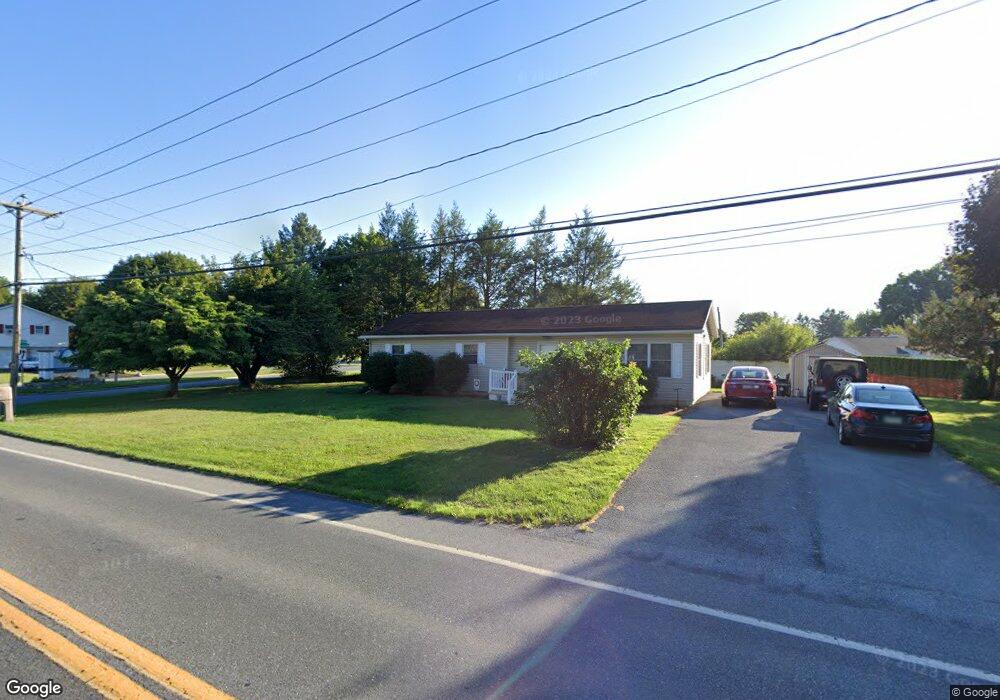
1212 S Forge Rd Palmyra, PA 17078
Estimated Value: $305,000 - $320,000
3
Beds
1
Bath
1,896
Sq Ft
$166/Sq Ft
Est. Value
About This Home
This home is located at 1212 S Forge Rd, Palmyra, PA 17078 and is currently estimated at $314,086, approximately $165 per square foot. 1212 S Forge Rd is a home located in Lebanon County with nearby schools including Palmyra Area Senior High School.
Ownership History
Date
Name
Owned For
Owner Type
Purchase Details
Closed on
Jan 31, 2007
Sold by
Bsw Holdings Pa
Bought by
Blazi Matthew P and Blazi Pamela M
Current Estimated Value
Home Financials for this Owner
Home Financials are based on the most recent Mortgage that was taken out on this home.
Original Mortgage
$177,000
Outstanding Balance
$106,015
Interest Rate
6.16%
Mortgage Type
New Conventional
Estimated Equity
$208,071
Purchase Details
Closed on
May 16, 2006
Sold by
Wells Fargo Bank Na
Bought by
Bsw Holdings
Home Financials for this Owner
Home Financials are based on the most recent Mortgage that was taken out on this home.
Original Mortgage
$92,000
Interest Rate
6.55%
Mortgage Type
Future Advance Clause Open End Mortgage
Purchase Details
Closed on
Oct 6, 2005
Sold by
Love Jacklyn E and Love Jajacklyn E
Bought by
Wells Fargo Bank
Create a Home Valuation Report for This Property
The Home Valuation Report is an in-depth analysis detailing your home's value as well as a comparison with similar homes in the area
Home Values in the Area
Average Home Value in this Area
Purchase History
| Date | Buyer | Sale Price | Title Company |
|---|---|---|---|
| Blazi Matthew P | $177,000 | None Available | |
| Bsw Holdings | $115,000 | None Available | |
| Wells Fargo Bank | $110,000 | None Available |
Source: Public Records
Mortgage History
| Date | Status | Borrower | Loan Amount |
|---|---|---|---|
| Open | Blazi Matthew P | $177,000 | |
| Previous Owner | Bsw Holdings | $92,000 |
Source: Public Records
Tax History Compared to Growth
Tax History
| Year | Tax Paid | Tax Assessment Tax Assessment Total Assessment is a certain percentage of the fair market value that is determined by local assessors to be the total taxable value of land and additions on the property. | Land | Improvement |
|---|---|---|---|---|
| 2025 | $3,853 | $156,900 | $36,400 | $120,500 |
| 2024 | $3,570 | $156,900 | $36,400 | $120,500 |
| 2023 | $3,570 | $156,900 | $36,400 | $120,500 |
| 2022 | $3,479 | $156,900 | $36,400 | $120,500 |
| 2021 | $3,287 | $156,900 | $36,400 | $120,500 |
| 2020 | $3,242 | $156,900 | $36,400 | $120,500 |
| 2019 | $3,179 | $156,900 | $36,400 | $120,500 |
| 2018 | $3,146 | $156,900 | $36,400 | $120,500 |
| 2017 | $833 | $156,900 | $36,400 | $120,500 |
| 2016 | $2,942 | $156,900 | $36,400 | $120,500 |
| 2015 | -- | $156,900 | $36,400 | $120,500 |
| 2014 | -- | $156,900 | $36,400 | $120,500 |
Source: Public Records
Map
Nearby Homes
- 1325 Mill Pond Way
- 1160 Park Dr
- 1027 S Green St
- 21 Saratoga Run L-0121 Run
- 11 Wickerberry Ln
- 18 Hartford Dr
- 22 Lexington Dr
- 925 E Oak St
- Sullivan Plan at Summer Layne
- Berkley Plan at Summer Layne
- Charlotte Plan at Summer Layne
- Hunter Plan at Summer Layne
- Westbrooke Plan at Summer Layne
- Kingston Plan at Summer Layne
- Darien Plan at Summer Layne
- Silverbrooke Plan at Summer Layne
- Huntington Plan at Summer Layne
- Amberbrook Plan at Summer Layne
- Wesley Plan at Summer Layne
- Stonecroft Plan at Summer Layne
- 1211 S Queen St
- 1220 S Forge Rd
- 1221 S Queen St
- 1223 S Forge Rd
- 1167 S Forge Rd
- 1231 S Queen St
- 1212 S Queen St
- 1162 S Forge Rd
- 1232 S Forge Rd
- 1222 S Queen St
- 705 Londonderry Blvd
- 1233 S Forge Rd
- 1241 S Queen St
- 716 Londonderry Blvd
- 1161 S Forge Rd
- 1232 S Queen St
- 1242 S Forge Rd
- 715 Londonderry Blvd
- 1243 S Forge Rd
- 1152 S Forge Rd