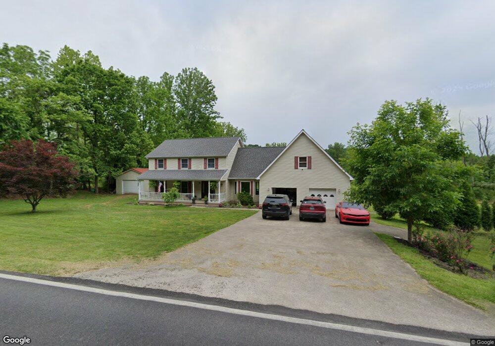
1212 State Highway 174 Olive Hill, KY 41164
Estimated Value: $252,000 - $372,000
--
Bed
--
Bath
4,480
Sq Ft
$66/Sq Ft
Est. Value
About This Home
This home is located at 1212 State Highway 174, Olive Hill, KY 41164 and is currently estimated at $297,871, approximately $66 per square foot. 1212 State Highway 174 is a home located in Carter County with nearby schools including Tygart Creek Elementary School, West Carter Middle School, and West Carter County High School.
Ownership History
Date
Name
Owned For
Owner Type
Purchase Details
Closed on
Oct 10, 2019
Sold by
Rawlins Jeremy C and Rawlins Megan L
Bought by
Wagoner Jason and Wagoner Amanda
Current Estimated Value
Home Financials for this Owner
Home Financials are based on the most recent Mortgage that was taken out on this home.
Original Mortgage
$50,000
Outstanding Balance
$43,980
Interest Rate
3.7%
Mortgage Type
Future Advance Clause Open End Mortgage
Estimated Equity
$253,891
Purchase Details
Closed on
Feb 26, 2014
Sold by
Burns William
Bought by
Rawlins Jeremy C and Rawlins Megan L
Home Financials for this Owner
Home Financials are based on the most recent Mortgage that was taken out on this home.
Original Mortgage
$184,000
Interest Rate
4.43%
Mortgage Type
New Conventional
Create a Home Valuation Report for This Property
The Home Valuation Report is an in-depth analysis detailing your home's value as well as a comparison with similar homes in the area
Home Values in the Area
Average Home Value in this Area
Purchase History
| Date | Buyer | Sale Price | Title Company |
|---|---|---|---|
| Wagoner Jason | $191,000 | Accurate Equity Group | |
| Rawlins Jeremy C | $230,000 | None Available |
Source: Public Records
Mortgage History
| Date | Status | Borrower | Loan Amount |
|---|---|---|---|
| Open | Wagoner Jason | $50,000 | |
| Previous Owner | Rawlins Jeremy C | $184,000 |
Source: Public Records
Tax History Compared to Growth
Tax History
| Year | Tax Paid | Tax Assessment Tax Assessment Total Assessment is a certain percentage of the fair market value that is determined by local assessors to be the total taxable value of land and additions on the property. | Land | Improvement |
|---|---|---|---|---|
| 2024 | $1,733 | $202,000 | $0 | $0 |
| 2023 | $1,646 | $191,000 | $0 | $0 |
| 2022 | $1,652 | $191,000 | $0 | $0 |
| 2021 | $1,685 | $191,000 | $0 | $0 |
| 2020 | $1,689 | $191,000 | $10,000 | $181,000 |
| 2019 | $2,028 | $230,000 | $10,000 | $220,000 |
| 2018 | $2,029 | $230,000 | $10,000 | $220,000 |
| 2017 | $1,936 | $230,000 | $10,000 | $220,000 |
| 2016 | $1,932 | $230,000 | $10,000 | $220,000 |
| 2015 | $1,886 | $230,000 | $30,000 | $200,000 |
| 2014 | $820 | $100,000 | $5,000 | $95,000 |
| 2011 | $806 | $100,000 | $5,000 | $95,000 |
Source: Public Records
Map
Nearby Homes
- 110 Clark Hill Ave
- 000 Tick Ridge Rd
- 655 Mason Cir
- 411 Webb St
- 202 Cable Powers Dr
- 500 &538 Waterside
- 335 Hillside St
- 3342 State Highway 174
- 6698 Kentucky 2
- 5190 Kentucky 2
- 461 Hillman Hollow Rd
- 425 Parker Memorial Dr
- 126 Mills St
- 133 Olive St
- 178 Mills Branch
- 0 Craig St
- 451 Irwin Rd
- 58 Mckenzie Ln
- 208 Strawberry Ln
- 188 Strawberry Ln
- 1261 State Highway 174
- 1219 State Highway 174
- 1133 State Highway 174
- 1127 State Highway 174
- 1719 Tick Ridge Rd
- 1719 Tick Ridge
- 1235 State Highway 174
- 1235 Kentucky 174
- 1499 State Highway 174
- 1355 Tick Ridge
- 83 Bands Loop
- 168 Dogwood Hollow
- 97 Bands Loop
- 610 Tick Ridge Fork
- 202 Bands Loop
- 1390 Tick Ridge
- 746 Tick Ridge Fork
- 1316 Tick Ridge
- 397 State Highway 174
- 211 Bands Loop