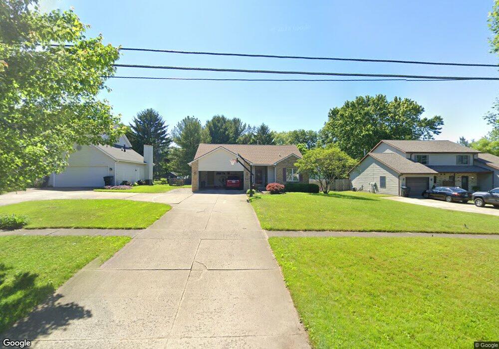
1212 State Rd Wadsworth, OH 44281
Estimated Value: $159,000 - $349,000
3
Beds
2
Baths
1,444
Sq Ft
$180/Sq Ft
Est. Value
About This Home
This home is located at 1212 State Rd, Wadsworth, OH 44281 and is currently estimated at $259,748, approximately $179 per square foot. 1212 State Rd is a home located in Medina County with nearby schools including Valley View Elementary School, Central Intermediate School, and Wadsworth Middle School.
Ownership History
Date
Name
Owned For
Owner Type
Purchase Details
Closed on
Dec 3, 2021
Sold by
Stubbendieck Kent and Stubbendieck Marcia
Bought by
Matheny Christopher J and Matheny Michele J
Current Estimated Value
Purchase Details
Closed on
Jun 10, 2016
Sold by
Matheny David A and Pollarine Matheny Wendy E
Bought by
Stubbendieck Kent and Stubbendieck Marcia
Purchase Details
Closed on
Apr 4, 2003
Sold by
Sharon Land Developers Ltd
Bought by
Matheny David A
Home Financials for this Owner
Home Financials are based on the most recent Mortgage that was taken out on this home.
Original Mortgage
$129,600
Interest Rate
5.94%
Mortgage Type
Purchase Money Mortgage
Create a Home Valuation Report for This Property
The Home Valuation Report is an in-depth analysis detailing your home's value as well as a comparison with similar homes in the area
Home Values in the Area
Average Home Value in this Area
Purchase History
| Date | Buyer | Sale Price | Title Company |
|---|---|---|---|
| Matheny Christopher J | $122,100 | None Available | |
| Stubbendieck Kent | $152,500 | Ohio Title Corp | |
| Matheny David A | $145,800 | -- |
Source: Public Records
Mortgage History
| Date | Status | Borrower | Loan Amount |
|---|---|---|---|
| Previous Owner | Matheny David A | $129,600 | |
| Closed | Matheny David A | $16,200 | |
| Closed | Matheny Christopher J | $0 |
Source: Public Records
Tax History
| Year | Tax Paid | Tax Assessment Tax Assessment Total Assessment is a certain percentage of the fair market value that is determined by local assessors to be the total taxable value of land and additions on the property. | Land | Improvement |
|---|---|---|---|---|
| 2024 | $3,188 | $69,560 | $21,880 | $47,680 |
| 2023 | $3,054 | $69,560 | $21,880 | $47,680 |
| 2022 | $3,064 | $69,560 | $21,880 | $47,680 |
| 2021 | $2,958 | $55,650 | $17,500 | $38,150 |
| 2020 | $2,549 | $55,650 | $17,500 | $38,150 |
| 2019 | $2,553 | $55,650 | $17,500 | $38,150 |
| 2018 | $2,737 | $55,970 | $19,760 | $36,210 |
| 2017 | $2,738 | $55,970 | $19,760 | $36,210 |
| 2016 | $2,783 | $55,970 | $19,760 | $36,210 |
| 2015 | $2,689 | $51,350 | $18,130 | $33,220 |
| 2014 | $2,733 | $51,350 | $18,130 | $33,220 |
| 2013 | $2,737 | $51,350 | $18,130 | $33,220 |
Source: Public Records
Map
Nearby Homes
- 137 Stauffer Dr
- 1482 Barrymore Ln
- 190 Deepwood Dr
- 4896 Ridge Rd
- 1411 Tullamore Trail
- 1138 Ledgestone Dr
- 330 Deepwood Dr
- 346 Deepwood Dr
- 976 Rosemarie Cir Unit 68
- 1662 Cobham Ln
- 7565 John Arthur Ln
- 7553 John Arthur Ln
- 1045 Ashley Taylor Ct Unit 14
- 1250 Reserve Blvd
- 290 Park Place Dr Unit 72
- 681 Highland Ave
- 1166 Reserve Blvd
- 236 Knollwood Dr
- V/L Hartman Rd
- 579 West St
- 1204 State Rd
- 1220 State Rd Unit 1222
- 1228 State Rd
- 1212 Laila Ln
- 1204 Laila Ln
- 1216 Laila Ln
- 1175 Reimer Rd
- 1200 Laila Ln
- 127 Stauffer Dr Unit 129
- 1224 Laila Ln
- 1238 State Rd
- 1209 Laila Ln
- 1215 Laila Ln
- 1197 High St Unit 108
- 1197 High St Unit 106
- 1219 Laila Ln
- 145 Stauffer Dr
- 139 Peace Ln
- 142 Cornerstone Dr
- 143 Peace Ln
Your Personal Tour Guide
Ask me questions while you tour the home.