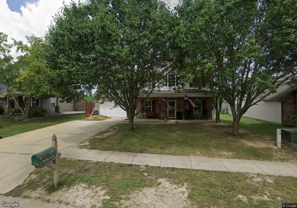
1212 Stellar Dr Franklin, IN 46131
Estimated Value: $340,817 - $370,000
About This Home
This home is located at 1212 Stellar Dr, Franklin, IN 46131 and is currently estimated at $354,704, approximately $146 per square foot. 1212 Stellar Dr is a home located in Johnson County with nearby schools including Creekside Elementary School, Franklin Community Middle School, and Custer Baker Intermediate School.
Ownership History
We collect this data history from publicly available records. To have your information removed, we recommend requesting removal directly through your county’s website.
Purchase Details
Home Financials for this Owner
Home Financials are based on the most recent Mortgage that was taken out on this home.Purchase Details
Home Financials for this Owner
Home Financials are based on the most recent Mortgage that was taken out on this home.Purchase Details
Home Values in the Area
Average Home Value in this Area
Purchase History
We collect this data history from publicly available records. To have your information removed, we recommend requesting removal directly through your county’s website.
| Date | Buyer | Sale Price | Title Company |
|---|---|---|---|
| -- | None Available | ||
| -- | None Available | ||
| -- | None Available |
Mortgage History
We collect this data history from publicly available records. To have your information removed, we recommend requesting removal directly through your county’s website.
| Date | Status | Borrower | Loan Amount |
|---|---|---|---|
| Open | $182,395 | ||
| Previous Owner | $141,964 |
Tax History
We collect this data history from publicly available records. To have your information removed, we recommend requesting removal directly through your county’s website.
| Year | Tax Paid | Tax Assessment Tax Assessment Total Assessment is a certain percentage of the fair market value that is determined by local assessors to be the total taxable value of land and additions on the property. | Land | Improvement |
|---|---|---|---|---|
| 2025 | $3,278 | $320,200 | $28,800 | $291,400 |
| 2024 | $3,282 | $295,400 | $28,800 | $266,600 |
| 2023 | $2,945 | $265,200 | $28,800 | $236,400 |
| 2022 | $2,850 | $254,400 | $28,800 | $225,600 |
| 2021 | $2,579 | $230,800 | $28,800 | $202,000 |
| 2020 | $2,605 | $233,100 | $28,800 | $204,300 |
| 2019 | $2,583 | $231,200 | $27,700 | $203,500 |
| 2018 | $2,118 | $214,300 | $27,700 | $186,600 |
| 2017 | $2,092 | $209,200 | $27,700 | $181,500 |
| 2016 | $1,810 | $196,800 | $27,700 | $169,100 |
| 2014 | $1,806 | $180,600 | $21,100 | $159,500 |
| 2013 | $1,806 | $179,100 | $21,100 | $158,000 |
Map
- 1117 Foxtail Dr
- 893 Sagittarius Ave
- 923 Aurora Ln
- 986 Youngs Creek Dr
- 910 Borealis Dr
- 1216 Pegasus Dr
- 928 Borealis Dr
- 1261 Pegasus Dr
- 872 Franklin Lakes Blvd
- 725 Lake Shore Rd
- 1058 Creekwood Ln
- 434 Driftwood Ct
- 884 Capricorn Dr
- 783 N Shore Blvd
- 942 Ram Dr
- 1004 Wild Ivy Trail
- 808 S Nineveh Rd
- 6516 N U S Highway 31
- 925 Mallory Pkwy
- 492 Pelenor Dr
- 1211 Stellar Dr
- 1207 Stellar Dr
- 1215 Stellar Dr
- 1219 Stellar Dr
- 1114 Foxtail Dr
- 880 Sagittarius Ave
- 884 Sagittarius Ave
- 1110 Foxtail Dr
- 1216 Stellar Dr
- 888 Sagittarius Ave
- 1208 Stellar Dr
- 1204 Stellar Dr
- 1118 Foxtail Dr
- 1220 Stellar Dr
- 892 Sagittarius Ave
- 1125 Foxtail Dr
- 896 Sagittarius Ave
- 1200 Stellar Dr
- 1121 Foxtail Dr
- 1191 Stellar Dr
Ask me questions while you tour the home.