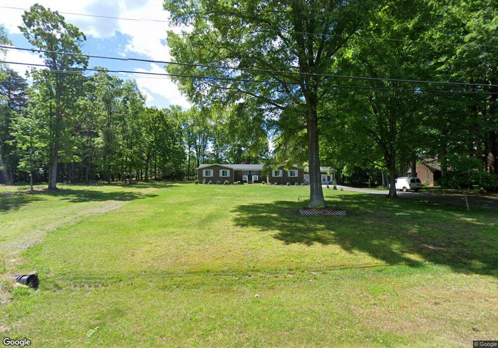
1212 Tangle Ln High Point, NC 27265
Hickswood NeighborhoodEstimated Value: $332,000 - $344,511
5
Beds
2
Baths
2,720
Sq Ft
$125/Sq Ft
Est. Value
About This Home
This home is located at 1212 Tangle Ln, High Point, NC 27265 and is currently estimated at $340,378, approximately $125 per square foot. 1212 Tangle Ln is a home located in Guilford County with nearby schools including Florence Elementary School, Welborn Academy of Science & Technology, and T.W. Andrews High School.
Ownership History
Date
Name
Owned For
Owner Type
Purchase Details
Closed on
Aug 24, 2023
Sold by
Beulah Green Living Trust and Green Beulah
Bought by
Green John E and Green Beulah
Current Estimated Value
Purchase Details
Closed on
Jun 11, 2019
Sold by
Green John and Green Beulah
Bought by
Green Beulah and Green John E
Purchase Details
Closed on
Apr 1, 2014
Sold by
Haizlip Jacquelyn L
Bought by
Green John and Green Beulah
Home Financials for this Owner
Home Financials are based on the most recent Mortgage that was taken out on this home.
Original Mortgage
$28,000
Interest Rate
4.43%
Mortgage Type
Purchase Money Mortgage
Purchase Details
Closed on
Feb 12, 2013
Sold by
Clarbrook Manggement Inc
Bought by
Gomez Oved and Lazcano Sunen
Create a Home Valuation Report for This Property
The Home Valuation Report is an in-depth analysis detailing your home's value as well as a comparison with similar homes in the area
Home Values in the Area
Average Home Value in this Area
Purchase History
| Date | Buyer | Sale Price | Title Company |
|---|---|---|---|
| Green John E | -- | None Listed On Document | |
| Green John E | -- | None Listed On Document | |
| Green Beulah | -- | None Available | |
| Green John | $29,500 | None Available | |
| Gomez Oved | -- | None Available |
Source: Public Records
Mortgage History
| Date | Status | Borrower | Loan Amount |
|---|---|---|---|
| Previous Owner | Green John | $28,000 |
Source: Public Records
Tax History
| Year | Tax Paid | Tax Assessment Tax Assessment Total Assessment is a certain percentage of the fair market value that is determined by local assessors to be the total taxable value of land and additions on the property. | Land | Improvement |
|---|---|---|---|---|
| 2025 | $1,649 | $192,900 | $45,000 | $147,900 |
| 2024 | $1,649 | $192,900 | $45,000 | $147,900 |
| 2023 | $1,649 | $192,900 | $45,000 | $147,900 |
| 2022 | $1,649 | $192,900 | $45,000 | $147,900 |
| 2021 | $1,515 | $177,300 | $45,000 | $132,300 |
| 2020 | $1,462 | $177,300 | $45,000 | $132,300 |
| 2019 | $1,091 | $177,300 | $0 | $0 |
| 2018 | $1,455 | $177,300 | $0 | $0 |
| 2017 | $1,462 | $177,300 | $0 | $0 |
| 2016 | $1,368 | $161,100 | $0 | $0 |
| 2015 | $1,376 | $161,100 | $0 | $0 |
| 2014 | $1,392 | $161,100 | $0 | $0 |
Source: Public Records
Map
Nearby Homes
- 1217 Lakeview Heights Dr
- 2606 Wexford Place
- 2674 Splitbrooke Dr
- 2706 Edenridge Dr
- 2922 Hearthstone Point Dr
- 2700 Edenridge Dr
- 3920 Cloverwood Meadow Ln
- 3946 Cobblestone Bend Dr
- 3650 Sunset Hollow Dr
- 3973 Cobblestone Bend Dr
- 113 Red Plum Ln
- 423 Dogwood Cir
- 3630 Sunset Hollow Dr
- 3534 Running Cedar Trail
- 3871 Eagleston Ct
- 1650 Penny Rd
- 3464 Basalt Ct
- 3724 Spanish Peak Dr Unit 2B
- 2511 Copperleaf Ct
- 3518 Pebblestone Ln
- 1210 Tangle Ln
- 3919 Stafford Run Ct
- 3923 Stafford Run Ct
- 3915 Stafford Run Ct
- 3927 Stafford Run Ct
- 3911 Stafford Run Ct
- 3933 Stafford Run Ct
- 3907 Stafford Run Ct
- 1215 Tangle Ln
- 1211 Tangle Ln
- 3903 Stafford Run Ct
- 3937 Stafford Run Ct
- 3867 Stafford Run Ct
- 1204 Tangle Ln
- 1216 Tangle Ln
- 3863 Stafford Run Ct
- 3922 Stafford Run Ct
- 3926 Stafford Run Ct
- 3945 Stafford Run Ct
- 3910 Stafford Run Ct
Your Personal Tour Guide
Ask me questions while you tour the home.