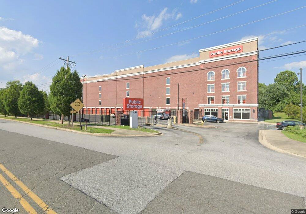
12120 Pierce Rd Waldorf, MD 20601
Estimated Value: $45,830,984
--
Bed
--
Bath
132,745
Sq Ft
$345/Sq Ft
Est. Value
About This Home
This home is located at 12120 Pierce Rd, Waldorf, MD 20601 and is currently estimated at $45,830,984, approximately $345 per square foot. 12120 Pierce Rd is a home located in Charles County with nearby schools including C. Paul Barnhart Elementary School, Mattawoman Middle School, and Thomas Stone High School.
Ownership History
Date
Name
Owned For
Owner Type
Purchase Details
Closed on
Apr 28, 2021
Sold by
Waldorf Land Lllp
Bought by
Ps Atlantic Coast 2021 B Llc
Current Estimated Value
Purchase Details
Closed on
Feb 21, 2013
Sold by
Waldorf Land Lllp
Bought by
County Commisioners Of Charles County
Purchase Details
Closed on
Aug 14, 2006
Sold by
Waldorf Shopping Mall Inc
Bought by
Waldorf Land Lllp
Purchase Details
Closed on
Aug 10, 2006
Sold by
Waldorf Shopping Mall Inc
Bought by
Waldorf Land Lllp and C/O Siena Corporation
Create a Home Valuation Report for This Property
The Home Valuation Report is an in-depth analysis detailing your home's value as well as a comparison with similar homes in the area
Home Values in the Area
Average Home Value in this Area
Purchase History
| Date | Buyer | Sale Price | Title Company |
|---|---|---|---|
| Ps Atlantic Coast 2021 B Llc | $38,755,557 | First Amer Ttl Ins Co Ncs | |
| County Commisioners Of Charles County | $341,050 | Title Professionals Ltd | |
| Waldorf Land Lllp | $860,000 | -- | |
| Waldorf Land Lllp | $860,000 | -- |
Source: Public Records
Tax History Compared to Growth
Tax History
| Year | Tax Paid | Tax Assessment Tax Assessment Total Assessment is a certain percentage of the fair market value that is determined by local assessors to be the total taxable value of land and additions on the property. | Land | Improvement |
|---|---|---|---|---|
| 2025 | -- | $17,966,600 | -- | -- |
| 2024 | $230,443 | $17,473,100 | $913,400 | $16,559,700 |
| 2023 | $212,450 | $14,867,067 | $0 | $0 |
| 2022 | $165,899 | $12,576,433 | $0 | $0 |
| 2021 | $127,401 | $9,655,000 | $913,400 | $8,741,600 |
| 2020 | $118,110 | $8,951,733 | $0 | $0 |
| 2019 | $108,851 | $8,248,467 | $0 | $0 |
| 2018 | $99,370 | $7,545,200 | $913,400 | $6,631,800 |
| 2017 | $93,789 | $7,325,467 | $0 | $0 |
| 2016 | -- | $7,105,733 | $0 | $0 |
| 2015 | $82,728 | $6,886,000 | $0 | $0 |
| 2014 | $82,728 | $6,886,000 | $0 | $0 |
Source: Public Records
Map
Nearby Homes
- 12061 Pierce Rd
- 12276 Wendy Ln
- 12288 Wendy Ln
- 2002 English Oak Ct
- 2204 Holly Oak Ct
- 12113 Farrar Place
- 2031 Tanglewood Dr
- 12820 Twin Oak Dr
- 12720 Bar Oak Dr
- 2073 Tanglewood Dr
- 1525 Pin Oak Dr
- 2545 Enterprise Place
- 12606 Sub Station Rd
- 1610 Pin Oak Dr
- 2552 Fernwood Ct
- 11748 Torcello Ct
- 2290 Mattawoman Beantown Rd
- HAYDEN Plan at Acton Park
- 2522 Regal Place
- 11565 Timberbrook Dr
- 2285 Crain Hwy
- 2295 Crain Hwy
- 2242 Delight Ct
- 12084 Pierce Rd
- 2238 Delight Ct
- 2246 Delight Ct
- 2234 Delight Ct
- 12085 Pierce Rd
- 12220 Gillespie Cir
- 12081 Pierce Rd
- 2230 Delight Ct
- 12078 Pierce Rd
- 2355 Crain Hwy
- 2247 Delight Ct
- 2243 Delight Ct
- 2255 Crain Hwy Unit 102
- 2255 Crain Hwy Unit 107 AND 207
- 2255 Crain Hwy Unit 107
- 2255 Crain Hwy Unit 207
- 2255 Crain Hwy Unit 104