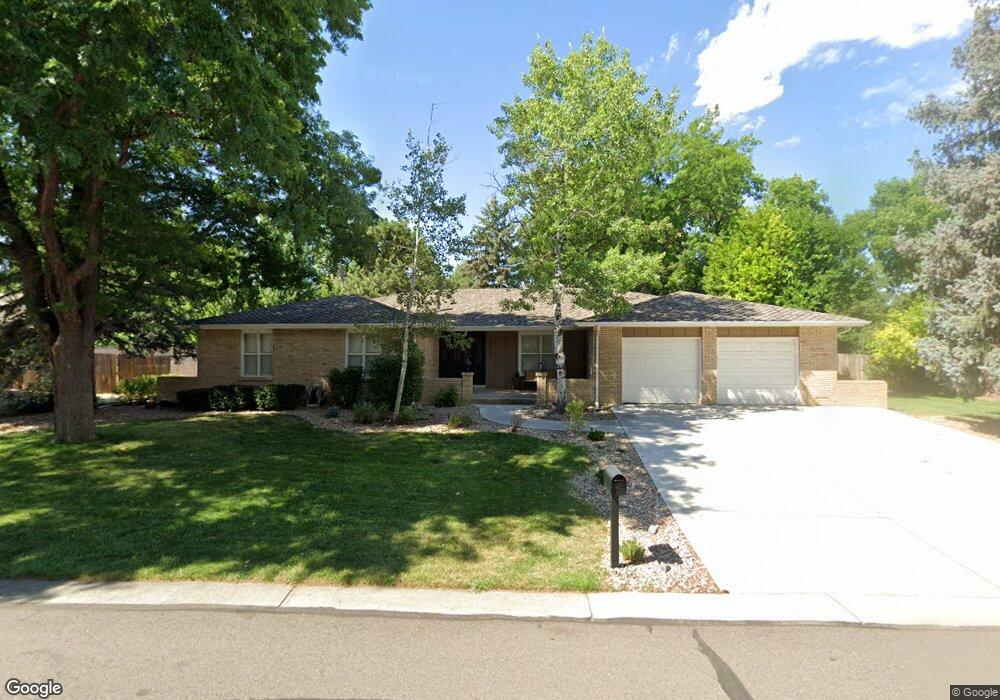
12120 W 54th Ave Arvada, CO 80002
Rainbow Ridge NeighborhoodEstimated Value: $782,000 - $950,000
5
Beds
7
Baths
2,024
Sq Ft
$435/Sq Ft
Est. Value
About This Home
This home is located at 12120 W 54th Ave, Arvada, CO 80002 and is currently estimated at $881,065, approximately $435 per square foot. 12120 W 54th Ave is a home located in Jefferson County with nearby schools including Vanderhoof Elementary School, Drake Junior High School, and Arvada West High School.
Ownership History
Date
Name
Owned For
Owner Type
Purchase Details
Closed on
Aug 25, 2020
Sold by
Miller Greg and Miller Teresa
Bought by
Miller Gregory and Miller Teresa
Current Estimated Value
Home Financials for this Owner
Home Financials are based on the most recent Mortgage that was taken out on this home.
Original Mortgage
$365,000
Outstanding Balance
$261,040
Interest Rate
3%
Mortgage Type
New Conventional
Estimated Equity
$620,025
Purchase Details
Closed on
Oct 12, 2018
Sold by
Clain Carol
Bought by
Miller Greg and Miller Teresa
Home Financials for this Owner
Home Financials are based on the most recent Mortgage that was taken out on this home.
Original Mortgage
$483,750
Interest Rate
3.75%
Mortgage Type
Adjustable Rate Mortgage/ARM
Create a Home Valuation Report for This Property
The Home Valuation Report is an in-depth analysis detailing your home's value as well as a comparison with similar homes in the area
Home Values in the Area
Average Home Value in this Area
Purchase History
| Date | Buyer | Sale Price | Title Company |
|---|---|---|---|
| Miller Gregory | -- | Canyon Title | |
| Miller Greg | $537,500 | Assured Title Agency |
Source: Public Records
Mortgage History
| Date | Status | Borrower | Loan Amount |
|---|---|---|---|
| Open | Miller Gregory | $365,000 | |
| Closed | Miller Greg | $483,750 |
Source: Public Records
Tax History Compared to Growth
Tax History
| Year | Tax Paid | Tax Assessment Tax Assessment Total Assessment is a certain percentage of the fair market value that is determined by local assessors to be the total taxable value of land and additions on the property. | Land | Improvement |
|---|---|---|---|---|
| 2024 | $5,088 | $53,937 | $26,515 | $27,422 |
| 2023 | $5,088 | $53,937 | $26,515 | $27,422 |
| 2022 | $4,389 | $46,086 | $19,274 | $26,812 |
| 2021 | $4,459 | $47,413 | $19,829 | $27,584 |
| 2020 | $3,577 | $38,075 | $15,611 | $22,464 |
| 2019 | $3,529 | $38,075 | $15,611 | $22,464 |
| 2018 | $2,997 | $38,649 | $11,600 | $27,049 |
| 2017 | $2,738 | $38,649 | $11,600 | $27,049 |
| 2016 | $2,500 | $34,871 | $10,943 | $23,928 |
| 2015 | $1,854 | $34,871 | $10,943 | $23,928 |
| 2014 | $1,854 | $26,746 | $9,353 | $17,393 |
Source: Public Records
Map
Nearby Homes
- 11873 W 56th Cir
- 5555 Ward Rd
- 5173 Vivian St
- 5154 Taft Ct
- 5188 Ward Rd
- 5160 Ward Rd
- 5738 Urban Center
- 5738 Vivian St
- 12320 W 51st Ave
- 11958 W 57th Place
- 5240 Routt Ct Unit B
- 12284 W 57th Ln
- 11944 W 57th Dr
- 11924 W 57th Dr
- The SIXTEEN Plan at Sabell - Townhomes
- The NINETEEN Plan at Sabell - Townhomes
- 5779 Taft St
- Haskins Station Plan at Haskins Station
- Plan 133 at Haskins Station
- Plan 132 at Haskins Station
- 5436 Vivian Cir
- 12278 W 54th Dr
- 5395 Union Way
- 12288 W 54th Dr
- 12121 W 54th Ave
- 5426 Vivian Cir
- 5385 Union Way
- 12101 W 54th Ave
- 12114 W 54th Dr
- 5425 Vivian Cir
- 5390 Union Way
- 12285 W 54th Dr
- 5375 Union Way
- 12275 W 54th Dr
- 12167 W 54th Dr
- 12295 W 54th Dr
- 5445 Vivian Cir
- 5435 Vivian Cir
- 12081 W 54th Ave
- 12084 W 54th Dr