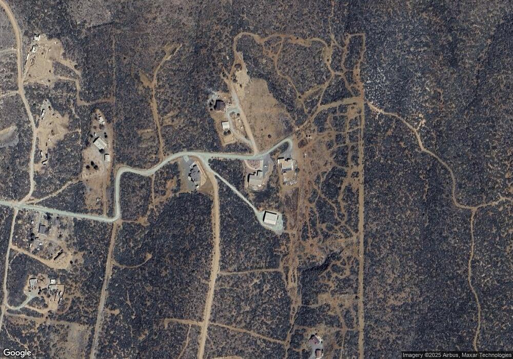
12121 E Remuda Ln Mayer, AZ 86333
Mayer NeighborhoodEstimated Value: $748,000 - $1,095,557
5
Beds
5
Baths
6,693
Sq Ft
$146/Sq Ft
Est. Value
About This Home
This home is located at 12121 E Remuda Ln, Mayer, AZ 86333 and is currently estimated at $976,389, approximately $145 per square foot. 12121 E Remuda Ln is a home located in Yavapai County with nearby schools including Mayer Elementary School and Mayer High School.
Ownership History
Date
Name
Owned For
Owner Type
Purchase Details
Closed on
Jun 11, 2025
Sold by
Roskopf Greg A and Roskopf Mary H
Bought by
Greg And Mary Roskopf Family Trust and Roskopf
Current Estimated Value
Purchase Details
Closed on
Oct 20, 2015
Sold by
Grim Gary and Grim Cathy
Bought by
Roskopf Greg and Roskopf Mary
Home Financials for this Owner
Home Financials are based on the most recent Mortgage that was taken out on this home.
Original Mortgage
$250,000
Interest Rate
3.81%
Mortgage Type
Seller Take Back
Create a Home Valuation Report for This Property
The Home Valuation Report is an in-depth analysis detailing your home's value as well as a comparison with similar homes in the area
Home Values in the Area
Average Home Value in this Area
Purchase History
| Date | Buyer | Sale Price | Title Company |
|---|---|---|---|
| Greg And Mary Roskopf Family Trust | -- | None Listed On Document | |
| Roskopf Greg | $250,000 | Dhi Title Arrowhead |
Source: Public Records
Mortgage History
| Date | Status | Borrower | Loan Amount |
|---|---|---|---|
| Previous Owner | Roskopf Greg | $250,000 |
Source: Public Records
Tax History
| Year | Tax Paid | Tax Assessment Tax Assessment Total Assessment is a certain percentage of the fair market value that is determined by local assessors to be the total taxable value of land and additions on the property. | Land | Improvement |
|---|---|---|---|---|
| 2026 | $5,033 | $107,054 | -- | -- |
| 2024 | $4,989 | $114,378 | -- | -- |
| 2023 | $4,989 | $71,263 | $3,675 | $67,588 |
| 2022 | $4,843 | $59,069 | $2,866 | $56,203 |
| 2021 | $5,009 | $57,204 | $2,449 | $54,755 |
| 2020 | $4,819 | $0 | $0 | $0 |
| 2019 | $4,773 | $0 | $0 | $0 |
| 2018 | $2,738 | $0 | $0 | $0 |
| 2017 | $2,662 | $0 | $0 | $0 |
| 2016 | $2,542 | $0 | $0 | $0 |
| 2015 | -- | $0 | $0 | $0 |
| 2014 | -- | $0 | $0 | $0 |
Source: Public Records
Map
Nearby Homes
- 6308 S Wolf Pack Trail Unit 500-09-149B
- 0 Thoroughbred Branding Iron Unit 1037684
- 6117 S Country Rd
- 12055 E Branding Iron Way
- 11100 E Meadow Dr
- 7925 S Lone Spruce Dr
- 10410 E Vaca Bonita Trail
- 10450 E Vaca Bonita Trail
- 0000 Arizona 69
- 10450 E Vaca Bonita Rd
- 10410 E Vaca Bonita Rd
- 5720 Miners Pick Rd Unit 3
- 5720 Miners Pick Rd
- 5668 Miners Pick Rd
- 0 E Bright Moons Way Unit PAR1076490
- 0j Bullhorn
- 0 E Bright Moons Way Unit 5
- 0 E Pearl Mountain Rd Unit PAR1065556
- 0 E Poland Rd Unit PAR1076644
- 0 E Winding View Dr Unit PAR1076617
- 12161 E Remuda Ln
- 12055 E Remuda Ln
- 6350 S Cool Breeze Trail
- 12850 E Remuda Ln
- 6345 S Cool Breeze Trail
- 6345 S Cool Breeze Trail
- 6434 S Coxcomb Dr
- 6474 S Coxcomb Dr
- 6474 S Coxcomb Dr Unit 7
- 6474 S Coxcomb Dr Unit 1
- 11500 Meadow Cir
- 6722 S Border Tr
- 6514 S Coxcomb Dr
- 6514 S Coxcomb Dr Unit 9
- 6514 S Coxcomb Dr Unit 1
- 6514 S Coxcomb Dr
- 6514 S Coxcomb Dr Unit 2
- 6499 S Estrella Ln Unit B
- 6276 S Cool Breeze Trail
- 6276 S Cool Breeze Trail
Your Personal Tour Guide
Ask me questions while you tour the home.
