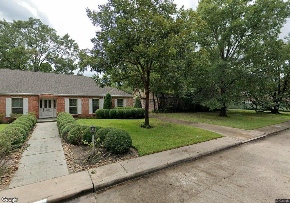
12123 Perthshire Rd Houston, TX 77024
Memorial NeighborhoodEstimated Value: $1,022,000 - $1,094,665
3
Beds
3
Baths
2,273
Sq Ft
$467/Sq Ft
Est. Value
About This Home
This home is located at 12123 Perthshire Rd, Houston, TX 77024 and is currently estimated at $1,061,166, approximately $466 per square foot. 12123 Perthshire Rd is a home located in Harris County with nearby schools including Bunker Hill Elementary School, Memorial Middle, and Memorial High School.
Ownership History
Date
Name
Owned For
Owner Type
Purchase Details
Closed on
Dec 6, 2022
Sold by
Harris County
Bought by
Jelinis Llc
Current Estimated Value
Purchase Details
Closed on
Jul 29, 2003
Sold by
Rice Robert William
Bought by
Rice Robert William
Purchase Details
Closed on
Jul 15, 1993
Sold by
Rice Robert R and Rice Dorothy C
Bought by
Rice Robert R and Rice Dorothy C
Create a Home Valuation Report for This Property
The Home Valuation Report is an in-depth analysis detailing your home's value as well as a comparison with similar homes in the area
Home Values in the Area
Average Home Value in this Area
Purchase History
| Date | Buyer | Sale Price | Title Company |
|---|---|---|---|
| Jelinis Llc | $500,000 | -- | |
| Rice Robert William | -- | -- | |
| Rice Robert R | -- | -- |
Source: Public Records
Tax History Compared to Growth
Tax History
| Year | Tax Paid | Tax Assessment Tax Assessment Total Assessment is a certain percentage of the fair market value that is determined by local assessors to be the total taxable value of land and additions on the property. | Land | Improvement |
|---|---|---|---|---|
| 2025 | $19,510 | -- | -- | -- |
| 2024 | $19,510 | $885,086 | $717,500 | $167,586 |
| 2023 | $19,510 | $898,174 | $717,500 | $180,674 |
| 2022 | $17,756 | $759,499 | $666,250 | $93,249 |
| 2021 | $17,807 | $729,375 | $615,000 | $114,375 |
| 2020 | $16,758 | $668,818 | $615,000 | $53,818 |
| 2019 | $17,755 | $678,200 | $615,000 | $63,200 |
| 2018 | $6,372 | $672,000 | $615,000 | $57,000 |
| 2017 | $18,313 | $700,000 | $615,000 | $85,000 |
| 2016 | $17,337 | $700,000 | $615,000 | $85,000 |
| 2015 | $11,452 | $700,000 | $615,000 | $85,000 |
| 2014 | $11,452 | $610,000 | $461,250 | $148,750 |
Source: Public Records
Map
Nearby Homes
- 12231 Kimberley Ln
- 12318 Queensbury Ln
- 12315 Barryknoll Ln
- 601 Strey Ln
- 11933 Barryknoll Ln
- 12326 Old Oaks Dr
- 11905 Barryknoll Ln
- 12406 Overcup Dr
- 11910 Heritage Ln
- 12 Gage Ct
- 939 Memorial Village Dr Unit 38
- 12003 Tall Oaks St
- 979 Memorial Village Dr Unit 48
- 902 Memorial Village Dr Unit 66
- 827 Bunker Hill Rd
- 11801 Barryknoll Ln
- 711 Timber Hill Dr
- 826 Bunker Hill Rd
- 12511 Overcup Dr
- 12454 Mooreknoll Ln
- 12127 Perthshire Rd
- 12126 Pebblebrook Dr
- 12122 Pebblebrook Dr
- 12131 Perthshire Rd
- 12115 Perthshire Rd
- 12130 Pebblebrook Dr
- 12122 Perthshire Rd
- 12118 Pebblebrook Dr
- 12118 Perthshire Rd
- 12126 Perthshire Rd
- 12114 Perthshire Rd
- 12111 Perthshire Rd
- 12114 Pebblebrook Dr
- 12130 Perthshire Rd
- 12110 Perthshire Rd
- 12127 Pebblebrook Dr
- 12115 Kimberley Ln
- 12119 Kimberley Ln
- 12203 Perthshire Rd
- 12123 Pebblebrook Dr