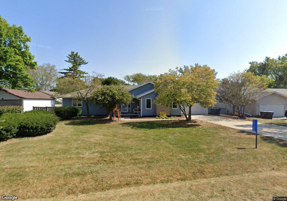
12125 220th Ave Bristol, WI 53104
Estimated Value: $482,000 - $606,000
3
Beds
3
Baths
3,195
Sq Ft
$163/Sq Ft
Est. Value
About This Home
This home is located at 12125 220th Ave, Bristol, WI 53104 and is currently estimated at $522,148, approximately $163 per square foot. 12125 220th Ave is a home located in Kenosha County with nearby schools including Salem Elementary School and Central High School.
Ownership History
Date
Name
Owned For
Owner Type
Purchase Details
Closed on
Jun 28, 2022
Sold by
V. Santare Raymond and A. Carol
Bought by
Revocabl Raymond and Revocabl Carol
Current Estimated Value
Purchase Details
Closed on
Apr 8, 2016
Sold by
Bergmann William R and Bergmann Anne C
Bought by
Santare Raymond V and Santare Carol A
Home Financials for this Owner
Home Financials are based on the most recent Mortgage that was taken out on this home.
Original Mortgage
$167,400
Interest Rate
3.62%
Mortgage Type
New Conventional
Create a Home Valuation Report for This Property
The Home Valuation Report is an in-depth analysis detailing your home's value as well as a comparison with similar homes in the area
Home Values in the Area
Average Home Value in this Area
Purchase History
| Date | Buyer | Sale Price | Title Company |
|---|---|---|---|
| Revocabl Raymond | $362,700 | Attorney James W. Pruitt | |
| Santare Raymond V | $265,000 | Knight Barry Title Inc |
Source: Public Records
Mortgage History
| Date | Status | Borrower | Loan Amount |
|---|---|---|---|
| Previous Owner | Santare Raymond V | $167,400 |
Source: Public Records
Tax History Compared to Growth
Tax History
| Year | Tax Paid | Tax Assessment Tax Assessment Total Assessment is a certain percentage of the fair market value that is determined by local assessors to be the total taxable value of land and additions on the property. | Land | Improvement |
|---|---|---|---|---|
| 2024 | $5,405 | $374,700 | $88,600 | $286,100 |
| 2023 | $5,232 | $374,700 | $88,600 | $286,100 |
| 2022 | $5,955 | $355,600 | $85,400 | $270,200 |
| 2021 | $6,050 | $355,600 | $85,400 | $270,200 |
| 2020 | $5,582 | $301,300 | $80,700 | $220,600 |
| 2019 | $5,431 | $301,300 | $80,700 | $220,600 |
| 2018 | $4,939 | $252,600 | $77,000 | $175,600 |
| 2017 | $5,317 | $252,600 | $77,000 | $175,600 |
| 2016 | $5,154 | $229,900 | $72,300 | $157,600 |
| 2015 | $4,525 | $229,900 | $72,300 | $157,600 |
| 2014 | $4,580 | $215,100 | $67,200 | $147,900 |
Source: Public Records
Map
Nearby Homes
- 11621 224th Ave
- 21605 117th St
- 22727 126th St
- 12725 228th Ave
- 12789 228th Ave
- Lt35 128th St
- 11736 231st Ct
- 12290 233rd Ave
- 198 Bridgewood Dr
- 188 Oakwood Dr
- 12719 234th Ave
- 23607 125th St
- 324 Elmwood Ln
- 11207 234th Ct
- 394 Birchwood Dr
- 42909 N Deep Lake Rd
- 11825 243rd Ave
- 602 Anita Ave
- 45 Van Dyke Dr
- 19900 128th St Unit 210
- 12135 220th Ave
- 21925 121st St
- 21937 121st St
- 12102 220th Ave
- 12163 220th Ave
- 21928 121st St
- 12142 219th Ave
- 12132 220th Ave
- 12158 220th Ave
- 21922 121st St
- 21934 121st St
- 12126 219th Ave
- 12120 219th Ave
- 21916 122nd St
- 21930 122nd St
- 21940 121st St
- 21916 121st St
- 21906 122nd St
- 12125 221st Ave
- 21912 121st St