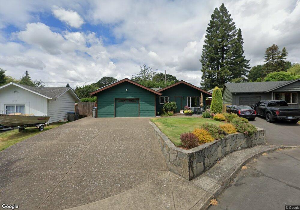
12125 SW 92nd Ave Portland, OR 97223
Greenburg Road NeighborhoodEstimated Value: $407,000 - $507,369
3
Beds
1
Bath
967
Sq Ft
$466/Sq Ft
Est. Value
About This Home
This home is located at 12125 SW 92nd Ave, Portland, OR 97223 and is currently estimated at $450,592, approximately $465 per square foot. 12125 SW 92nd Ave is a home located in Washington County with nearby schools including Charles F. Tigard Elementary School, Thomas R. Fowler Middle School, and Tigard High School.
Ownership History
Date
Name
Owned For
Owner Type
Purchase Details
Closed on
Nov 18, 1997
Sold by
Erkenbeck Eric S and Erkenbeck Kristine M
Bought by
Mcallister Karen L
Current Estimated Value
Home Financials for this Owner
Home Financials are based on the most recent Mortgage that was taken out on this home.
Original Mortgage
$122,050
Outstanding Balance
$19,942
Interest Rate
7.23%
Estimated Equity
$430,650
Create a Home Valuation Report for This Property
The Home Valuation Report is an in-depth analysis detailing your home's value as well as a comparison with similar homes in the area
Home Values in the Area
Average Home Value in this Area
Purchase History
| Date | Buyer | Sale Price | Title Company |
|---|---|---|---|
| Mcallister Karen L | $128,500 | First American Title Ins Co |
Source: Public Records
Mortgage History
| Date | Status | Borrower | Loan Amount |
|---|---|---|---|
| Open | Mcallister Karen L | $122,050 |
Source: Public Records
Tax History Compared to Growth
Tax History
| Year | Tax Paid | Tax Assessment Tax Assessment Total Assessment is a certain percentage of the fair market value that is determined by local assessors to be the total taxable value of land and additions on the property. | Land | Improvement |
|---|---|---|---|---|
| 2025 | $4,036 | $236,700 | -- | -- |
| 2024 | $3,927 | $229,810 | -- | -- |
| 2023 | $3,927 | $223,120 | $0 | $0 |
| 2022 | $3,815 | $223,120 | $0 | $0 |
| 2021 | $3,719 | $210,330 | $0 | $0 |
| 2020 | $3,495 | $197,860 | $0 | $0 |
| 2019 | $3,344 | $192,100 | $0 | $0 |
| 2018 | $3,208 | $186,510 | $0 | $0 |
| 2017 | $3,092 | $181,080 | $0 | $0 |
| 2016 | $2,953 | $175,810 | $0 | $0 |
| 2015 | $2,838 | $170,690 | $0 | $0 |
| 2014 | $2,754 | $165,720 | $0 | $0 |
Source: Public Records
Map
Nearby Homes
- 11790 SW 90th Ave
- 11600 SW 91st Ave
- 12300 SW Knoll Dr
- 11355 SW 97th Ct
- 11215 SW Hall Blvd
- 11185 SW Hall Blvd
- 10060 SW Molly Ct
- 10097 SW Woodard Ln
- 12065 SW Karol Ct
- 13235 SW Ash Dr
- 11044 SW Greenburg Rd Unit 321
- 8826 SW Spruce St
- 10455 SW Meadow St
- 10760 SW Sitka Ct
- 12385 SW 106th Dr
- 9096 SW Omara St
- 12230 SW 106th Dr
- 11311 SW Buffalo Place
- 11220 SW Buffalo Place
- 10482 SW 90th Ave
- 12135 SW 92nd Ave
- 12115 SW 92nd Ave
- 12040 SW Lincoln Ave
- 12145 SW 92nd Ave
- 12030 SW Lincoln Ave
- 12050 SW Lincoln Ave
- 11990 SW Lincoln Ave
- 12060 SW Lincoln Ave
- 12120 SW 92nd Ave
- 9235 SW Center St
- 12130 SW 92nd Ave
- 12100 SW 92nd Ave
- 12110 SW 92nd Ave
- 11915 SW Lincoln Ave
- 9175 SW Center St
- 9265 SW Center St
- 11970 SW Lincoln Ave
- 12070 SW Lincoln Ave
- 9125 SW Center St
- 12045 SW Lincoln Ave