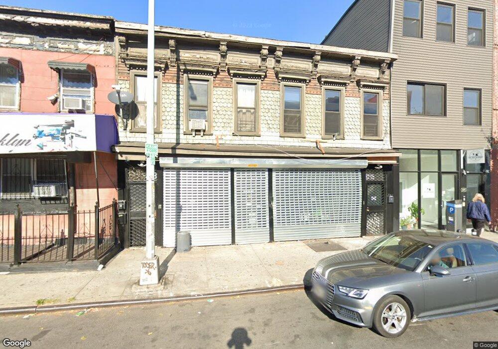
1213-1215 Atlantic Ave Brooklyn, NY 11216
Bed-Stuy NeighborhoodEstimated Value: $1,676,000 - $2,192,000
--
Bed
--
Bath
2,334
Sq Ft
$818/Sq Ft
Est. Value
About This Home
This home is located at 1213-1215 Atlantic Ave, Brooklyn, NY 11216 and is currently estimated at $1,908,130, approximately $817 per square foot. 1213-1215 Atlantic Ave is a home located in Kings County with nearby schools including P.S. 93 - William H. Prescott, Success Academy Charter School-NYC 9, and Brooklyn Ascend Charter School.
Ownership History
Date
Name
Owned For
Owner Type
Purchase Details
Closed on
Jun 27, 2012
Sold by
Icart-Pierre Jean Patrick and Icart-Pierre Serena
Bought by
Bolden Bernice
Current Estimated Value
Home Financials for this Owner
Home Financials are based on the most recent Mortgage that was taken out on this home.
Original Mortgage
$406,250
Outstanding Balance
$280,827
Interest Rate
3.7%
Mortgage Type
Commercial
Estimated Equity
$1,627,303
Purchase Details
Closed on
Nov 4, 2005
Sold by
Woods Surdonna
Bought by
Icart Icart- Pierre Jean Patrick and Icart Pierre Serena
Home Financials for this Owner
Home Financials are based on the most recent Mortgage that was taken out on this home.
Original Mortgage
$400,548
Interest Rate
6.67%
Mortgage Type
Purchase Money Mortgage
Create a Home Valuation Report for This Property
The Home Valuation Report is an in-depth analysis detailing your home's value as well as a comparison with similar homes in the area
Home Values in the Area
Average Home Value in this Area
Purchase History
| Date | Buyer | Sale Price | Title Company |
|---|---|---|---|
| Bolden Bernice | $677,500 | -- | |
| Icart Icart- Pierre Jean Patrick | $200,000 | -- |
Source: Public Records
Mortgage History
| Date | Status | Borrower | Loan Amount |
|---|---|---|---|
| Open | Bolden Bernice | $406,250 | |
| Previous Owner | Icart Icart- Pierre Jean Patrick | $400,548 |
Source: Public Records
Tax History Compared to Growth
Tax History
| Year | Tax Paid | Tax Assessment Tax Assessment Total Assessment is a certain percentage of the fair market value that is determined by local assessors to be the total taxable value of land and additions on the property. | Land | Improvement |
|---|---|---|---|---|
| 2025 | $6,447 | $91,200 | $16,500 | $74,700 |
| 2024 | $6,447 | $107,280 | $16,500 | $90,780 |
| 2023 | $6,150 | $128,460 | $16,500 | $111,960 |
| 2022 | $6,022 | $105,120 | $16,500 | $88,620 |
| 2021 | $6,172 | $81,180 | $16,500 | $64,680 |
| 2020 | $3,520 | $98,400 | $16,500 | $81,900 |
| 2019 | $4,679 | $78,240 | $16,500 | $61,740 |
| 2018 | $5,144 | $25,234 | $6,413 | $18,821 |
| 2017 | $5,124 | $25,138 | $6,522 | $18,616 |
| 2016 | $4,886 | $24,440 | $8,562 | $15,878 |
| 2015 | $1,907 | $23,627 | $10,539 | $13,088 |
| 2014 | $1,907 | $22,290 | $11,924 | $10,366 |
Source: Public Records
Map
Nearby Homes
- 1251 Pacific St Unit 1 A
- 1251 Pacific St Unit 2 A
- 1251 Pacific St Unit 4
- 1251 Pacific St Unit 1
- 1251 Pacific St Unit 2
- 35 Herkimer St
- 18 Arlington Place
- 1150 Pacific St
- 11A Arlington Place
- 1219 Dean St
- 151 Herkimer St
- 1235 Dean St Unit 4
- 43 Halsey St Unit 4
- 43 Halsey St Unit 3
- 1240 Bedford Ave Unit 1H
- 1240 Bedford Ave Unit 5B
- 1240 Bedford Ave Unit 1D
- 1304 Pacific St Unit B1
- 971 Bergen St
- 1106 Bergen St
- 1213 Atlantic Ave Unit 1215
- 1219 Atlantic Ave
- 1219 Atlantic Ave Unit 1
- 1211 Atlantic Ave
- 44-46 Herkimer Place
- 44 Herkimer Place Unit 46
- 1221 Atlantic Ave Unit 3
- 1205-1209 Atlantic Ave
- 1225-1227 Atlantic Ave
- 1199-1201 Atlantic Ave
- 43 Herkimer Place
- 1237 Atlantic Ave
- 1250 Atlantic Ave
- 1260 Atlantic Ave
- 1239 Atlantic Ave
- 1195-1197 Atlantic Ave
- 1266 Atlantic Ave
- 570-572 Nostrand Ave
- 90-92 Herkimer St
- 27-29 Herkimer Place