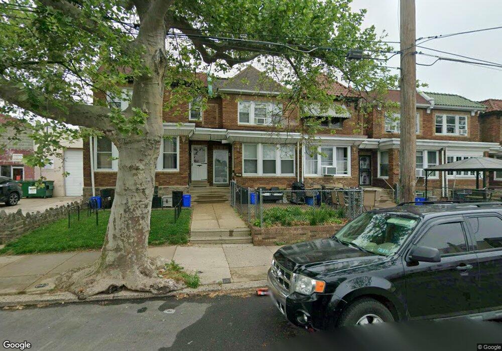
1213 Bridge St Philadelphia, PA 19124
Frankford NeighborhoodEstimated Value: $203,673 - $229,000
3
Beds
1
Bath
1,088
Sq Ft
$197/Sq Ft
Est. Value
About This Home
This home is located at 1213 Bridge St, Philadelphia, PA 19124 and is currently estimated at $213,918, approximately $196 per square foot. 1213 Bridge St is a home located in Philadelphia County with nearby schools including Frankford High School, The Philadelphia Charter School for the Arts & Sciences, and Mastery Schools Smedley Elementary.
Ownership History
Date
Name
Owned For
Owner Type
Purchase Details
Closed on
Nov 13, 2001
Sold by
Strube Barry and Strube Joyce E
Bought by
Canada Ieshia
Current Estimated Value
Home Financials for this Owner
Home Financials are based on the most recent Mortgage that was taken out on this home.
Original Mortgage
$50,015
Outstanding Balance
$19,433
Interest Rate
6.64%
Mortgage Type
FHA
Estimated Equity
$194,485
Purchase Details
Closed on
Dec 28, 1993
Sold by
Stewart Thomas
Bought by
Strube Barry and Strube Joyce E
Create a Home Valuation Report for This Property
The Home Valuation Report is an in-depth analysis detailing your home's value as well as a comparison with similar homes in the area
Home Values in the Area
Average Home Value in this Area
Purchase History
| Date | Buyer | Sale Price | Title Company |
|---|---|---|---|
| Canada Ieshia | $49,900 | -- | |
| Strube Barry | $45,000 | -- |
Source: Public Records
Mortgage History
| Date | Status | Borrower | Loan Amount |
|---|---|---|---|
| Open | Canada Ieshia | $50,015 |
Source: Public Records
Tax History Compared to Growth
Tax History
| Year | Tax Paid | Tax Assessment Tax Assessment Total Assessment is a certain percentage of the fair market value that is determined by local assessors to be the total taxable value of land and additions on the property. | Land | Improvement |
|---|---|---|---|---|
| 2025 | $1,953 | $171,700 | $34,340 | $137,360 |
| 2024 | $1,953 | $171,700 | $34,340 | $137,360 |
| 2023 | $1,953 | $139,500 | $27,900 | $111,600 |
| 2022 | $1,379 | $139,500 | $27,900 | $111,600 |
| 2021 | $1,379 | $0 | $0 | $0 |
| 2020 | $1,379 | $0 | $0 | $0 |
| 2019 | $1,323 | $0 | $0 | $0 |
| 2018 | $1,296 | $0 | $0 | $0 |
| 2017 | $1,296 | $0 | $0 | $0 |
| 2016 | $1,296 | $0 | $0 | $0 |
| 2015 | $1,241 | $0 | $0 | $0 |
| 2014 | -- | $92,600 | $20,956 | $71,644 |
| 2012 | -- | $12,416 | $1,677 | $10,739 |
Source: Public Records
Map
Nearby Homes
- 1150 Bridge St
- 1218 Pratt St
- 1220 Pratt St
- 1137 Bridge St
- 5347 Sylvester St
- 5304 Akron St
- 5241 Akron St
- 1244 E Sanger St
- 5118 Oakland St
- 1209 E Sanger St
- 5244 Saul St
- 5300 Saul St
- 1206 Dyre St
- 5345 Akron St
- 1048 Bridge St
- 1528 E Cheltenham Ave
- 1208 Haworth St
- 1214 Haworth St
- 5422 Akron St
- 5033 Akron St
- 1215 Bridge St
- 1217 Bridge St
- 1211 Bridge St
- 1219 Bridge St
- 1209 Bridge St
- 1221 Bridge St
- 1223 Bridge St
- 1225 Bridge St
- 5312 Sylvester St
- 5315 Horrocks St
- 5314 Sylvester St
- 1227 Bridge St
- 5316 Sylvester St
- 5317 Horrocks St
- 5318 Sylvester St
- 5319 Horrocks St
- 5264 Sylvester St
- 5263 Horrocks St
- 5320 Sylvester St
- 5262 Sylvester St