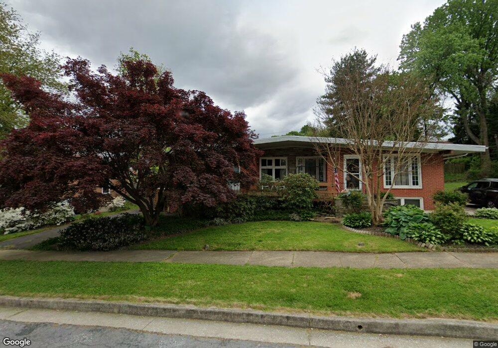
1213 Brixton Rd Baltimore, MD 21239
Estimated Value: $238,362 - $328,000
--
Bed
2
Baths
1,234
Sq Ft
$231/Sq Ft
Est. Value
About This Home
This home is located at 1213 Brixton Rd, Baltimore, MD 21239 and is currently estimated at $284,591, approximately $230 per square foot. 1213 Brixton Rd is a home located in Baltimore County with nearby schools including Halstead Academy, Loch Raven Technical Academy, and Towson High Law & Public Policy.
Ownership History
Date
Name
Owned For
Owner Type
Purchase Details
Closed on
Aug 16, 2021
Sold by
Rayme Elaine A
Bought by
Rayme Elaine A and Rayme Mary P
Current Estimated Value
Purchase Details
Closed on
Dec 27, 1994
Sold by
Oconnor Charles J
Bought by
Rayme Elaine A
Home Financials for this Owner
Home Financials are based on the most recent Mortgage that was taken out on this home.
Original Mortgage
$66,000
Interest Rate
9.19%
Purchase Details
Closed on
Oct 18, 1984
Sold by
Loechel Thomas W
Bought by
Oconnor Charles J
Create a Home Valuation Report for This Property
The Home Valuation Report is an in-depth analysis detailing your home's value as well as a comparison with similar homes in the area
Home Values in the Area
Average Home Value in this Area
Purchase History
| Date | Buyer | Sale Price | Title Company |
|---|---|---|---|
| Rayme Elaine A | -- | None Available | |
| Rayme Elaine A | $105,000 | -- | |
| Oconnor Charles J | $87,300 | -- |
Source: Public Records
Mortgage History
| Date | Status | Borrower | Loan Amount |
|---|---|---|---|
| Closed | Rayme Elaine A | $66,000 |
Source: Public Records
Tax History Compared to Growth
Tax History
| Year | Tax Paid | Tax Assessment Tax Assessment Total Assessment is a certain percentage of the fair market value that is determined by local assessors to be the total taxable value of land and additions on the property. | Land | Improvement |
|---|---|---|---|---|
| 2025 | $3,009 | $215,000 | $80,000 | $135,000 |
| 2024 | $3,009 | $205,700 | $0 | $0 |
| 2023 | $1,492 | $196,400 | $0 | $0 |
| 2022 | $2,290 | $187,100 | $80,000 | $107,100 |
| 2021 | $2,679 | $181,933 | $0 | $0 |
| 2020 | $2,679 | $176,767 | $0 | $0 |
| 2019 | $2,631 | $171,600 | $80,000 | $91,600 |
| 2018 | $2,469 | $166,500 | $0 | $0 |
| 2017 | $2,290 | $161,400 | $0 | $0 |
| 2016 | $1,905 | $156,300 | $0 | $0 |
| 2015 | $1,905 | $156,300 | $0 | $0 |
| 2014 | $1,905 | $156,300 | $0 | $0 |
Source: Public Records
Map
Nearby Homes
- 1204 Saint Andrews Way
- 6931 Summit Cir
- 6923 Summit Cir
- 6702 Queens Ferry Rd
- 1108 Litchfield Rd
- 908 Stevenson Ln
- 12 Stone Ridge Ct
- 28 Stone Ridge Ct
- 701 Hillen Rd
- 703 Hillen Rd
- 6415 Falkirk Rd
- 625 Yarmouth Rd
- 500 Fairway Ct
- 612 Coventry Rd
- 664 Regester Ave
- 6216 Falkirk Rd
- 1602 Glen Keith Blvd
- 1235 Walker Ave
- 1211 Dalton Rd
- 1405 Putty Hill Ave
- 1215 Brixton Rd
- 1211 Brixton Rd
- 1217 Brixton Rd
- 1209 Brixton Rd
- 1207 Brixton Rd
- 1230 Saint Andrews Way
- 1234 Saint Andrews Way
- 1212 Brixton Rd
- 1214 Brixton Rd
- 1210 Brixton Rd
- 1228 Saint Andrews Way
- 1301 Brixton Rd
- 1205 Brixton Rd
- 1208 Brixton Rd
- 1216 Brixton Rd
- 1303 Brixton Rd
- 1206 Brixton Rd
- 1300 Highland Dr
- 1226 Saint Andrews Way
- 1203 Brixton Rd