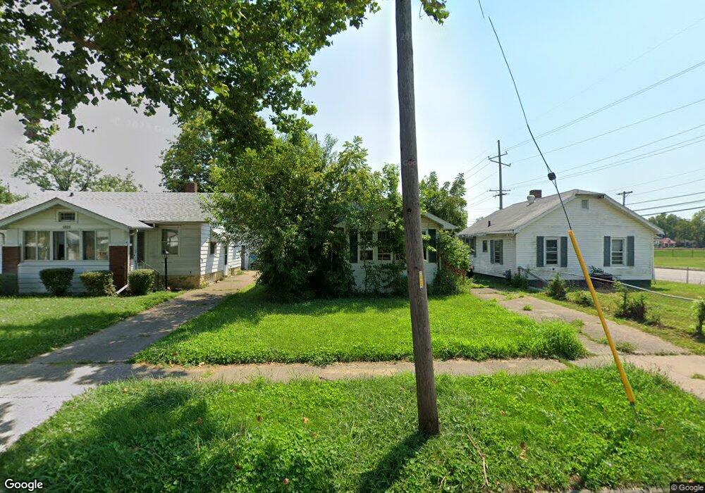
1213 E Decatur St Decatur, IL 62521
Lions Park NeighborhoodEstimated Value: $35,940 - $47,000
2
Beds
1
Bath
1,728
Sq Ft
$25/Sq Ft
Est. Value
About This Home
This home is located at 1213 E Decatur St, Decatur, IL 62521 and is currently estimated at $42,485, approximately $24 per square foot. 1213 E Decatur St is a home located in Macon County with nearby schools including South Shores Elementary School, Stephen Decatur Middle School, and St. Patrick School.
Ownership History
Date
Name
Owned For
Owner Type
Purchase Details
Closed on
Jul 27, 2018
Sold by
Atterberry Michael G D and Atterberry Sanet S
Bought by
Atterberry Jeremy R
Current Estimated Value
Purchase Details
Closed on
Sep 28, 2005
Sold by
Limb Shawn C
Bought by
Atteberry Michael G and Atteberry Janet S
Home Financials for this Owner
Home Financials are based on the most recent Mortgage that was taken out on this home.
Original Mortgage
$30,000
Interest Rate
6%
Mortgage Type
Future Advance Clause Open End Mortgage
Purchase Details
Closed on
Sep 1, 2002
Create a Home Valuation Report for This Property
The Home Valuation Report is an in-depth analysis detailing your home's value as well as a comparison with similar homes in the area
Home Values in the Area
Average Home Value in this Area
Purchase History
| Date | Buyer | Sale Price | Title Company |
|---|---|---|---|
| Atterberry Jeremy R | -- | None Available | |
| Atteberry Michael G | $37,500 | None Available | |
| -- | $32,000 | -- |
Source: Public Records
Mortgage History
| Date | Status | Borrower | Loan Amount |
|---|---|---|---|
| Closed | Atteberry Michael G | $30,000 |
Source: Public Records
Tax History Compared to Growth
Tax History
| Year | Tax Paid | Tax Assessment Tax Assessment Total Assessment is a certain percentage of the fair market value that is determined by local assessors to be the total taxable value of land and additions on the property. | Land | Improvement |
|---|---|---|---|---|
| 2024 | $423 | $8,488 | $1,066 | $7,422 |
| 2023 | $435 | $8,187 | $1,028 | $7,159 |
| 2022 | $447 | $7,676 | $951 | $6,725 |
| 2021 | $450 | $7,170 | $889 | $6,281 |
| 2020 | $465 | $6,837 | $848 | $5,989 |
| 2019 | $465 | $6,837 | $848 | $5,989 |
| 2018 | $817 | $7,772 | $1,447 | $6,325 |
| 2017 | $836 | $7,980 | $1,486 | $6,494 |
| 2016 | $852 | $8,061 | $1,501 | $6,560 |
| 2015 | $809 | $7,918 | $1,474 | $6,444 |
| 2014 | $751 | $7,839 | $1,459 | $6,380 |
| 2013 | $777 | $8,134 | $1,514 | $6,620 |
Source: Public Records
Map
Nearby Homes
- 1232 E Johns Ave
- 1104 E Moore St
- 1605 E Clay St
- 632 S 17th St
- 1645 E Wood St
- 1764 E Johns Ave
- 1753 E Clay St
- 1656 E Wood St
- 1263 E Dickinson Ave
- 318 S Martin Luther King Junior Dr
- 2039 E Whitmer St
- 1525 E North St
- 1232 S Silas St
- 1644 E William St
- 1283 S Illinois St
- 1850 E Prairie St
- 340 N 17th St
- 2015 E Lincoln Ave
- 2104 E Whitmer St
- 1408 E Buena Vista Ave
- 602 S Jasper St
- 1221 E Decatur St
- 630 S Jasper St
- 1229 E Decatur St
- 1212 E Decatur St
- 1204 E Decatur St
- 632 S Jasper St
- 1237 E Decatur St
- 1220 E Decatur St
- 640 S Jasper St
- 1251 E Decatur St
- 1228 E Decatur St
- 1220 E Lawrence St
- 1228 E Lawrence St
- 1238 E Decatur St
- 1259 E Decatur St
- 1232 E Lawrence St
- 1204 E Lawrence St
- 1244 E Decatur St
- 1236 E Lawrence St